Tourist attractions near Terebesti (Terebesti, Satu Mare county, Romania)
Photos of nearby places

Dragons Garden - Galgau Almasului (20 photos) 69.2 km away. The natural reservation site Dragon's Garden (Gradina Zmeilor, Sárkányok kertje) from Galgaul Almasului is located in Salaj County, in the Western Carpathians. This natural playground is made up of interesting and unusual sandstone formations, an ensemble of 10-12 m high towers with strange figures cut in sandstone by the wind and water erosion.

Cave of Winds - Padurea Craiului Mountains (24 photos) 83.5 km away. The Cave of Winds (Pestera Vantului) is located in the Padurea Craiului Mountains, not far from Frantura meadow, near Suncuius, on the left geographical side of the Crisul Repede River. The Cave of Winds was discovered in 1957 by Béla Bagaméri and is currently (as of 2003) the longest cave system known in Romania as well as in the Carpathian Basin.


Napistileu cave - Padurea Craiului (10 photos) 84.1 km away. Napistileu (Ungurul Mic) cave - Padurea Craiului Mountains.

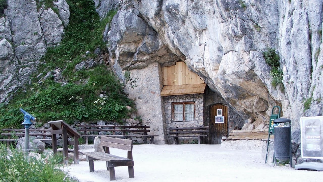
The cave from the spring - Padurea Craiului Mountains (8 photos) 84.1 km away. Pestera de la Izvor (The cave from the spring) - Padurea Craiului Mountains.

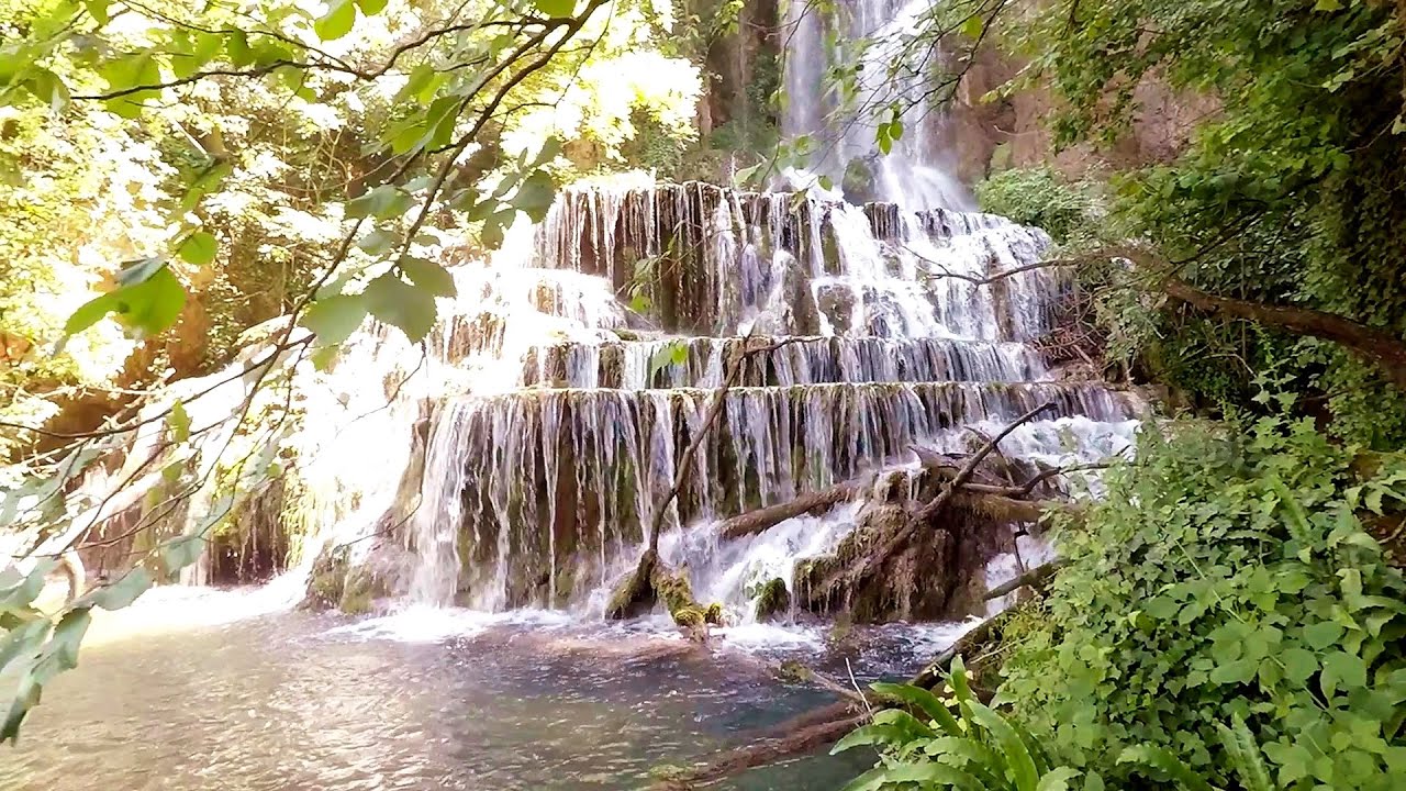
Oxen Waterfall - Padurea Craiului Mountains (12 photos) 86.6 km away. Oxen Waterfall (Cascada Boilor) - Padurea Craiului Mountains.

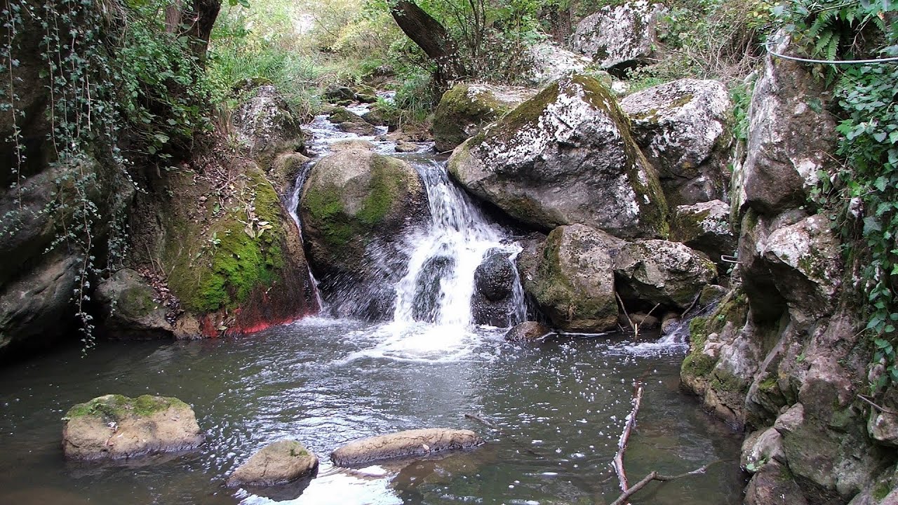
Moanei Cave - Padurea Craiului Mountains (58 photos) 88 km away. The Moanei Cave (Pestera Moanei) is located on the upper course of the Misid River, on the right side of the Misid Gorge (Cheilor Misidului). The cave has two entrances, one fossil and sloped, while a subterranean stream flows through the active gallery.

Sohodol pit cave - Padurea Craiului Mountains (10 photos) 92.5 km away. Sohodol pit cave (Avenul Sohodol) - Padurea Craiului Mountains.

Fern Cave - Padurea Craiului Mountains (9 photos) 94.4 km away. Ferigi (Fern) Cave - Padurea Craiului Mountains.

Kings Cave - Padurea Craiului Mountains (48 photos) 96.4 km away. Craiului (Kings) Cave - Padurea Craiului Mountains.

Valley of Hell - Padurea Craiului Mountains (23 photos) 96.5 km away. Valley of Hell (Valea Iadului) - Padurea Craiului Mountains.


Spherical concretions from Feleac (18 photos) 126.2 km away. The spherical concretions from Feleac are sedimentary rock materials that were cemented together to form a hard structure. The surrounding sediments slowly erode away, exposing the concretion.


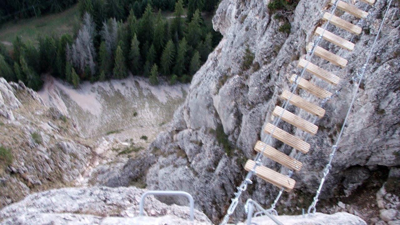
Tureni Gorge iron path visiting route (24 photos) 140.5 km away. Tureni Gorge iron path visiting route (via ferrata) - Trascau Mountains.


Turda Gorge - Trascau Mountains (9 photos) 143.3 km away. Turda Gorge (Cheile Turzii) - Trascau Mountains.

Turda Gorge - Trascau Mountains (11 photos) 143.3 km away. Turda Gorge (Cheile Turzii) - Trascau Mountains.
[ Top ↑ ]
Videos of nearby places


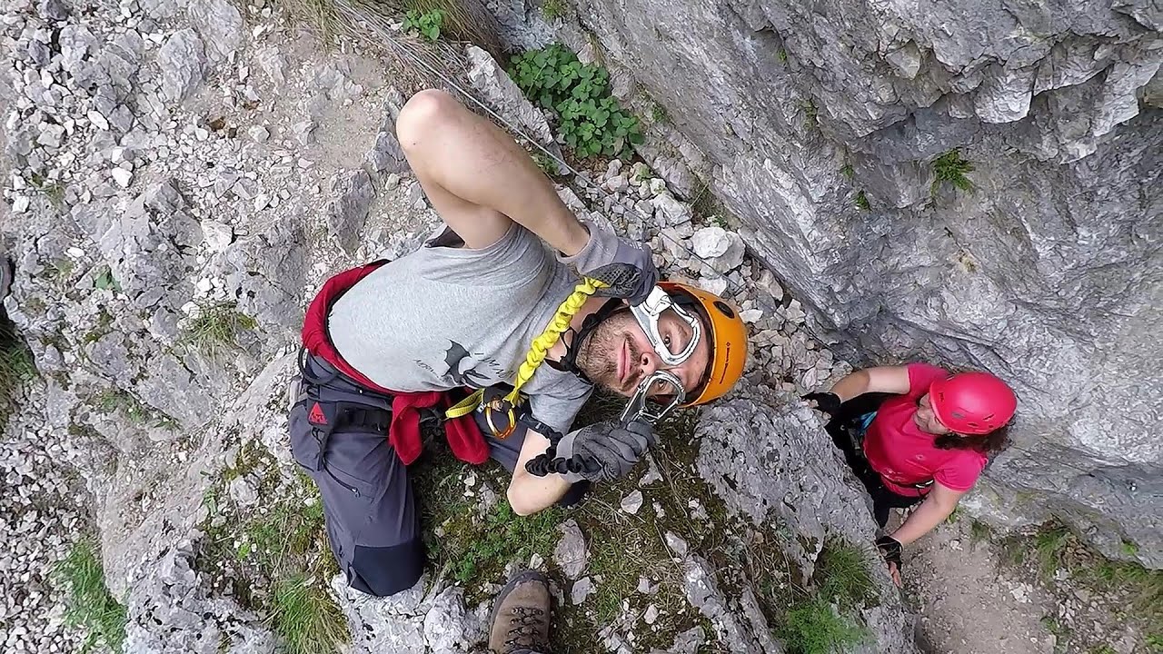
Via Ferrata Fairy Castle - Vadu Crisului 80.4 km away. Via Ferrata Fairy Castle (Castelul Zanelor, Casa Zmeului, The House of the Dragon) - Vadu Crisului. South of Vadu Crisului, in the Padurea Craiului Mountains, lies the Vadu Crisului Gorge, a section of the Crisul Repede river that narrows between rocky walls.

Fairy Cliff via ferrata route - Vadu Crisului 80.5 km away. Fairy Cliff (Peretele Zanelor) via ferrata route - Vadu Crisului. In Vadu Crisului, in the Padurea Craiului Mountains, on the right bank of the Crisul Repede, you can find the newest, in chronological order (2015) the fifth Transylvanian, new type of via ferrata route.

Vadu Crisului cave 81.4 km away. The Vadu Crisului Cave, with a total length of over 1000 meters, is located in the picturesque gorge of Crisul Repede creek. It consists of a gently meandering, long passage that features an active, stream level next to an upper, fossil level in its first section.

Other places
Womens Spiral via ferrata, climbing fun Baia de Fier 287.8 km away. The Women's Spiral (Spirala Muierilor) via ferrata is set up on the rock that conceals the Women's Cave (Pestera Muierii). It is one of the seven routes near Baia de Fier as of now (2018).

Black Rocks iron path Bihor Mountains 129.5 km away. Black Rocks is located in the Bihor Mountains, near the Vartop Saddle, to the west of it. It is interesting that the locals (if I understood correctly) do not know this name, but use the name Piatra Buna (meaning Good Stone) for this spectacular rock.
White Drin waterfall Drini i Bardhe (White Drin) waterfall.
Krushuna waterfalls Krushuna The Krushuna Waterfalls are a series of karst cascades formed in travertine. They are located near the village of Krushuna, not far from the town of Lovech, and are Bulgaria's largest waterfall of this type.
Giant Ice Cave Dachstein Salzkammergut, Obertraun am Hallstättersee The second cave accessible to the public at the Schönbergalm above Obertraun on Lake Hallstatt is the Giant Ice Cave (Rieseneishöhle). For me, it was more spectacular than the Mammoth Cave.

Kossuth Rock Harghita Bath 265.2 km away. Kossuth Rock - Harghita Bath (Harghita-Bai), Harghita Mountains.

Tureni Gorge iron path 140.3 km away. Tureni Gorge iron path visiting route (Via ferrata Cheile Tureni), Trascau Mountains.
Wild Ferenc iron path Suhardul Mic 251.8 km away. While I climbed the new iron path mostly in the dark for the first time, this time I managed to explore it during the day. But I still missed the sunset by a few minutes.
[ Top ↑ ]
Copyright © 2003-2026 Trekkingklub and friends. Reproduction of any text, picture or video from this website, either in printed or electronic form, is prohibited without prior written permission. Website made with love  in Miercurea Ciuc.