Tourist attractions near Poieni (Pietroasa, Timis county, Romania)
Photos of nearby places

Natural bridge next to the Banita Stone Quarry (12 photos) 74.2 km away. Although the Banita Stone Bridge is not far from the road that passes through the village, it is located beyond the railway line, so its approach is a bit cumbersome. We can go around the railway line on Carierei Street, and then we have to walk a few meters from the stone quarry.

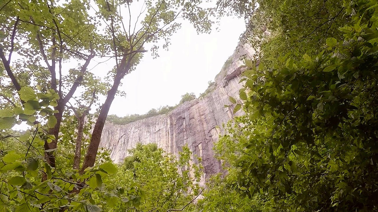
Banita Gorge - Banita (16 photos) 77.2 km away. The approximately 250 m long gorge, similar to the Corcoaia Gorge, is truly spectacular. According to assumptions, it was formed by the collapse of a cave passage ceiling, and then the erosion formed spectacular karst formations in the limestone.

Boli Cave - Banita (20 photos) 77.6 km away. The main cave passage is approximately 460 m long, with an entrance portal that is 10 m high and 20 m wide at its base. In the 1960s, bridges were built over the underground stream flowing through the cave.


Goat Stone - Craiva, Trascau Mountains (18 photos) 91.7 km away. Goat Stone (Piatra Craivii, Piatra Craivei, Apulon) - Craiva, Trascau Mountains.


Stone of Cetea, Horse Pit - Trascau (16 photos) 94.9 km away. Stone of Cetea, Horse Pit (The pit cave from the Stone of Cetea) - Trascau Mountains.


Goats Ledge - Trascau Mountains (10 photos) 95.2 km away. Goats Ledge (Brana Caprei, Kecskék párkánya) - Trascau Mountains .

Parangul Mare peak (16 photos) 98.8 km away. Chamois saddle (Saua Caprelor), Carja mountain shelter (Refugiul Carja) - Carja peak (Varful Carja) - Stoienita peak (Varful Stoienita) - Gemanarea - Parangul Mare peak.

Dark Blue Bruises of the Ponor - Trascau Mountains (16 photos) 100.1 km away. The Dark Blue Bruises of the Ponor (Vanatarile Ponorului) is a polje-type protected area. Polje is a Slovenian word meaning plain, and it refers to a surface karst form.

Dark Blue Bruises of the Ponor, Bedeleu (24 photos) 102.3 km away. Dark Blue Bruises of the Ponor (Vanatarile Ponorului), Bedeleu - Trascau Mountains.

Balcony Clearing - Trascau Mountains (6 photos) 103 km away. Balcony Clearing (Erkély-tisztás, Balconul Sipotelor) - Trascau Mountains.

Aries valley - Trascau Mountains (10 photos) 104 km away. Aries (Golden) valley - Trascau Mountains.

Beusnita waterfall (8 photos) 108.9 km away. Cascada Beusnita, located in the Caras-Severin county, is one of the most impressive waterfalls in the Anina Mountains. The water falling from a height of approximately 15 m, into a clearing in the middle of the forest, creates a uniquely picturesque landscape.


Szekler Stone North - Trascau Mountains (8 photos) 113 km away. Szekler Stone North (Piatra Secuilor Nord) - Trascau Mountains.

Szekler Stone - Trascau Mountains (42 photos) 113 km away. Szekler Stone (Székely-kő, Piatra Secuilor) - Trascau Mountains.

Valley of Hell - Padurea Craiului Mountains (23 photos) 113.4 km away. Valley of Hell (Valea Iadului) - Padurea Craiului Mountains.
[ Top ↑ ]
Videos of nearby places


Billy-goat lake, Closed Gates - Retezat Mountains 59.8 km away. The most unique ridge trail of the Retezat Mountains is the Closed Gates.Below, at an altitude of 2070 m above sea level, is the Billy-goat lake.

Sheepdogs - Govora sheepfold - Retezat mountains 60.9 km away. On the second day of my weekend Retezat hike, I visited a sheepfold on the Lancita Ridge. To my great disappointment, they didn't make cheese or curd here.

The palm of God and the Heavens door - Fundatura Ponorului mountain village 62.2 km away. One of the most picturesque places in Romania, one of the most beautiful mountain villages, and a photographer's paradise. Fundatura Ponorului is located in the Ponor Stream Valley, part of the Gradistea Muncelului - Cioclovina National Park, in the Sureanu Mountains.
Other places

Cherven, a medieval fortified town Bulgaria 371.6 km away. Located about 30 km south of the city of Ruse in Bulgaria, the Cherven medieval fortress can be found in the Rusenski Lom Nature Park. Originally a Byzantine fortification from the 6th century, it reached the height of its development in the 14th century.

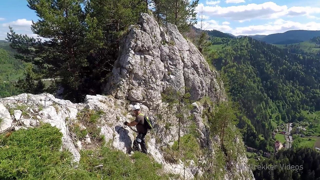
Hodoaba Valley iron path Suncuius 126 km away. The Hodoaba Valley iron path is Romania's shortest and easiest (official) via ferrata route. It is located near Suncuius, in the Padurea Craiului Mountains, on the left bank of the Crisul Repede River.
Via ferrata Ari Peja 391 km away.

Acapulcos spur via ferrata 126.6 km away. Acapulco's spur (Pintenul lui Acapulco) via ferrata (B/C) - Montana Land, Suncuius.
Neviastata ecopath and iron path Smolyan The Neviastata eco-trail is located in Bulgaria, nestled in the heart of the Rhodope Mountains, between Smolyan and Pamporovo. Here, you will find a small, paid adventure park.
Skaklya waterfall Vratsa 303.9 km away. The largest seasonal waterfall in Bulgaria plunges down from a height of 141 meters. It is located in the Vratsa Mountain National Park, just one and a half kilometers away from the city of Vratsa.

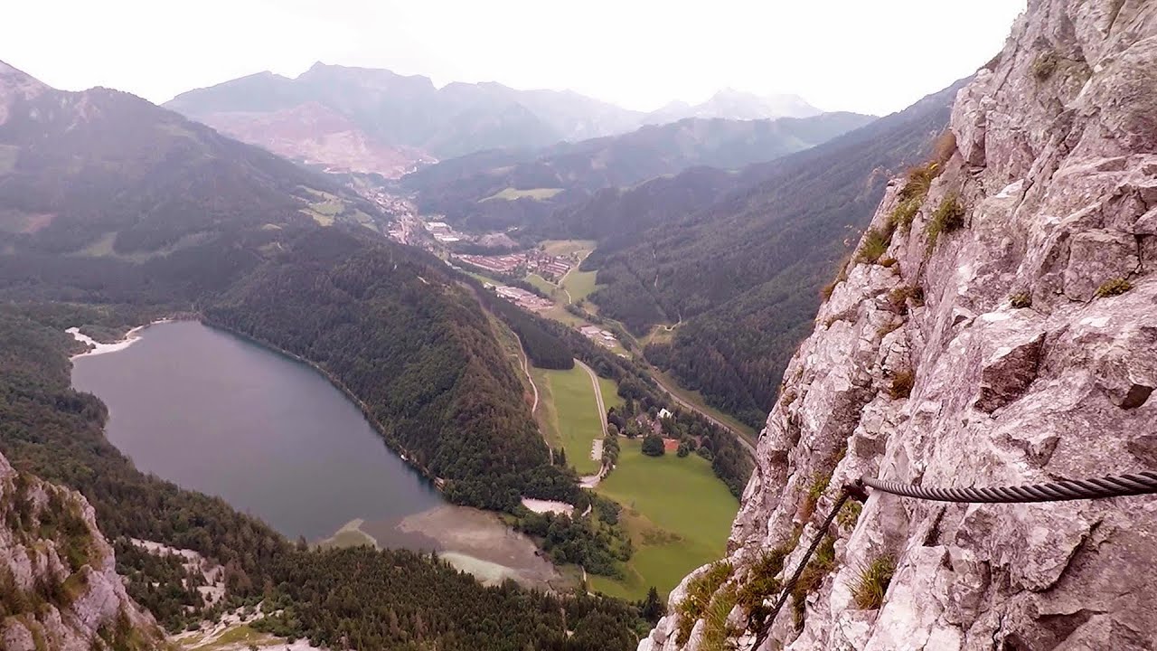
Kaiser Franz-Josef Klettersteig Leopoldsteiner See The Franz-Josef Klettersteig is located on the Seemauer cliff face, which rises 900 meters above Leopoldsteiner Lake, in the western part of the Hochschwab mountain range, just 4 km from the town of Eisenerz. This via ferrata is named after the Kaisersteig, a hunting trail established for the esteemed Emperor Franz Joseph I of Austria and Hungary at the end of the 19th century, traces of which can still be observed today.
Other destinations
Gornjak via ferrata and Kudelinovs fortress Zdrelo 184.7 km away. Difficulty level C/D, total length: 400 m, height difference: 330 m, year of construction: 2019, total length of the route to Kudelinov's fortress: 1100 m. Access to the via ferrata is free.
[ Top ↑ ]
Copyright © 2003-2026 Trekkingklub and friends. Reproduction of any text, picture or video from this website, either in printed or electronic form, is prohibited without prior written permission. Website made with love  in Miercurea Ciuc.