Durdevica via ferrata and the canyon of the Ibar river - Ribarice
Difficulty level C/D (D/E), total length: 700 m, height difference: 200 m, year of construction: 2024. For experienced climbers with their own equipment, the registration fee is 5 euros per person.
Read more
Login (register) for the full descriptions, and access to the photos and videos.
Airport nearby: Morava Airport (KVO - Kraljevo, Rs), 95 km away.
Photos of nearby places


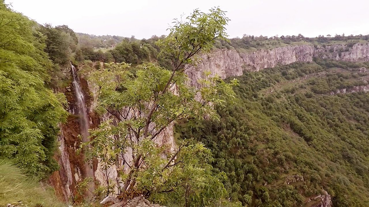
Beusnita waterfall (8 photos) 244.6 km away. Cascada Beusnita, located in the Caras-Severin county, is one of the most impressive waterfalls in the Anina Mountains. The water falling from a height of approximately 15 m, into a clearing in the middle of the forest, creates a uniquely picturesque landscape.


[ Top ↑ ]
Videos of nearby places
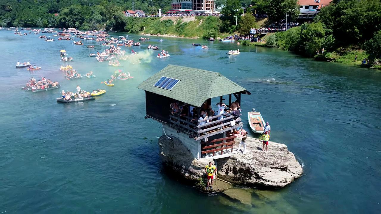
Drina river house - Bajina Bašta 133.1 km away. The house visible on the Drina River (Kućica na Drini) is a unique wooden structure built on a rock in the middle of the river, near Bajina Bašta, Serbia. The house is located on the border between Serbia and Bosnia-Herzegovina, close to the border line between the two countries.

Belogradchik fortress 195.4 km away. Belogradchik is located in the northwestern part of Bulgaria, in the Vidin Province, at the foot of the Balkan Mountains, near the Serbian border. Its name means little white town.
Bovska Skaklya waterfall - Iskar gorge 235.5 km away. The Bovska Skaklya waterfall is located near the town of Svoge in Bulgaria. The waterfall formed on the Zaselska River has several reported heights online (120 m, 85 m).
Iskar gorge Lyutibrod - Temnata dupka cave Lakatnik 240 km away. The Iskar is the longest purely Bulgarian river, the oldest river in the Balkans, and a right tributary of the Danube. The river is 368 km long, with approximately 150 km consisting of a gorge.

Rudariei watermills - Eftimie Murgu 249.8 km away. I have visited the twenty-two wooden water mills with horizontal wheels, located in the valley of the Rudaria stream, mostly in the rain and under an umbrella. Some of them are still in use today.
Other places
Iskar gorge Lyutibrod Temnata dupka cave Lakatnik 240 km away. The Iskar is the longest purely Bulgarian river, the oldest river in the Balkans, and a right tributary of the Danube. The river is 368 km long, with approximately 150 km consisting of a gorge.
The Trovants Museum in Winter Costesti 377.4 km away.
Little Spiral via ferrata Baia de Fier 362.5 km away.
Bovska Skaklya waterfall Iskar gorge 235.5 km away. The Bovska Skaklya waterfall is located near the town of Svoge in Bulgaria. The waterfall formed on the Zaselska River has several reported heights online (120 m, 85 m).
Doabra Stones Brezoi, Lotru Mountains 403.4 km away. The DN7A road branches off west from the Olt Valley, from the main road between Sibiu and Ramnicu Valcea, leading towards Voineasa and Lake Vidra. The first settlement is a small town, Brezoi, which is located at the confluence of the Lotru and Olt rivers.
Balázs Hill Lookout Western Mecsek 396.6 km away. The Balázs hill lookout, located at an altitude of 320 meters, offers a beautiful view of Lake Pécs and the wooded mountain ranges of Western Mecsek. The original lookout, built in 1975, was destroyed by fire, and it was rebuilt in 2001 using a metal structure, which was renovated in 2014.
Devils Bridge Ardino 412.8 km away. The Devil's Bridge (Dyavolski Most, in Turkish Sheytan Kyupriya) is located in the gorge of the Arda River, just north of the town of Ardino in Bulgaria. It was constructed in the early 16th century, between 1515 and 1518, by an architect named Dimitar, on the remains of an earlier Roman bridge.
Jacob Hill Lookout Western Mecsek 392.3 km away. Jacob Hill is a popular hiking destination in Western Mecsek, with an elevation of 592 m. At the top, there are the ruins of a Pauline monastery and a lookout tower.
Turcinovac via ferrata and cave Ovcar Banja 106.5 km away. Difficulty level B, total length: 60 m, height difference: 45 m, year of construction: 2010. Climbing the via ferrata is only permitted with the approval of the Extreme Sports Club Armadillo from Cacak, and there is a fee for it.
Siklós castle 363 km away. The Siklós Castle is an important historical landmark in Hungary. Its fortress walls were laid around 1260, with the first written record dating back to 1294.
Agnes Waterfall Western Mecsek 394.4 km away. The Agnes Waterfall is the largest waterfall in the Mecsek region, although the stream's water only cascades down from a height of one and a half to two meters, over a travertine ledge. Nearby attractions include the Meleg-mány Waterfall and the Mánfa Stone-Cave.
Vadu Crisului cave 473.1 km away. The Vadu Crisului Cave, with a total length of over 1000 meters, is located in the picturesque gorge of Crisul Repede creek. It consists of a gently meandering, long passage that features an active, stream level next to an upper, fossil level in its first section.
Deubels path Piatra Craiului Mountains 474.3 km away. Deubels path - Piatra Craiului Mountains (Kings Rock).
Big Via ferrata Rasnoavei Gorge 495.8 km away. The most dangerous Eastern European iron path, and also one of the most beautiful via ferrata routes in Romania, is in the Rasnoavei Gorges, Postavaru Mountains.The route is 450 m long, with a level difference of 220 m.
Other destinations
Berim via ferrata Zubin Potok 14.4 km away. Difficulty level D, total length: 4 km, height difference: 520 m, year of construction: 2015. Climbing season: May 1 - October 30.
White Drin waterfall 27.6 km away. Drini i Bardhe (White Drin) waterfall.
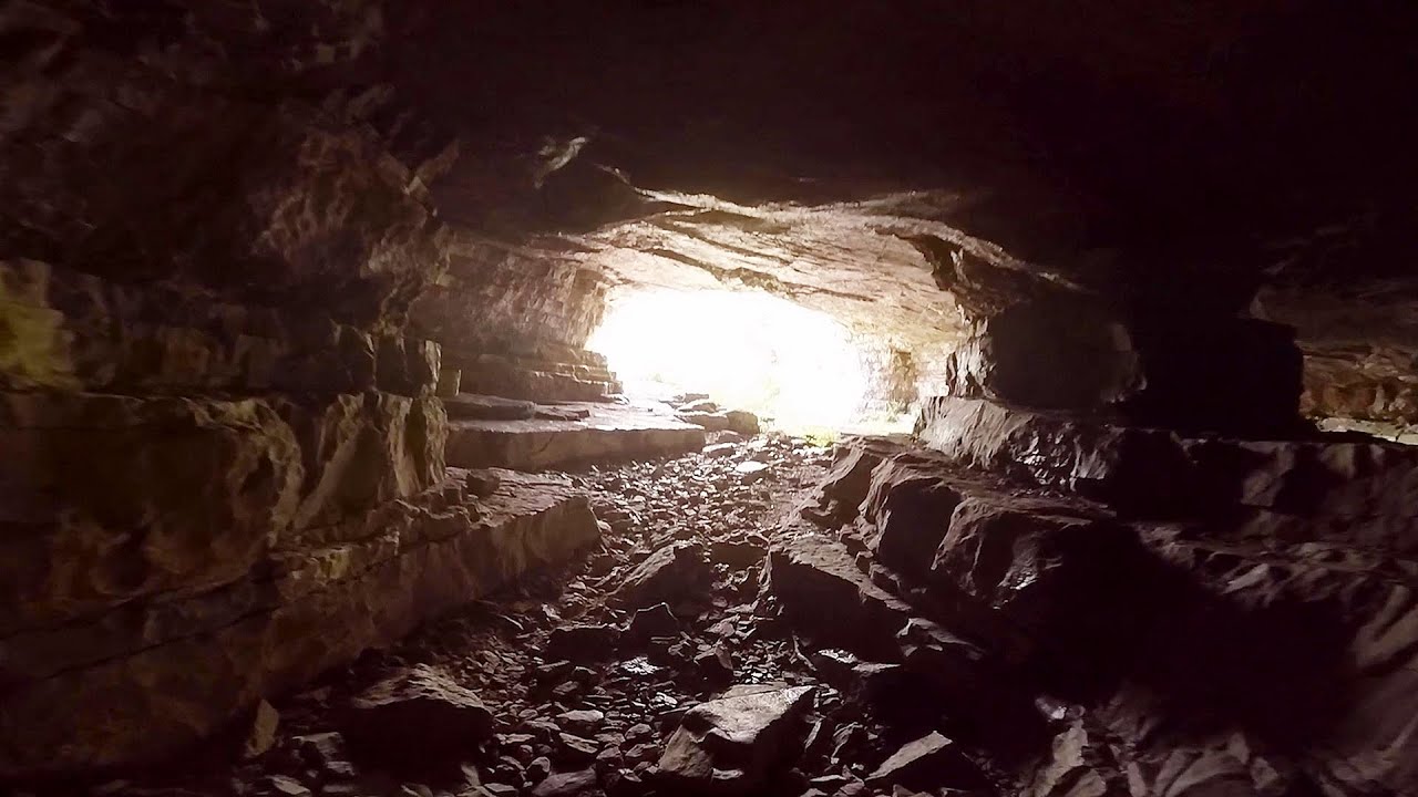
Sleeping Beauty cave 27.7 km away. Shpella e Radacit (Sleeping Beauty) cave.
Via ferrata Shpellat Peja 37.1 km away.
[ Top ↑ ]
Copyright © 2003-2026 Trekkingklub and friends. Reproduction of any text, picture or video from this website, either in printed or electronic form, is prohibited without prior written permission.
The given distances are to be understood as straight line distances, and are approximate. Website made in Miercurea Ciuc  .
.