Split Cliff (Razdelenata kanara) - Sinemorets

The Split Cliff, also known as Divided Rock, is an interesting rock formation located south of Sinemorets and north of Listi Beach. There is a trail along the plateau, starting from either Listi or Lipite Beach.
Planned destination. Copyright © - 2025 Trekkingklub.com.
Already published 8741 photos and 136 videos. Please register for full access.
Photos of nearby places


Smooth Cliffs (Smooth Rocks, Gladkite Skali) - Rezovo (12 photos) 6.68 km away
Uniquely polished and smooth, these rocks near Rezovo stand out among the rough, sharp-edged rock formations along Bulgaria's Black Sea coast.

Rezovo, Bulgaria's Southeasternmost Coastal Village (14 photos) 6.93 km away
Located in southeastern Bulgaria on the Bulgaria-Turkey border, Rezovo is a picturesque seaside village and resort at the southernmost tip of the Bulgarian Black Sea Coast. It is notable for its position overlooking the Turkish bank of the Rezovo River.

The rocky coast of the Black Sea - Rezovo (23 photos) 7.02 km away
The coast of Rezovo village, which includes the Smooth Rocks (Gladkite Skali) and the Old Pier (Stariat Kei), is one of the most stunning rocky coastlines along Bulgaria's Black Sea coast.

The Old Pier (Stariat_Kei) - Rezovo (16 photos) 7.07 km away
The Old Pier is a historic structure that has served as a point for fishing and transportation. Today, it is a destination for visitors seeking tranquility, beautiful natural surroundings, and picturesque sea views.

Mermaid - Primorsko (8 photos) 31.57 km away
The statue of the mermaid is situated at the tip of the peninsula extending east of Primorsko. Elevated above the promenade on a rocky hillside, it occupies a highly visible location.

Portraits on the rocks - Primorsko Promenade and Lighthouse (12 photos) 31.73 km away
A wide seaside promenade that connects the northern and southern beaches of Primorsko. Along the promenade, on the rocks by the sea, the colorful images of famous personalities have been drawn.

The home of the mermaid - Primorsko (6 photos) 33.71 km away
A human-sized mermaid statue, weighing 800 kg, is lying on the seabed. It is located near the Small Crocodile Islet, south of the underwater chapel, at a depth of 12 meters next to a vertical cliff.
[ Top ↑ ]
Videos of nearby places
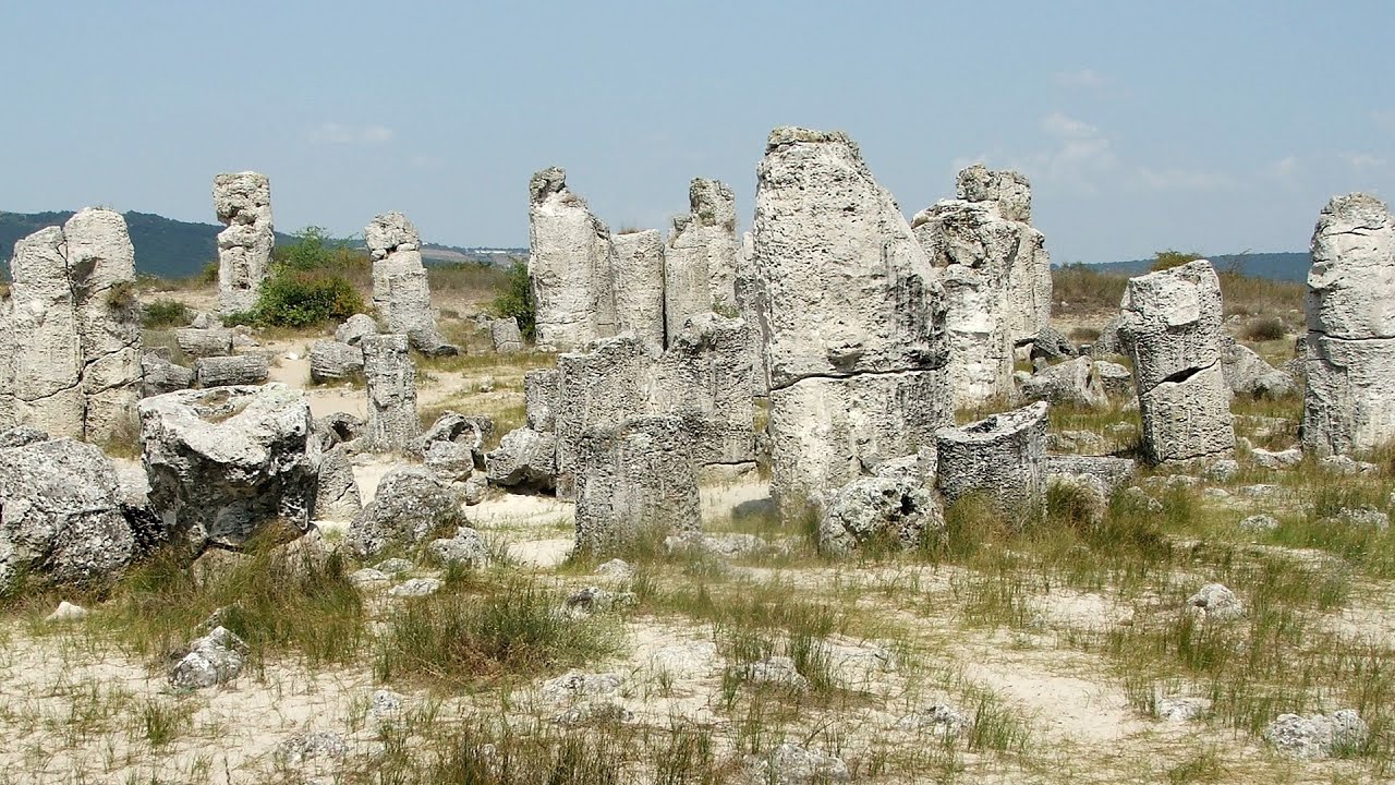
Pobiti Kamani (Stone Forest) - Slanchevo 134.12 km away
The Stone Forest of Bulgaria is located 18 km west of Varna, at the foothills of the Eastern Balkan Mountains. Its Bulgarian name, Pobiti Kamani, translates to planted stones, and it is referred to in English as the Stone Desert or Stone Forest.
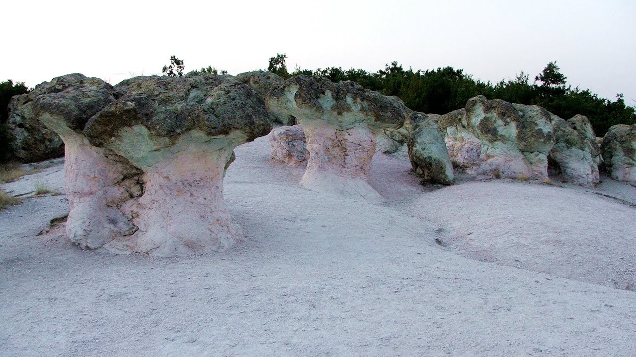
Kamenni Gabi (Stone Mushrooms) - Beli Plast 214.55 km away
The Stone Mushrooms (Kamenni Gabi) nature reserve in Bulgaria is situated east of the village of Beli Plast, along the road that connects Kardzhali to Haskovo. Spanning an area of 3 hectares, the reserve is home to several mushroom-shaped rock formations.
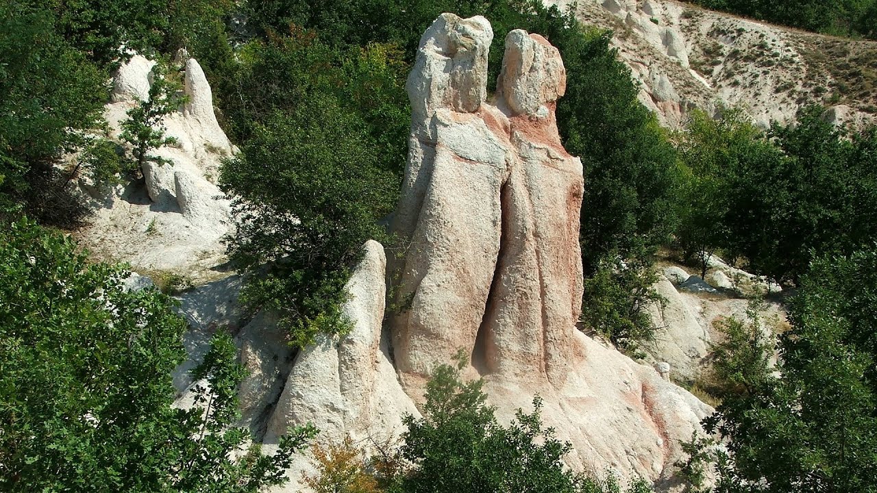
The Stone Wedding - Zimzelen, Kardzhali 219.82 km away
The Stone Wedding (Kamenna Svatba, Petrified Wedding, Kardzhali Pyramids) is located near the village of Zimzelen, close to the city of Kardzhali, in the eastern part of the Rhodope Mountains in Bulgaria. This spectacular natural formation was declared a natural monument in 1974.

Buzludzha monument - Kazanluk 227.65 km away
Buzludzha is a historically significant mountain located in the Central Balkan Mountains of Bulgaria. At its summit, at an altitude of 1432 meters above sea level, there is an abandoned monument.
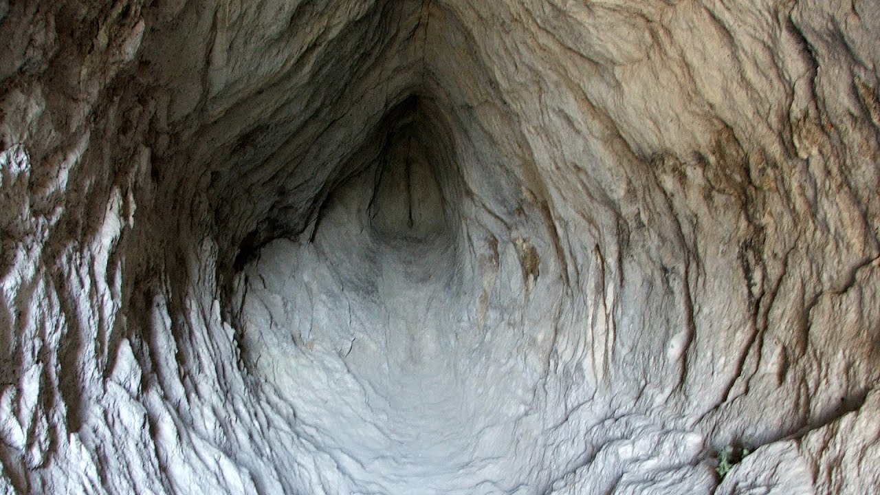
Vulva cave - Rhodope Mountains 231.1 km away
The Vulva Cave (Peshtera Utroba) is situated near the village of Nenkovo and the city of Kardzhali, in the Rhodope Mountains of Bulgaria. It derives its name from the shape of its entrance, which resembles a vulva.
Other places
Hili cove iron path Turda Gorges 609.17 km away
While the first time I climbed this via ferrata in the morning, now I climbed it in the light of the setting sun. The red-dressed rocks created a special atmosphere, and I could admire the sunset from the top of the climbing route.
While the first time I climbed this via ferrata in the morning, now I climbed it in the light of the setting sun. The red-dressed rocks created a special atmosphere, and I could admire the sunset from the top of the climbing route.
Big Via ferrata Rasnoavei Gorges 437.57 km away
The most dangerous Eastern European iron path, and also one of the most beautiful via ferrata routes in Romania, is in the Rasnoavei Gorges, Postavaru Mountains.The route is 450 m long, with a level difference of 220 m.
The most dangerous Eastern European iron path, and also one of the most beautiful via ferrata routes in Romania, is in the Rasnoavei Gorges, Postavaru Mountains.The route is 450 m long, with a level difference of 220 m.
Iskar gorge (Lyutibrod) Temnata dupka cave (Lakatnik) 395.6 km away
The Iskar is the longest purely Bulgarian river, the oldest river in the Balkans, and a right tributary of the Danube. The river is 368 km long, with approximately 150 km consisting of a gorge.
The Iskar is the longest purely Bulgarian river, the oldest river in the Balkans, and a right tributary of the Danube. The river is 368 km long, with approximately 150 km consisting of a gorge.
Kamenni Gabi (Stone Mushrooms) Beli Plast 214.55 km away
The Stone Mushrooms (Kamenni Gabi) nature reserve in Bulgaria is situated east of the village of Beli Plast, along the road that connects Kardzhali to Haskovo. Spanning an area of 3 hectares, the reserve is home to several mushroom-shaped rock formations.
The Stone Mushrooms (Kamenni Gabi) nature reserve in Bulgaria is situated east of the village of Beli Plast, along the road that connects Kardzhali to Haskovo. Spanning an area of 3 hectares, the reserve is home to several mushroom-shaped rock formations.
Snow-covered valley of Balea and the Transfagarasan in winter The ascent 483.55 km away
The Fagarasi Mountains can be easily approached from the north, mainly by using the Transfagarasan Road. This high altitude mountain road is only accessible during the summer months (throughout its entire length), but from the Balea Waterfall station (Statia Balea Cascada) you can also reach the Balea Lake by cable car.
The Fagarasi Mountains can be easily approached from the north, mainly by using the Transfagarasan Road. This high altitude mountain road is only accessible during the summer months (throughout its entire length), but from the Balea Waterfall station (Statia Balea Cascada) you can also reach the Balea Lake by cable car.
Planned destinations
Abandoned Sports Hall Varna 130.69 km away
An abandoned sports hall in Varna, with an unfinished dormitory and tennis courts across three levels.
An abandoned sports hall in Varna, with an unfinished dormitory and tennis courts across three levels.
Thracian stone sharapani (Grape processing containers) Nochevo 231.97 km away
Sharapani is a traditional stone container used by ancient Thracians for processing grapes in wine production. Two well-preserved sharapani containers are located about 200 meters apart.
Sharapani is a traditional stone container used by ancient Thracians for processing grapes in wine production. Two well-preserved sharapani containers are located about 200 meters apart.
Kodzha in (Golyamata Peshtera, Big Cave) Nochevo 232.28 km away
Kamennata pateka (The Stone Path) Nochevo 232.45 km away
[ Top ↑ ]
[ Top ↑ ]
Copyright © 2003-2025 Trekkingklub and friends. Reproduction of any text, picture or video from this website, either in printed or electronic form, is prohibited without prior written permission. The given distances are to be understood as straight line distances, and are approximate. Website made in Miercurea Ciuc  .
.