Devil's Hand Rock - Ciucas Mountains - photos


Page no. 1, photos: 1-10, 30 photos in total. >>>

Dalghiu - Devil's Hand Rock - Ciucas peak - Vama Buzaului
Copyright © 2010 - 2025 Trekkingklub.com.
Already published 8925 photos and 149 videos. Please register for full access.
Photos of nearby places


[ Top ↑ ]
Videos of nearby places
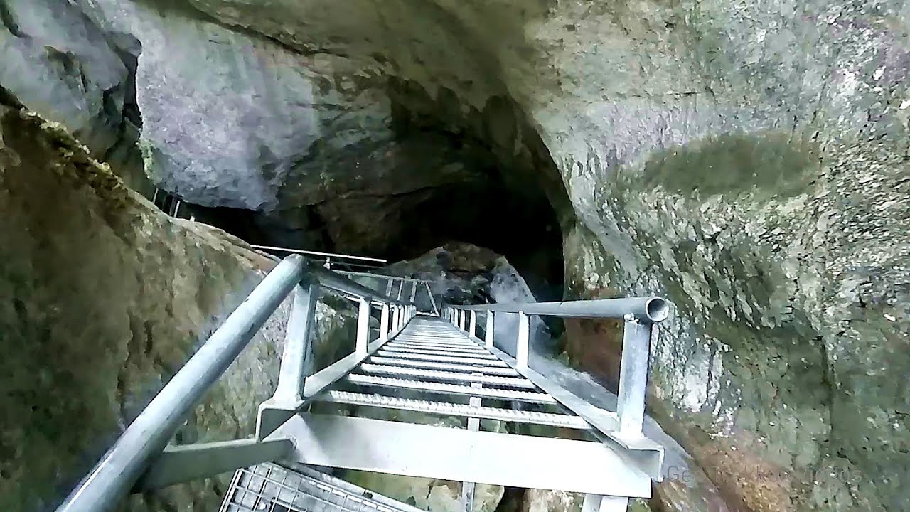
Seven Ladder Canyon and Waterfall - Piatra Mare Mountain 26.44 km away
The Seven Ladder Gorge is the largest and most spectacular gorge in the Piatra Mare massif. The narrow canyon has a length of 160 meters, and over a drop of 58 meters includes 7 bigger and several smaller waterfalls.
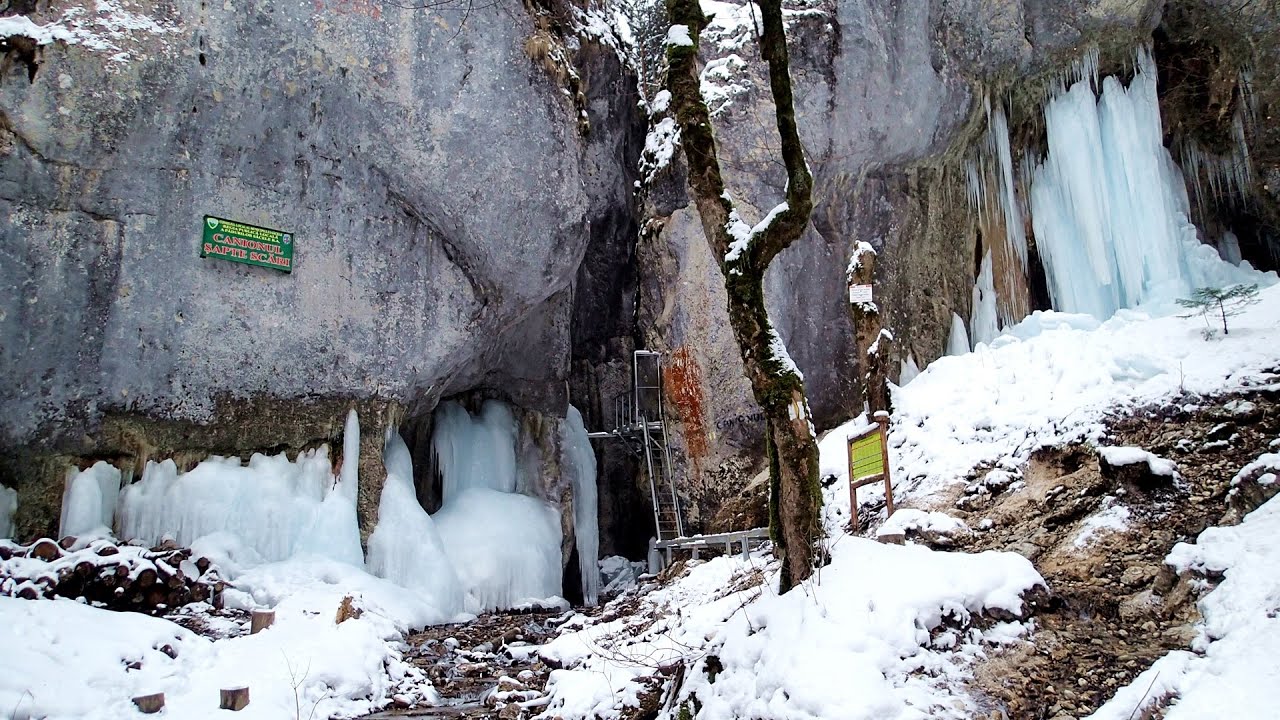
Seven Ladder Canyon in Winter - Piatra Mare Mountain 26.52 km away
Seven Ladder Canyon and Waterfall in Winter - Piatra Mare Mountain
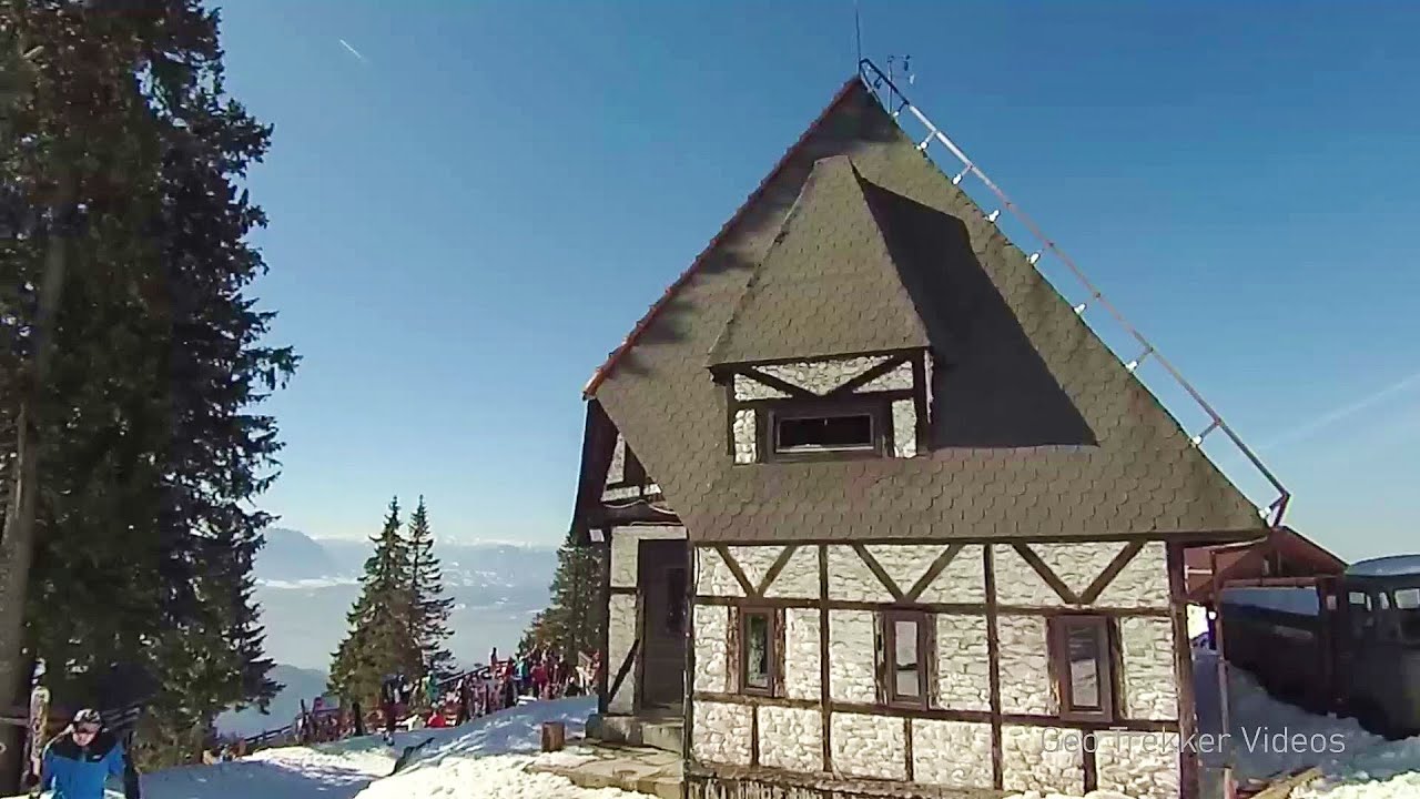
Ski resort - Poiana Brasov - Postavarul Mountains 33.43 km away
Shining sun and an Austria-feeling on the impeccable slopes of the ski paradise Poiana Brasov above Brasov. Sunbathing, coffee and refreshing drinks on the terrace of Julius Römer chalet.
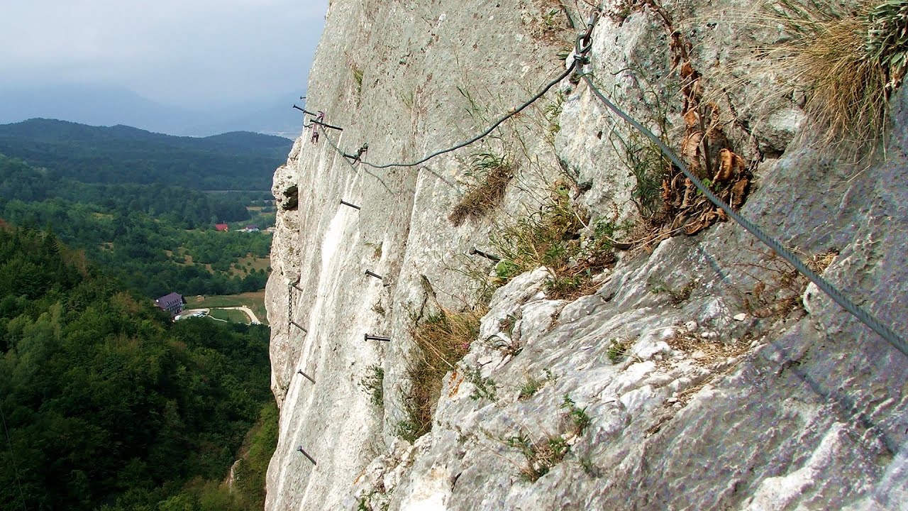
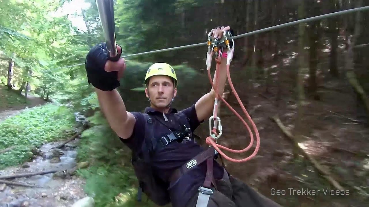
Big Via ferrata Rasnoavei Gorge 36.36 km away
The most dangerous Eastern European iron path, and also one of the most beautiful via ferrata routes in Romania, is in the Rasnoavei Gorges, Postavaru Mountains.The route is 450 m long, with a level difference of 220 m.
Other places
Ticuiata Rock (Stanca Picuiata) Trascau Mountains 202.71 km away
Doabra Stones Brezoi, Lotru Mountains 137.62 km away
The DN7A road branches off west from the Olt Valley, from the main road between Sibiu and Ramnicu Valcea, leading towards Voineasa and Lake Vidra. The first settlement is a small town, Brezoi, which is located at the confluence of the Lotru and Olt rivers.
The DN7A road branches off west from the Olt Valley, from the main road between Sibiu and Ramnicu Valcea, leading towards Voineasa and Lake Vidra. The first settlement is a small town, Brezoi, which is located at the confluence of the Lotru and Olt rivers.
With snowshoes in the Tihu creek valley Rastolita 182.7 km away
We met geotrekking treasure hunters from Gheorgheni, Miercurea Ciuc and Targu Mures in Rastolita. We entered the Calimani Mountains with an off-road vehicle, along the Rastolita and Tihu streams.
We met geotrekking treasure hunters from Gheorgheni, Miercurea Ciuc and Targu Mures in Rastolita. We entered the Calimani Mountains with an off-road vehicle, along the Rastolita and Tihu streams.
Ski Gyimes ski slope Lunca de Sus 106.16 km away
The Ski Gyimes ski slope is located in Lunca de Sus, right next to the main road. It is 800 m long, the level difference is 160 m.
The Ski Gyimes ski slope is located in Lunca de Sus, right next to the main road. It is 800 m long, the level difference is 160 m.
Wild Ferenc memorial path Suhardul Mic 137.85 km away
In recent days, this news has been everywhere: the via ferrata route built on the southwest wall of Suhardul Mic (Little Suhard) has finally been completed and inaugurated. The new route has been named after Ferenc Wild, in memory of the former mountain rescuer, sports writer, and one of the founders of the mountain rescue association in Gheorgheni.
In recent days, this news has been everywhere: the via ferrata route built on the southwest wall of Suhardul Mic (Little Suhard) has finally been completed and inaugurated. The new route has been named after Ferenc Wild, in memory of the former mountain rescuer, sports writer, and one of the founders of the mountain rescue association in Gheorgheni.
[ Top ↑ ]
[ Top ↑ ]
Copyright © 2003-2025 Trekkingklub and friends. Reproduction of any text, picture or video from this website, either in printed or electronic form, is prohibited without prior written permission.
Nearby settlements: Vama Buzaului 3.48 km away, Tourist attractions near Vama Buzaului 3.48 km away. The given distances are to be understood as straight line distances, and are approximate. Website made in Miercurea Ciuc  .
.