Slunjcica - Rastoke, Slunj - Croatia | Photos


Page no. 1, photos: 1-10, 12 photos in total. >>>

The Slunjcica river is situated in central Croatia, flowing through the Kordun region. The city of Slunj is named after this river. Read more
Copyright © 2010 - 2025 Trekkingklub.com.
Already published 8983 photos and 180 videos. Please register for full and ad-free access.
Photos of nearby places

Plitvice Lakes - Croatia (60 photos) 24.49 km away
The Plitvice Lakes National Park is the oldest and largest national park in Croatia. It is located in a mountainous region between Mala Kapela and Licka Pljesivica.

Port of Jablanac - Croatia (18 photos) 71.18 km away
Situated in Lika-Senj county, Croatia, Jablanac is a village located beneath the Velebit mountain, overlooking the neighboring island of Rab in the Adriatic Sea. In close proximity to Jablanac are the Velebit mountain and the Northern Velebit National Park.

Rab Island - Croatia (24 photos) 76.62 km away
Rab is a small island located in the Adriatic Sea, belonging to Croatia. It is known for its beautiful beaches, mild climate, and historic town of the same name.

Old town Krk - Krk Island, Croatia (11 photos) 80.03 km away
Krk is a Croatian island located in the Adriatic Sea. It is the largest island in the country, and has a rich history dating back to ancient times.

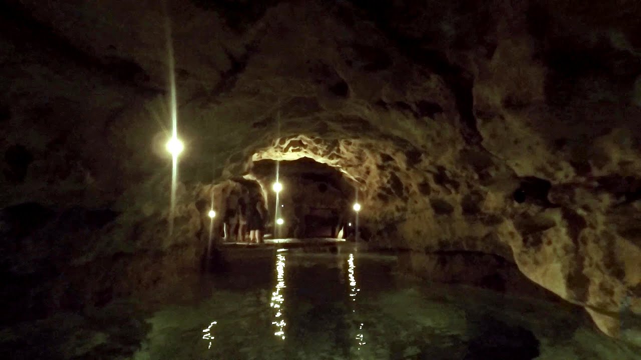
Manita pec cave - Croatia (21 photos) 90.01 km away
There are 115 caves so far known in the Paklenica National Park, Manita pec is the most famous one, and is open to the public for guided visits. The cave has beautiful chambers, and various cave formations such as stalagmites, stalactites, columns, and flowstones.

Paklenica National Park - Croatia (55 photos) 92.37 km away
In 1949, the area of Velika and Mala Paklenica was designated as a national park due to its natural features, forests, and geomorphologic structures. The main purpose was to protect the largest and best-preserved forest complex in Dalmatia, which was at risk from excessive exploitation.

Postojna Cave - Slovenia (12 photos) 130.69 km away
The Postojna Cave (Postojnska jama) is a renowned tourist attraction located in Slovenia. It is a network of underground galleries and halls, stretching over 24 kilometers, known for its geological formations, including stalagmites and stalactites.

Predjama Castle - Slovenia (54 photos) 137.69 km away
Predjama Castle built onto a cave, is situated on a cliff, in the village of Predjama, Slovenia. The castle has a rich history dating back to the 13th century.
[ Top ↑ ]
Videos of nearby places
Tapolca lake cave - Balaton-felvidéki National Park 242.9 km away
The Tapolca lake cave is situated in the Balaton-felvidéki National Park. A modern visitor center has been constructed at its entrance, featuring ten rooms that highlight the unique characteristics of karst regions.
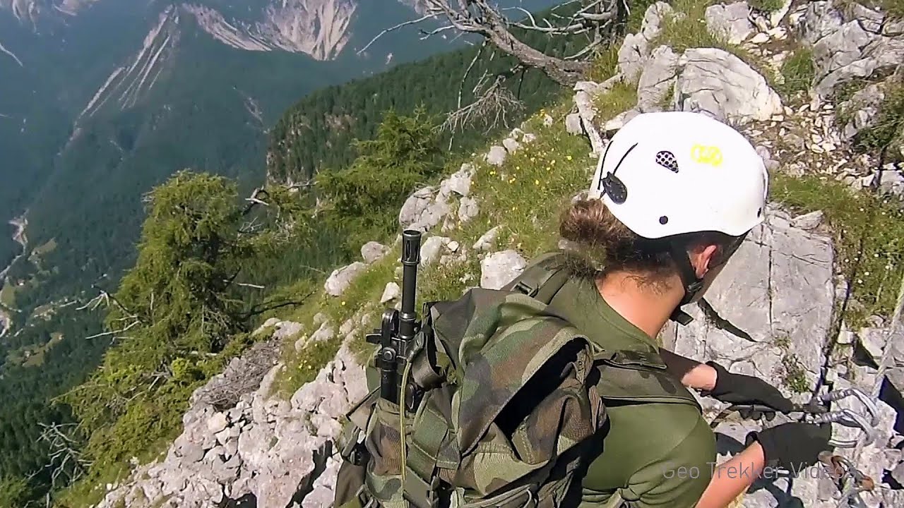
Kaiserschild Klettersteig - Eisenerzer Ramsau 274.33 km away
The 2,085-meter-high Kaiserschild peak is situated on the northern edge of the Eisenerz Alps in Styria, Austria. It forms a double summit with the slightly taller Hochkogel peak, which stands at 2,105 meters.
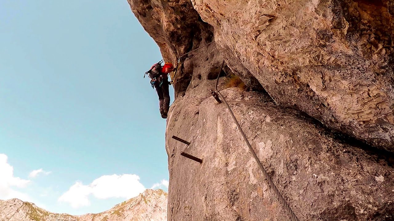
Via ferrata Adventure Climb Varmost - Forni di Sopra, Cima Clap Varmost, Alpi Carniche 276.53 km away
I participated in a joint, Szekler-Italian 'military exercise' :-) on the Adventure Climb Varmost via ferrata. The iron climbing route is located in the Friuli-Venezia Giulia region, in the Carnic Alps, and it leads up to the summit of Clap Varmost above Forni di Sopra.
Leopoldsteiner lake - Eisenerz, Steiermark 278.48 km away
Leopoldsteiner See is located in Styria, 4 km northwest of the town of Eisenerz. It lies at an elevation of 628 meters above sea level in the western part of the Hochschwab mountain range, at the foot of the Seemauer cliff.
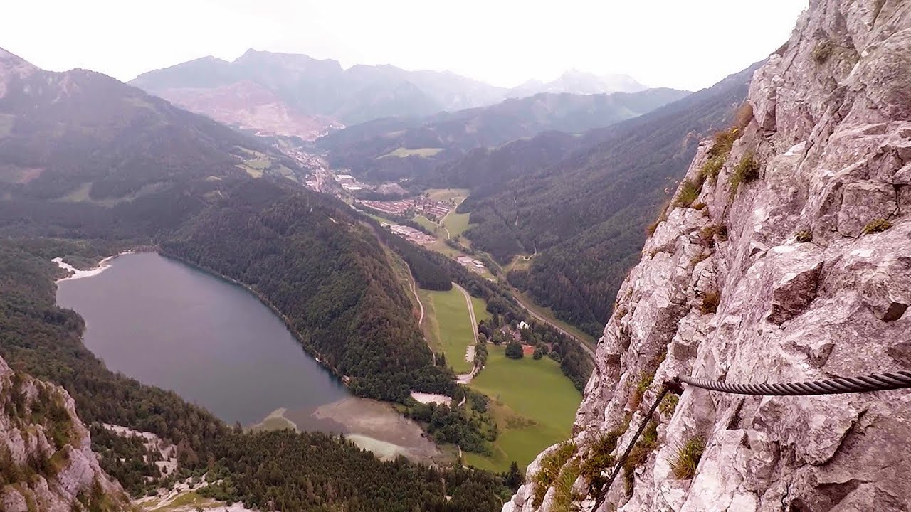
Kaiser Franz-Josef Klettersteig - Leopoldsteiner See 278.76 km away
The Franz-Josef Klettersteig is located on the Seemauer cliff face, which rises 900 meters above Leopoldsteiner Lake, in the western part of the Hochschwab mountain range, just 4 km from the town of Eisenerz. This via ferrata is named after the Kaisersteig, a hunting trail established for the esteemed Emperor Franz Joseph I of Austria and Hungary at the end of the 19th century, traces of which can still be observed today.
Other places
Silberkar Gorge (Silberkarklamm) Ramsau am Dachstein, Austria 294.97 km away
One of the most beautiful hiking spots in the area of Ramsau am Dachstein, is the Silberkarklamm. It is possible to drive to the entrance of the gorge, there is parking available on the side of the road, and you have to pay an entrance fee.
One of the most beautiful hiking spots in the area of Ramsau am Dachstein, is the Silberkarklamm. It is possible to drive to the entrance of the gorge, there is parking available on the side of the road, and you have to pay an entrance fee.
Kaiserschild Klettersteig Eisenerzer Ramsau 274.33 km away
The 2,085-meter-high Kaiserschild peak is situated on the northern edge of the Eisenerz Alps in Styria, Austria. It forms a double summit with the slightly taller Hochkogel peak, which stands at 2,105 meters.
The 2,085-meter-high Kaiserschild peak is situated on the northern edge of the Eisenerz Alps in Styria, Austria. It forms a double summit with the slightly taller Hochkogel peak, which stands at 2,105 meters.
Siega via ferrata Silberkar Gorge, Ramsau am Dachstein 296.04 km away
The Siega via ferrata, categorized as a C/D level of difficulty, is perhaps the least interesting of the three via ferrata routes in the Silberkar Gorge (Silberkarklamm). This doesn't mean that it's not good, just that the other two are even better.
The Siega via ferrata, categorized as a C/D level of difficulty, is perhaps the least interesting of the three via ferrata routes in the Silberkar Gorge (Silberkarklamm). This doesn't mean that it's not good, just that the other two are even better.
Leopoldsteiner lake Eisenerz, Steiermark 278.48 km away
Leopoldsteiner See is located in Styria, 4 km northwest of the town of Eisenerz. It lies at an elevation of 628 meters above sea level in the western part of the Hochschwab mountain range, at the foot of the Seemauer cliff.
Leopoldsteiner See is located in Styria, 4 km northwest of the town of Eisenerz. It lies at an elevation of 628 meters above sea level in the western part of the Hochschwab mountain range, at the foot of the Seemauer cliff.
Kaiser Franz-Josef Klettersteig Leopoldsteiner See 278.76 km away
The Franz-Josef Klettersteig is located on the Seemauer cliff face, which rises 900 meters above Leopoldsteiner Lake, in the western part of the Hochschwab mountain range, just 4 km from the town of Eisenerz. This via ferrata is named after the Kaisersteig, a hunting trail established for the esteemed Emperor Franz Joseph I of Austria and Hungary at the end of the 19th century, traces of which can still be observed today.
The Franz-Josef Klettersteig is located on the Seemauer cliff face, which rises 900 meters above Leopoldsteiner Lake, in the western part of the Hochschwab mountain range, just 4 km from the town of Eisenerz. This via ferrata is named after the Kaisersteig, a hunting trail established for the esteemed Emperor Franz Joseph I of Austria and Hungary at the end of the 19th century, traces of which can still be observed today.
[ Top ↑ ]
[ Top ↑ ]
Select language: - Magyar - Romana - Deutsch - Français - Italiano - Español - Copyright © 2003-2025 Trekkingklub and friends. Reproduction of any text, picture or video from this website, either in printed or electronic form, is prohibited without prior written permission. The given distances are to be understood as straight line distances, and are approximate. Website made in Miercurea Ciuc