Tourist attractions near Cohani (Abram, Bihor county, Romania)
Photos of nearby places

Cave of Winds - Padurea Craiului Mountains (24 photos) 43.8 km away. The Cave of Winds (Pestera Vantului) is located in the Padurea Craiului Mountains, not far from Frantura meadow, near Suncuius, on the left geographical side of the Crisul Repede River. The Cave of Winds was discovered in 1957 by Béla Bagaméri and is currently (as of 2003) the longest cave system known in Romania as well as in the Carpathian Basin.


The cave from the spring - Padurea Craiului Mountains (8 photos) 44.4 km away. Pestera de la Izvor (The cave from the spring) - Padurea Craiului Mountains.

Napistileu cave - Padurea Craiului (10 photos) 44.4 km away. Napistileu (Ungurul Mic) cave - Padurea Craiului Mountains.

Moanei Cave - Padurea Craiului Mountains (58 photos) 47.8 km away. The Moanei Cave (Pestera Moanei) is located on the upper course of the Misid River, on the right side of the Misid Gorge (Cheilor Misidului). The cave has two entrances, one fossil and sloped, while a subterranean stream flows through the active gallery.

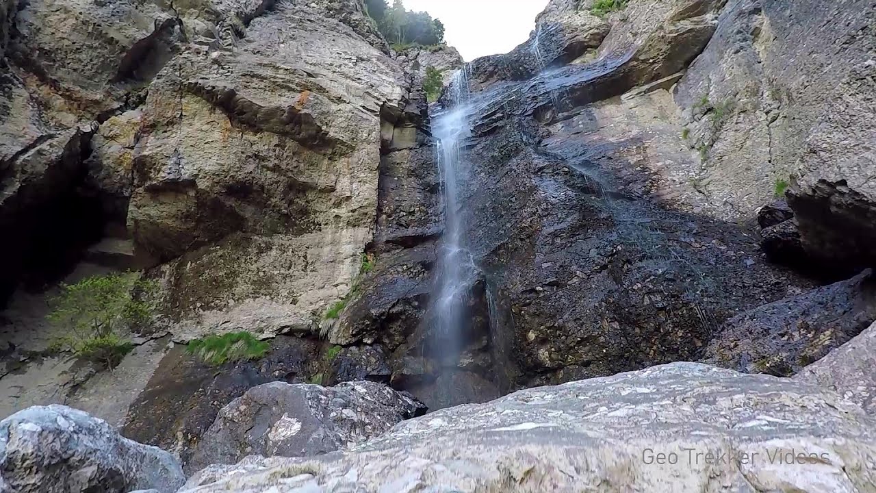
Oxen Waterfall - Padurea Craiului Mountains (12 photos) 49.1 km away. Oxen Waterfall (Cascada Boilor) - Padurea Craiului Mountains.

Sohodol pit cave - Padurea Craiului Mountains (10 photos) 50.5 km away. Sohodol pit cave (Avenul Sohodol) - Padurea Craiului Mountains.

Fern Cave - Padurea Craiului Mountains (9 photos) 53.4 km away. Ferigi (Fern) Cave - Padurea Craiului Mountains.

Kings Cave - Padurea Craiului Mountains (48 photos) 54.7 km away. Craiului (Kings) Cave - Padurea Craiului Mountains.

Valley of Hell - Padurea Craiului Mountains (23 photos) 57.7 km away. Valley of Hell (Valea Iadului) - Padurea Craiului Mountains.


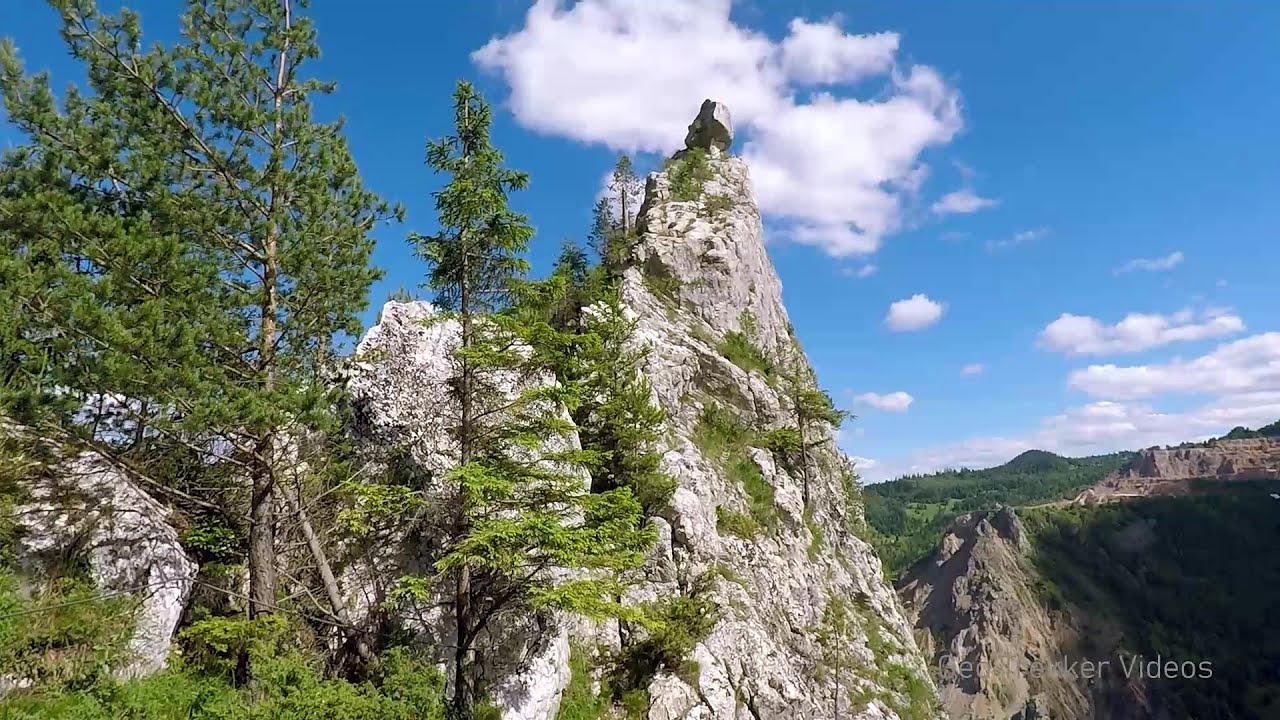
Dragons Garden - Galgau Almasului (20 photos) 69.4 km away. The natural reservation site Dragon's Garden (Gradina Zmeilor, Sárkányok kertje) from Galgaul Almasului is located in Salaj County, in the Western Carpathians. This natural playground is made up of interesting and unusual sandstone formations, an ensemble of 10-12 m high towers with strange figures cut in sandstone by the wind and water erosion.


Spherical concretions from Feleac (18 photos) 112.3 km away. The spherical concretions from Feleac are sedimentary rock materials that were cemented together to form a hard structure. The surrounding sediments slowly erode away, exposing the concretion.

Tureni Gorge iron path visiting route (24 photos) 126.7 km away. Tureni Gorge iron path visiting route (via ferrata) - Trascau Mountains.


Turda Gorge - Trascau Mountains (9 photos) 127.8 km away. Turda Gorge (Cheile Turzii) - Trascau Mountains.

Turda Gorge - Trascau Mountains (11 photos) 127.8 km away. Turda Gorge (Cheile Turzii) - Trascau Mountains.
[ Top ↑ ]
Videos of nearby places


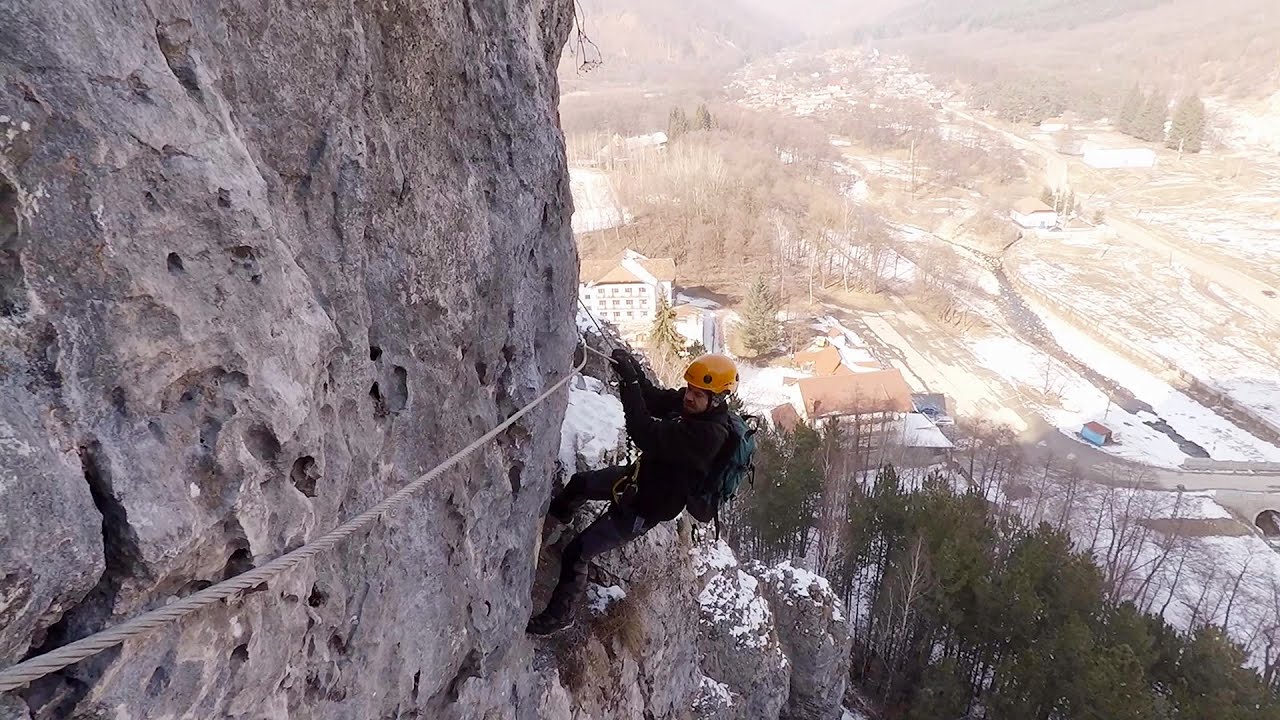
Via Ferrata Fairy Castle - Vadu Crisului 39.8 km away. Via Ferrata Fairy Castle (Castelul Zanelor, Casa Zmeului, The House of the Dragon) - Vadu Crisului. South of Vadu Crisului, in the Padurea Craiului Mountains, lies the Vadu Crisului Gorge, a section of the Crisul Repede river that narrows between rocky walls.

Fairy Cliff via ferrata route - Vadu Crisului 39.9 km away. Fairy Cliff (Peretele Zanelor) via ferrata route - Vadu Crisului. In Vadu Crisului, in the Padurea Craiului Mountains, on the right bank of the Crisul Repede, you can find the newest, in chronological order (2015) the fifth Transylvanian, new type of via ferrata route.

Vadu Crisului cave 40.8 km away. The Vadu Crisului Cave, with a total length of over 1000 meters, is located in the picturesque gorge of Crisul Repede creek. It consists of a gently meandering, long passage that features an active, stream level next to an upper, fossil level in its first section.

Other places
Upstream of the Izvorul Dorului creek Vanturis waterfalls 322.7 km away. Upstream of the Izvorul Dorului (Source of longing) creek - Vanturis waterfalls, Bucegi Mountains.
Sugau Rock lookout point and iron path 266.4 km away. Sugau Rock lookout point and iron path (B/C). Sugau Gorges - Munticelu Nature Reserve, Hasmas Mountains.

Stan Valley Canyon 276.2 km away. The Stan Valley is located near Lake Vidraru, southwest of it, in the Fruntii Mountains. Those who have visited the Seven Ladders Waterfall will appreciate this canyon, outfitted with infrastructure for tourist accessibility.
Womens Spiral, Cave Ridge, and The Great Crack iron paths Baia de Fier 258.5 km away. Perhaps the most interesting via ferrata among the routes in the Baia de Fier area is the Womens Spiral. After completing it, I can say that it is the second most thrilling via ferrata in Romania, following the Big Via Ferrata at Rasnov.
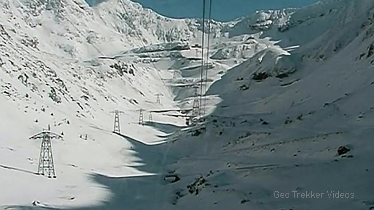
Snow-covered valley of Balea and the Transfagarasan in winter The ascent 252.1 km away. The Fagarasi Mountains can be easily approached from the north, mainly by using the Transfagarasan Road. This high altitude mountain road is only accessible during the summer months (throughout its entire length).
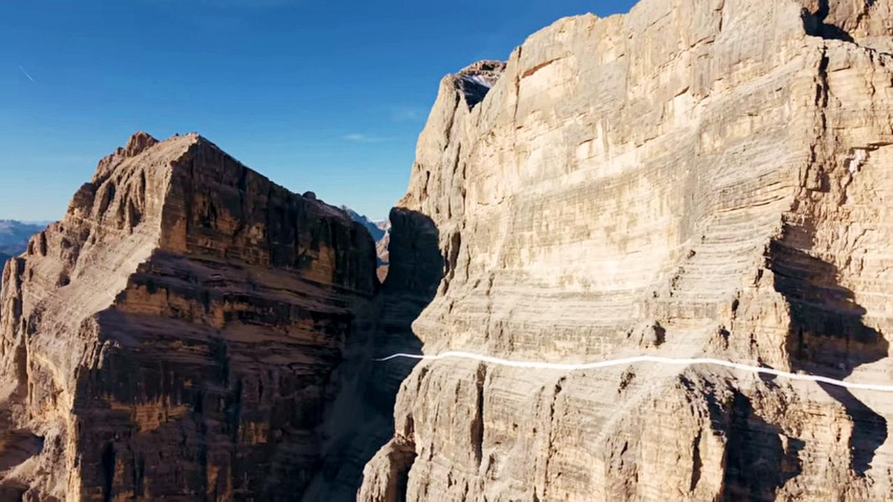
The Crack Grohmanns Ledge Monte Pelmo Monte Pelmo is nicknamed God's Armchair because its shape resembles a huge armchair. Between Monte Pelmo and Monte Pelmetto is The Crack (La Fessura).
Bicajel Gorge, Bicajel Waterfall, Stone of the Gorge 265.5 km away. Bicajel Gorge (Cheile Bicajelului), Bicajel Waterfall (Cascada Bicajel), Stone of the Gorge (Surduc Stone, Piatra Surducului) - Hasmas Mountains.
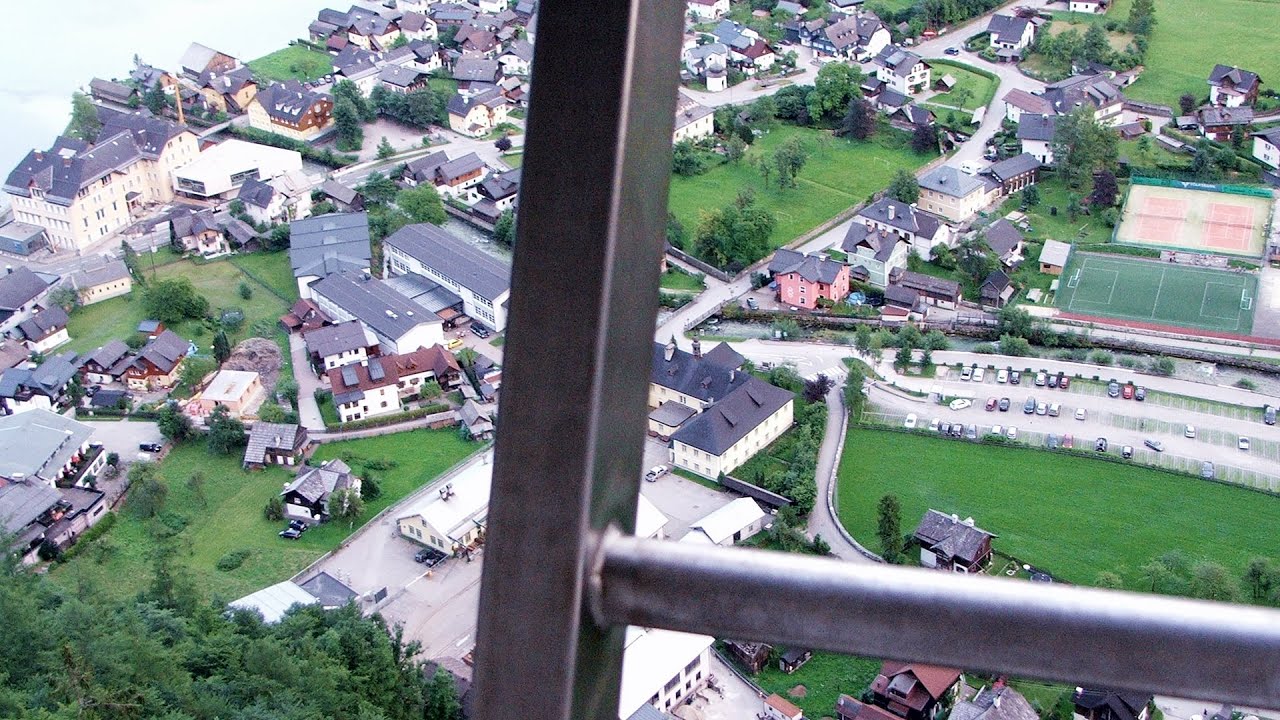
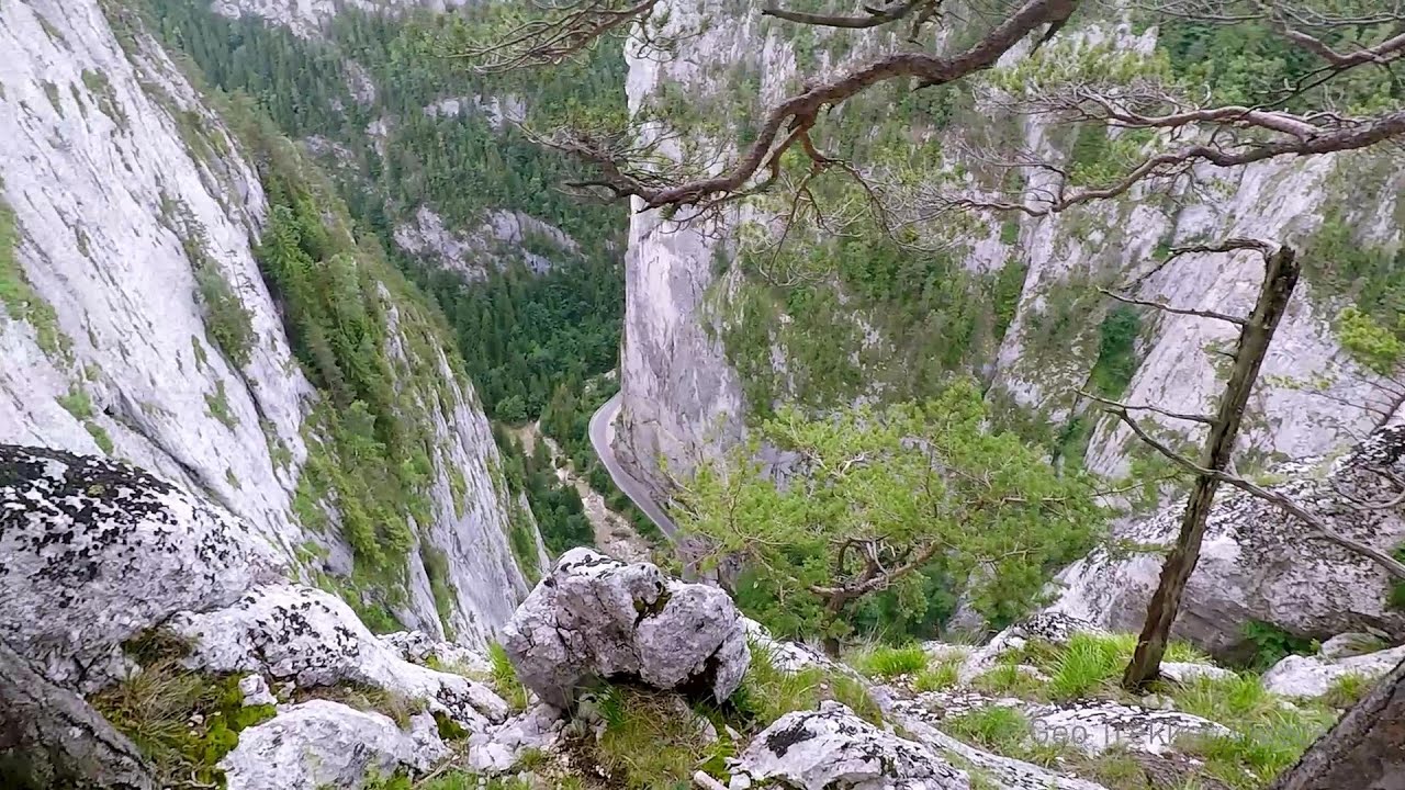
Echernwand via ferrata, World Heritage View Hallstatt, Salzberg, Dachstein Mountains I climbed the via ferrata on the Echernwand rock wall at dusk. This route is located above one of Austria's most beautiful lakes, and above Hallstatt.
[ Top ↑ ]
Copyright © 2003-2026 Trekkingklub and friends. Reproduction of any text, picture or video from this website, either in printed or electronic form, is prohibited without prior written permission. Website made with love  in Miercurea Ciuc.