Tourist attractions near Dobricionesti (Magesti, Bihor county, Romania)
Photos of nearby places

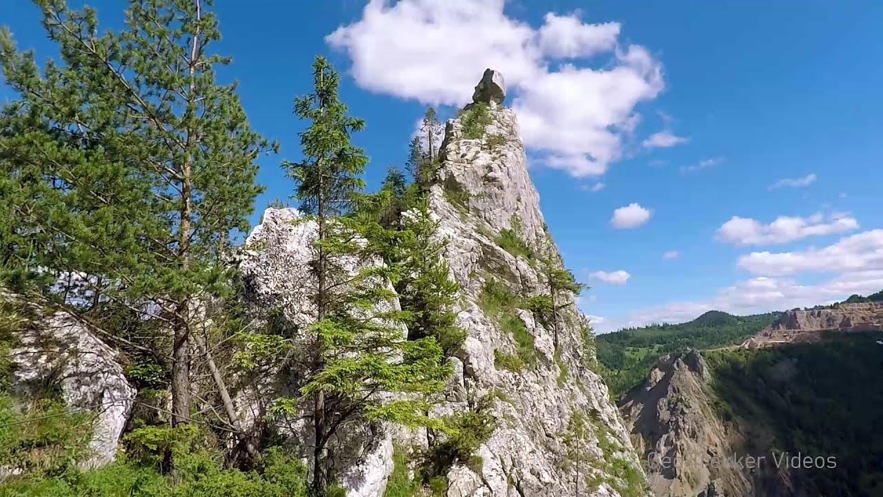
Cave of Winds - Padurea Craiului Mountains (24 photos) 8 km away. The Cave of Winds (Pestera Vantului) is located in the Padurea Craiului Mountains, not far from Frantura meadow, near Suncuius, on the left geographical side of the Crisul Repede River. The Cave of Winds was discovered in 1957 by Béla Bagaméri and is currently (as of 2003) the longest cave system known in Romania as well as in the Carpathian Basin.


The cave from the spring - Padurea Craiului Mountains (8 photos) 8.4 km away. Pestera de la Izvor (The cave from the spring) - Padurea Craiului Mountains.

Napistileu cave - Padurea Craiului (10 photos) 8.5 km away. Napistileu (Ungurul Mic) cave - Padurea Craiului Mountains.

Moanei Cave - Padurea Craiului Mountains (58 photos) 11.3 km away. The Moanei Cave (Pestera Moanei) is located on the upper course of the Misid River, on the right side of the Misid Gorge (Cheilor Misidului). The cave has two entrances, one fossil and sloped, while a subterranean stream flows through the active gallery.

Sohodol pit cave - Padurea Craiului Mountains (10 photos) 14.2 km away. Sohodol pit cave (Avenul Sohodol) - Padurea Craiului Mountains.

Oxen Waterfall - Padurea Craiului Mountains (12 photos) 14.7 km away. Oxen Waterfall (Cascada Boilor) - Padurea Craiului Mountains.

Fern Cave - Padurea Craiului Mountains (9 photos) 16.7 km away. Ferigi (Fern) Cave - Padurea Craiului Mountains.

Kings Cave - Padurea Craiului Mountains (48 photos) 18.2 km away. Craiului (Kings) Cave - Padurea Craiului Mountains.

Valley of Hell - Padurea Craiului Mountains (23 photos) 21.3 km away. Valley of Hell (Valea Iadului) - Padurea Craiului Mountains.


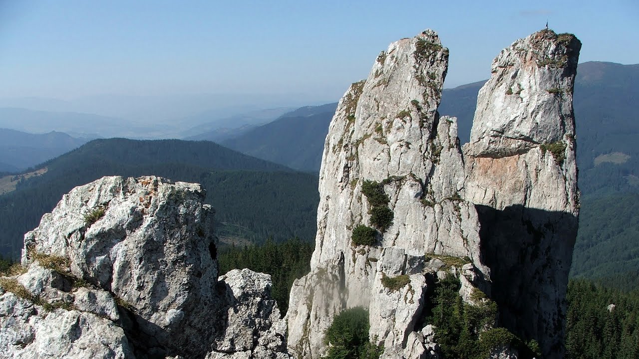
Dragons Garden - Galgau Almasului (20 photos) 66.6 km away. The natural reservation site Dragon's Garden (Gradina Zmeilor, Sárkányok kertje) from Galgaul Almasului is located in Salaj County, in the Western Carpathians. This natural playground is made up of interesting and unusual sandstone formations, an ensemble of 10-12 m high towers with strange figures cut in sandstone by the wind and water erosion.

Spherical concretions from Feleac (18 photos) 89.7 km away. The spherical concretions from Feleac are sedimentary rock materials that were cemented together to form a hard structure. The surrounding sediments slowly erode away, exposing the concretion.

Aries valley - Trascau Mountains (10 photos) 99.8 km away. Aries (Golden) valley - Trascau Mountains.

Balcony Clearing - Trascau Mountains (6 photos) 99.9 km away. Balcony Clearing (Erkély-tisztás, Balconul Sipotelor) - Trascau Mountains.

Dark Blue Bruises of the Ponor, Bedeleu (24 photos) 100.6 km away. Dark Blue Bruises of the Ponor (Vanatarile Ponorului), Bedeleu - Trascau Mountains.

Dark Blue Bruises of the Ponor - Trascau Mountains (16 photos) 102.1 km away. The Dark Blue Bruises of the Ponor (Vanatarile Ponorului) is a polje-type protected area. Polje is a Slovenian word meaning plain, and it refers to a surface karst form.
[ Top ↑ ]
Videos of nearby places

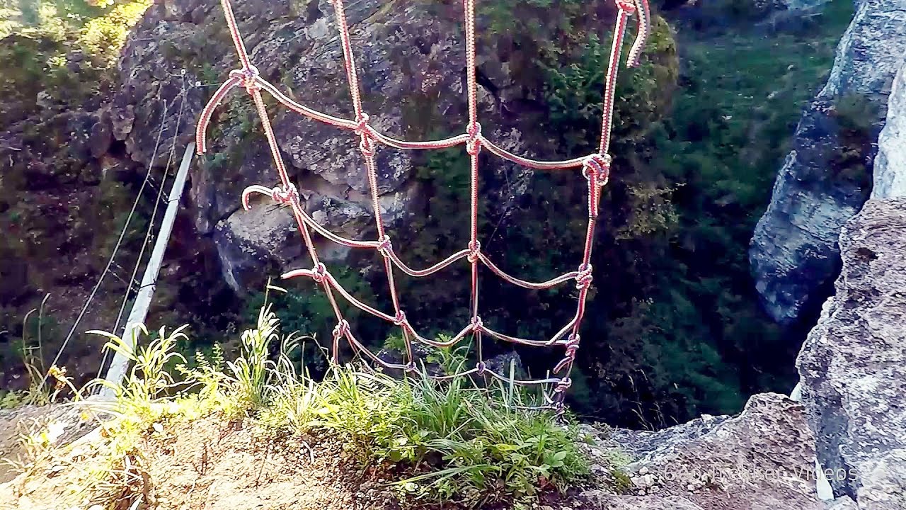
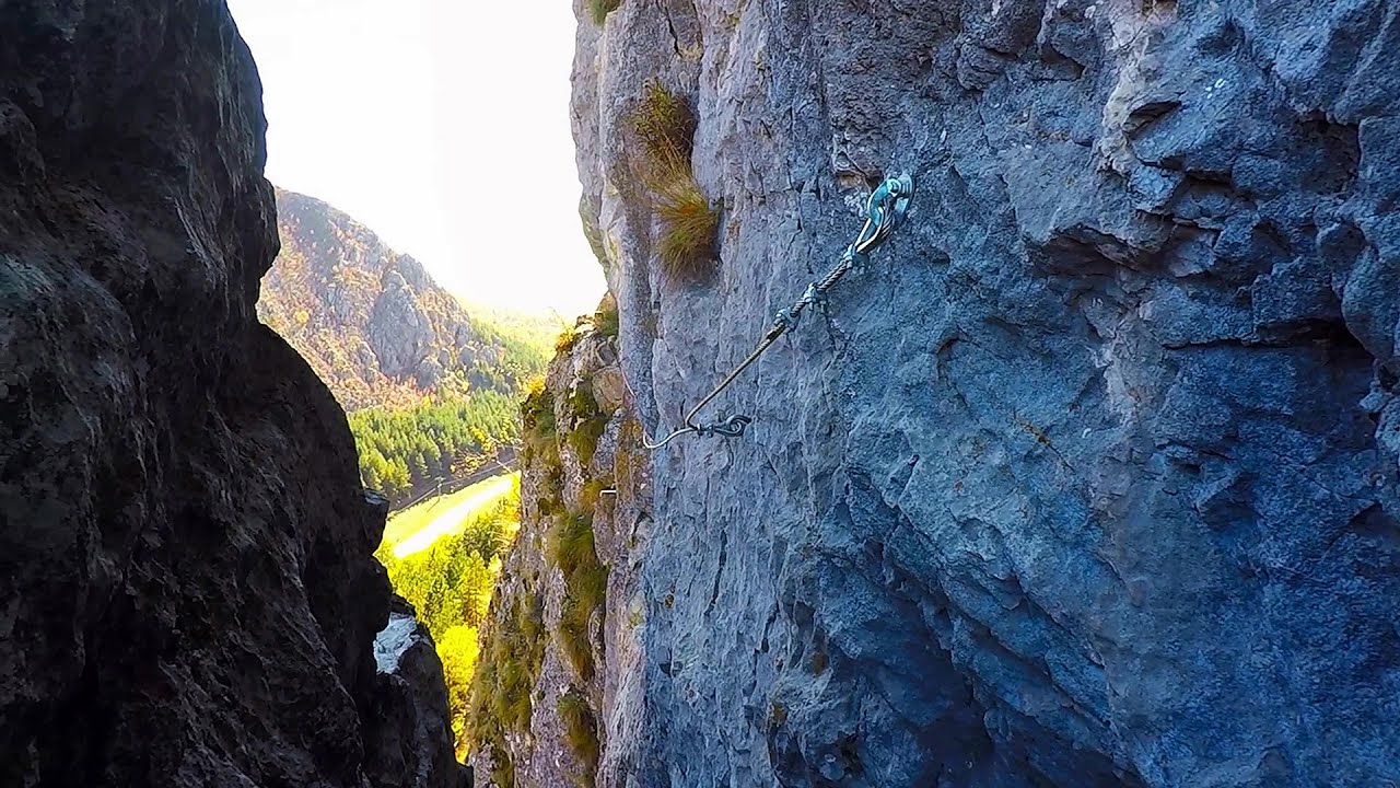
Via Ferrata Fairy Castle - Vadu Crisului 3.8 km away. Via Ferrata Fairy Castle (Castelul Zanelor, Casa Zmeului, The House of the Dragon) - Vadu Crisului. South of Vadu Crisului, in the Padurea Craiului Mountains, lies the Vadu Crisului Gorge, a section of the Crisul Repede river that narrows between rocky walls.

Fairy Cliff via ferrata route - Vadu Crisului 3.9 km away. Fairy Cliff (Peretele Zanelor) via ferrata route - Vadu Crisului. In Vadu Crisului, in the Padurea Craiului Mountains, on the right bank of the Crisul Repede, you can find the newest, in chronological order (2015) the fifth Transylvanian, new type of via ferrata route.

Vadu Crisului cave 4.5 km away. The Vadu Crisului Cave, with a total length of over 1000 meters, is located in the picturesque gorge of Crisul Repede creek. It consists of a gently meandering, long passage that features an active, stream level next to an upper, fossil level in its first section.


Acapulcos spur via ferrata 8.1 km away. Acapulco's spur (Pintenul lui Acapulco) via ferrata (B/C) - Montana Land, Suncuius.
Other places
Via ferrata Bear Cave adventure and climbing zone Borsec 234.3 km away. The Bear Cave in Borsec is a vast natural formation, scattered with rocks and deep crevices. Access to the cave's cavities is through a series of narrow formations resembling canyons, surrounded by giant fir trees and rocks with interesting shapes.
Ladys Stones Rarau Mountains 238.3 km away. The Lady's Stones represent the heart, the mind, and the soul. The first two only help to understand the world when one possesses knowledge (they can be climbed with rock climbing gear), as emotions and thoughts (the two rock towers) obscure reality (the view).

The palm of God and the Heavens door Fundatura Ponorului mountain village 169.2 km away. One of the most picturesque places in Romania, one of the most beautiful mountain villages, and a photographer's paradise. Fundatura Ponorului is located in the Ponor Stream Valley, part of the Gradistea Muncelului - Cioclovina National Park, in the Sureanu Mountains.
Lonely Stone Hasmas Mountains 256.9 km away. On June 1, 2003, with a small group of friends, I left Balan, walking along the valley of the Sep (Beautiful) stream towards the Lonely Stone (Piatra Singuratica). Those who were with me at the time fell behind, and then other people joined for the hike.

Jumping waterfall Harghita Mountains 245.6 km away. Jumping waterfall (Cascada Saritoarea, Szökő) - Harghita Mountains.
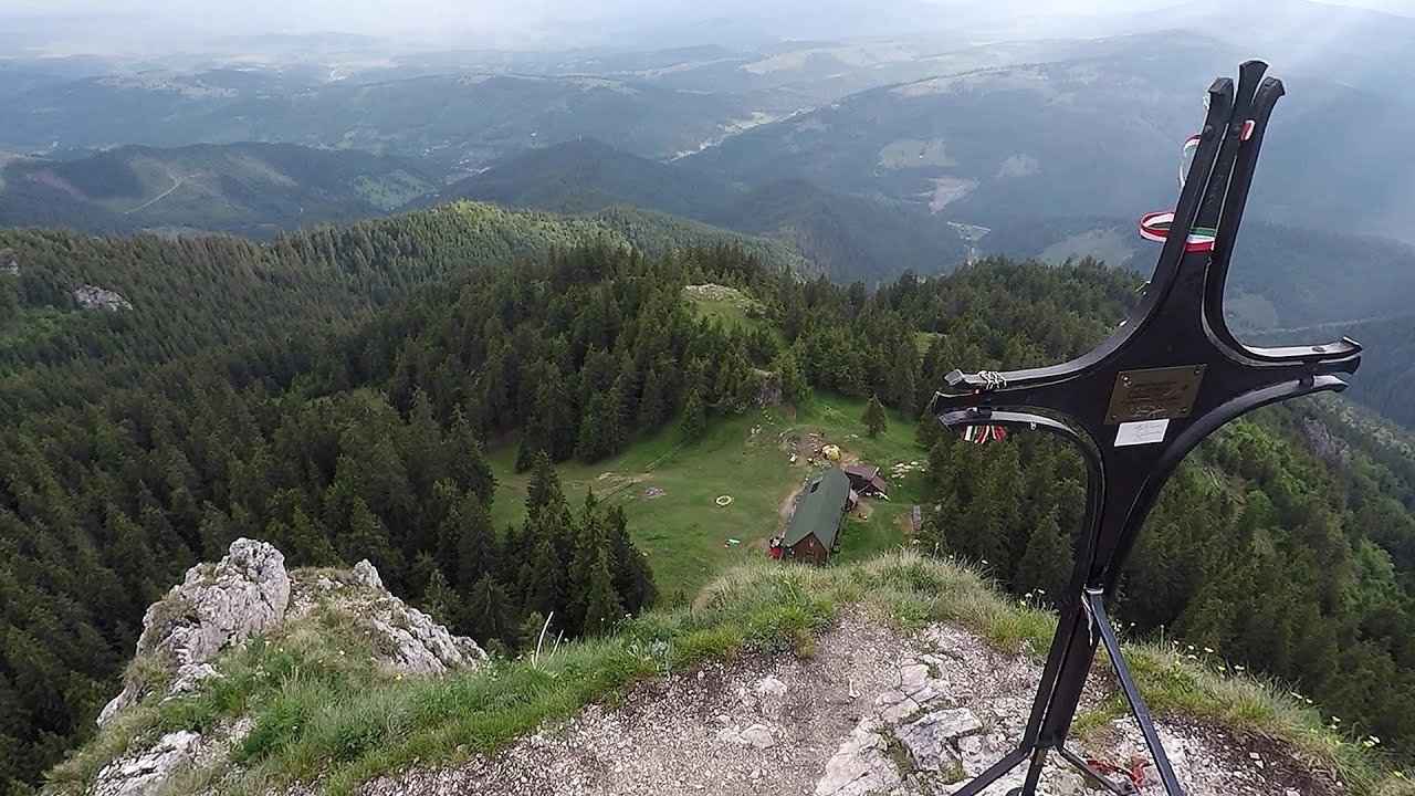
Sugau Rock lookout point and iron path 256.6 km away. Sugau Rock lookout point and iron path (B/C). Sugau Gorges - Munticelu Nature Reserve, Hasmas Mountains.

SkiGyimes ski slope Lunca de Sus 270.1 km away. It is well-known that in Rimetea, due to the Piatra Secuiului (Szekler's Rock) mountain, the Sun rises twice. However, perhaps few know that in Lunca de Sus, the Sun sets three times.
Middle Belt via ferrata route Baia de Fier 223.4 km away. Middle Belt (Spirala Medie) via ferrata route - Baia de Fier. In May 2018, two new via ferrata routes were inaugurated in Baia de Fier.

Shipka pass Shipka The Shipka Pass is one of the most spectacular crossings of the Balkan Mountains, and is part of the Bulgarka Nature Park. It separates the provinces of Gabrovo and Stara Zagora, and provides a connection between the cities of Gabrovo and Kazanlak.
[ Top ↑ ]
Copyright © 2003-2026 Trekkingklub and friends. Reproduction of any text, picture or video from this website, either in printed or electronic form, is prohibited without prior written permission. Website made with love  in Miercurea Ciuc.