Piatra Zimbrului (Bison Stone) - photos

64009144800
64009264801
64009274802
64009284803
64009294804
64009304805
48009316406
64009324807
Page no. 1, photos: 1-8, 20 photos in total. >>>

[ Hu ] - [ Ro ] - Hiking - Baile Tusnad
7th May 2008. Copyright © 2008 - 2024 Trekkingklub.com.
Already published 8077 photos and 65 videos. Please register for full access.

Photos of nearby places

Balvanyos Bath
Balvanyos Bath (3rd March 2004 - 11 photos) 1.28 km away
Balvanyos fortress - Baile Balvanyos
Balvanyos fortress - Baile Balvanyos (22nd July 2007 - 12 photos) 2.37 km away
Budos hegy
Budos hegy (15th April 2004 - 8 photos) 2.82 km away
Puturosu (Stinking) Mountain
Healing springs - Jombor creek baths
Healing springs - Jombor creek baths (22nd June 2009 - 15 photos) 2.85 km away
Buffogó swamp - Baile Balvanyos
Buffogó swamp - Baile Balvanyos (22nd July 2007 - 11 photos) 3.72 km away
Mohos peat bog
Mohos peat bog (10th May 2004 - 4 photos) 6.08 km away
Saint Ann lake
Saint Ann lake (19th March 2006 - 22 photos) 6.15 km away
[ Top ↑ ]

Videos of nearby places
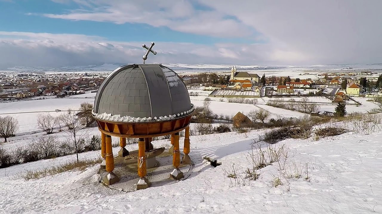
Preacher's Rock - Bodoc Mountains 9.82 km away
In the Bodoc Mountains, west-southwest from the Henter peak, we find a rock formation shaped like a mushroom by erosion, called Preacher's Rock. This 2-meter high rock probably got its name from the pagan Hungarian priests, who preached here in the past.
Walking to the top of Sumuleul Mare - Sumuleu Ciuc 31.71 km away
This was my first attempt at shooting a video.
Nobody's lake - Miercurea Ciuc 32.29 km away
The passage of time (time lapse), dusk at Nobody's Lake. Miercurea Ciuc and the Sumuleu mountain can be seen in the background.
Ski Gyimes ski slope - Lunca de Sus 47.39 km away
The Ski Gyimes ski slope is located in Lunca de Sus, right next to the main road. It is 800 m long, the level difference is 160 m. There are two lifts that takes you up to an altitude of 1060 meters above sea level.
Iron path - Harghita-Madaras 50.11 km away
Amateur filming in Harghita-Madaras, holding the camera by hand in the car, and helmet-mounted on the via ferrata. I climbed an iron path for the first time in my life on the Nyerges cliffs (Stancile Seii), I didn't have the right equipment yet. That's where I fell in love with climbing.

Other videos

Pricske peak Giurgeu Mountains 82.1 km away
If we want to reach Pricske (Prisca) peak, which rises above Gheorgheni and Lazarea, we start from the valley of the Güdüc (Ghidut) stream. Our path leads us past the ruins of a building known as the White House.
Banita Gorges and Banita rock bridge 216.97 km away
They say about this place that only very few people know about it, but that's not true. In fact, most nature lovers have heard of it, seen pictures taken here, even if not everyone has been able to come here. Since it has been talked about everywhere, and it has been advertised, I have also been planning to come here for years.
Hot air balloon parade 2015 Campu Cetatii 96.77 km away
This year, the Hot Air Balloon Parade was organized in Campu Cetatii for the tenth time. Unfortunately, the weather only allowed for flying on Saturday morning and evening.
Hili cove iron path Turda Gorges 182.28 km away
While the first time I climbed this via ferrata in the morning, now I climbed it in the light of the setting sun. The red-dressed rocks created a special atmosphere, and I could admire the sunset from the top of the climbing route. Although I prefer the sunrise more, because it lasts longer. :-)
Via ferrata Rocher de l'envers France 1549.91 km away
The Rocher de l'envers via ferrata is located in a beautiful environment, above Saint-Vincent-de-Mercuze, in France. Several beautiful and large waterfalls, as well as several small cascades, make it attractive.
Handeckfallbrücke, Gelmerbahn, Gelmersee Schweiz 1351.45 km away
Although the path from the Gelmerbahn parking bypasses the Handeckfall waterfall, it is worth descending a few steps from the valley station of the funicular, to reach Handeckfallbrücke. A 70-meter long suspension bridge that hangs 70 meters above the gorge, offering a spectacular view of the waterfall.
Via ferrata du Diable France 1492.89 km away
The Devil's Iron Path (Via ferrata du Diable) is a multi-part via ferrata, located above a spectacular waterfall (Cascade du Nant), in a gorge, below the Victor-Emmanuel fort. For me, this climbing route presented the greatest challenge so far.
Les Gorges de la Méouge France 1588.34 km away
Following today's climb, I experienced the soothing pleasure of immersing myself in the turquoise waters of the Méouge creek, in the pond beneath a waterfall. If you find yourself in Sisteron or Grenoble, do not miss the opportunity to explore the magnificent Méouge valley near Ribiers. And do not leave your swimwear behind.
Snow-covered valley of Balea and the Transfagarasan in winter The ascent 115.93 km away
The Fagarasi Mountains can be easily approached from the north, mainly by using the Transfagarasan Road. This road is only accessible during the summer months (throughout its entire length), but from the Balea Waterfall station (Statia Balea Cascada) you can also reach the Balea Lake by cable car.
Silberkarklamm Ramsau am Dachstein, Austria 942.77 km away
One of the most beautiful hiking spots in the area of Ramsau am Dachstein, is the Silberkarklamm. It is possible to drive to the entrance of the gorge, there is parking available on the side of the road, and you have to pay an entrance fee.
Crivadia Gorges 224.06 km away
The Crivadia Gorge is located next to the village of Crivadia, which belongs to Banita. Access is difficult, and the hike is made through the streambed, with water up to the waist at its narrowest point.
Black Rocks iron path Bihor Mountains 259.35 km away
Black Rocks is located in the Bihor Mountains, near the Vartop Saddle, to the west of it. It is interesting that the locals (if I understood correctly) do not know this name, but use the name Piatra Buna (meaning Good Stone) for this spectacular rock.
Echernwand Klettersteig Hallstatt, Austria 949.49 km away
I climbed the via ferrata on the Echernwand rock wall at dusk. This route is located above one of Austria's most beautiful lakes, and above Hallstatt. The iron climbing route was quite challenging at times, with the most exciting section being the Roll-dachl, an exposed rock formation, shaped like a nose.
Meziad cave Padurea Craiului Mountains 276.36 km away
The Meziad Cave is located near the village of Meziad, 22 km north of Beius, in the Padurea Craiului Mountains. It is one of our first tourist caves, its exploration is associated with the name of Gyula Czárán, cave researcher and writer.
Spirala Medie iron path Baia de Fier 198.1 km away
In May 2018, two new via ferrata routes were inaugurated in Baia de Fier. Both start from section G of the rock face hiding the Muierilor Cave, and their initial stages are shared. The Bear's Jump (in Romanian, Saritoarea Ursului) leads vertically upwards. The Middle Belt or Middle Spiral (in Romanian, Spirala Medie) connects the former to the Big Spiral via ferrata route.
[ Top ↑ ]
[ Top ↑ ]
Copyright © 2003-2024 Trekkingklub and friends. Reproduction of any text, picture or video from this website, either in printed or electronic form, is prohibited without prior written permission. Nearby settlements: Bixad 6.9 km away, Tourist attractions near Bixad 6.9 km away. The given distances are to be understood as straight line distances, and are approximate. Website made with love Made with love in Miercurea Ciuc.