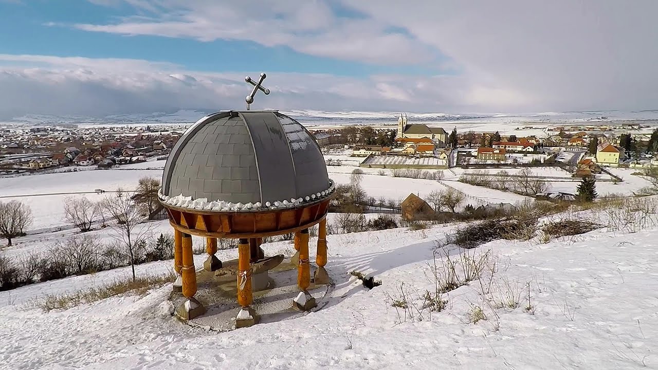
Balvanyos fortress - Baile Balvanyos - photos

64068344800
64068354801
64068364802
64068374803
64068384804
48068416405
64068424806
64068434807
Page no. 1, photos: 1-8, 12 photos in total. >>>

[ Hu ] - [ Ro ] - Hiking - Baile Tusnad
22nd July 2007. Copyright © 2007 - 2024 Trekkingklub.com.
Already published 8077 photos and 66 videos. Please register for full access.

Photos of nearby places

Balvanyos Bath
Balvanyos Bath (3rd March 2004 - 11 photos) 1.41 km away
Budos hegy
Budos hegy (15th April 2004 - 8 photos) 1.45 km away
Puturosu (Stinking) Mountain
Buffogó swamp - Baile Balvanyos
Buffogó swamp - Baile Balvanyos (22nd July 2007 - 11 photos) 1.92 km away
Piatra Zimbrului (Bison Stone)
Piatra Zimbrului (Bison Stone) (7th May 2008 - 20 photos) 2.37 km away
Healing springs - Jombor creek baths
Healing springs - Jombor creek baths (22nd June 2009 - 15 photos) 2.42 km away
Mohos peat bog
Mohos peat bog (10th May 2004 - 4 photos) 5.63 km away
Saint Ann lake
Saint Ann lake (19th March 2006 - 22 photos) 6.19 km away
[ Top ↑ ]

Videos of nearby places

Preacher's Rock - Bodoc Mountains 12.19 km away
In the Bodoc Mountains, west-southwest from the Henter peak, we find a rock formation shaped like a mushroom by erosion, called Preacher's Rock. This 2-meter high rock probably got its name from the pagan Hungarian priests, who preached here in the past.
Walking to the top of Sumuleul Mare - Sumuleu Ciuc 29.94 km away
This was my first attempt at shooting a video.
Nobody's lake - Miercurea Ciuc 30.89 km away
The passage of time (time lapse), dusk at Nobody's Lake. Miercurea Ciuc and the Sumuleu mountain can be seen in the background.
Ski Gyimes ski slope - Lunca de Sus 45.25 km away
The Ski Gyimes ski slope is located in Lunca de Sus, right next to the main road. It is 800 m long, the level difference is 160 m. There are two lifts that takes you up to an altitude of 1060 meters above sea level.
Iron path - Harghita-Madaras 49.02 km away
Amateur filming in Harghita-Madaras, holding the camera by hand in the car, and helmet-mounted on the via ferrata. I climbed an iron path for the first time in my life on the Nyerges cliffs (Stancile Seii), I didn't have the right equipment yet. That's where I fell in love with climbing.

Other videos

Sheepdogs Govora sheepfold Retezat mountains 244.56 km away
On the second day of my weekend Retezat hike, I visited a sheepfold on the Lancita Ridge. To my great disappointment, they didn't make cheese or curd here. The owners sell the more special types of sheep and rams in the autumn.
Via ferrata Adventure Climb Varmost Italia 1029.14 km away
I participated in a joint, Szekler-Italian 'military exercise' on the Adventure Climb Varmost via ferrata. :-) The iron climbing route is located in the Friuli-Venezia Giulia region, in the Carnic Alps, and it leads up to the summit of Clap Varmost above Forni di Sopra.
Les Gorges de la Méouge France 1589.34 km away
Following today's climb, I experienced the soothing pleasure of immersing myself in the turquoise waters of the Méouge creek, in the pond beneath a waterfall. If you find yourself in Sisteron or Grenoble, do not miss the opportunity to explore the magnificent Méouge valley near Ribiers. And do not leave your swimwear behind.
Nobody's lake Miercurea Ciuc 30.89 km away
The passage of time (time lapse), dusk at Nobody's Lake. Miercurea Ciuc and the Sumuleu mountain can be seen in the background.
Pricske peak Giurgeu Mountains 80.39 km away
If we want to reach Pricske (Prisca) peak, which rises above Gheorgheni and Lazarea, we start from the valley of the Güdüc (Ghidut) stream. Our path leads us past the ruins of a building known as the White House.
Astragalus iron path in winter Glod Stone, Munticelu 79.74 km away
The official website of the Sugau Gorges published information about a new via ferrata climbing route named Astragalus. Sugau Gorges - Munticelu is a nature conservation area part of Natura 2000 located in Neamt County, which borders Harghita County.
Crystal Cave at Farcu Mine 282.26 km away
In the Padurea Craiului Mountains, near Rosia, in the Farcu bauxite mine, in 1987, the miners accidentally discovered a cave. It was filled with crystal-shaped limestone formations.
Waterfalls of Velnita stone-quarry Targu Ocna 49.94 km away
Starting from the Velnita quarry, an adventurous nature enthusiast, accustomed to wild and rugged terrains, will discover a true waterfall paradise. At the upper part of the quarry, two streams converge.
The Heart of Jesus look-out Lupeni 62.74 km away
Through the mud on Gordon Mountain, above Farkaslaka (Lupeni commune, Harghita county, Transilvania), on a cloudy afternoon, at the end of February. The destination is the Heart of Jesus lookout, nicknamed as Pléhkrisztus (The Tin Christ).
Black Rocks iron path Bihor Mountains 259.91 km away
Black Rocks is located in the Bihor Mountains, near the Vartop Saddle, to the west of it. It is interesting that the locals (if I understood correctly) do not know this name, but use the name Piatra Buna (meaning Good Stone) for this spectacular rock.
Crivadia Gorges 225.66 km away
The Crivadia Gorge is located next to the village of Crivadia, which belongs to Banita. Access is difficult, and the hike is made through the streambed, with water up to the waist at its narrowest point.
Dachstein Gams klettersteig Austria 945.72 km away
The Dachstein Gams is a new via ferrata route on Krippenstein. It has three parts: Himmeleck (A/B), Gams (C), and Nordwand (E). Because it was my first time here, I only completed the first two sections.
Snow-covered valley of Balea and the Transfagarasan in winter The ascent 117.77 km away
The Fagarasi Mountains can be easily approached from the north, mainly by using the Transfagarasan Road. This road is only accessible during the summer months (throughout its entire length), but from the Balea Waterfall station (Statia Balea Cascada) you can also reach the Balea Lake by cable car.
Via ferrata de la Grande Fistoire France 1565.21 km away
Because I lost the footage I made the first time (don't buy SD cards from Alibaba!), at the end of June I visited this great and exciting via ferrata again. It has a 59-meter long suspension bridge (one of the longest in the Alps), at 200 m height, and a 32-meter long, uncomfortably swinging Nepalese bridge.
Mammuthöhle Dachstein Salzkammergut, Austria 944.7 km away
The first station of the Dachstein Krippenstein cable car, which starts in Obertraun, in the southern part of Lake Hallstatt, is Schönbergalm. Here you can find the Ice Cave and the Mammoth Cave. The latter is not named after the now extinct relatives of elephants, but rather because of its enormous size.
[ Top ↑ ]
[ Top ↑ ]
Copyright © 2003-2024 Trekkingklub and friends. Reproduction of any text, picture or video from this website, either in printed or electronic form, is prohibited without prior written permission. Nearby settlements: Bixad 7.95 km away, Tourist attractions near Bixad 7.95 km away. The given distances are to be understood as straight line distances, and are approximate. Website made with love Made with love in Miercurea Ciuc.