Balea Valley in April - Fagaras Mountains | Photos


Page no. 1, photos: 1-6, 36 photos in total. >>>

Copyright © 2012 - 2026 Trekkingklub.com. Please register for full and ad-free access.
Airport nearby: Sibiu International Airport (SBZ - Sibiu, Ro), 46 km away.
Photos of nearby places


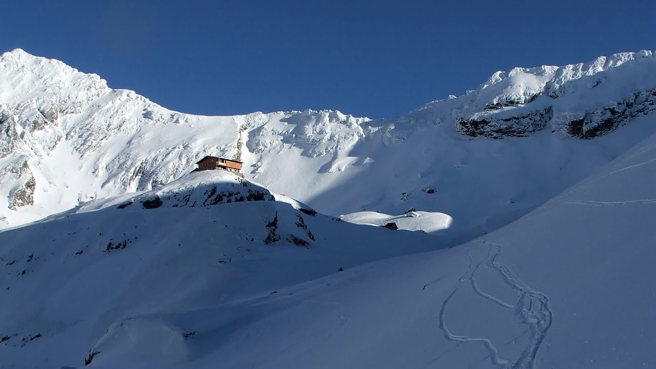
Chamois saddle - Fagaras Mountains (12 photos) 1.3 km away. Chamois saddle (Saua Caprei) - Fagaras Mountains.


[ Top ↑ ]
Videos of nearby places
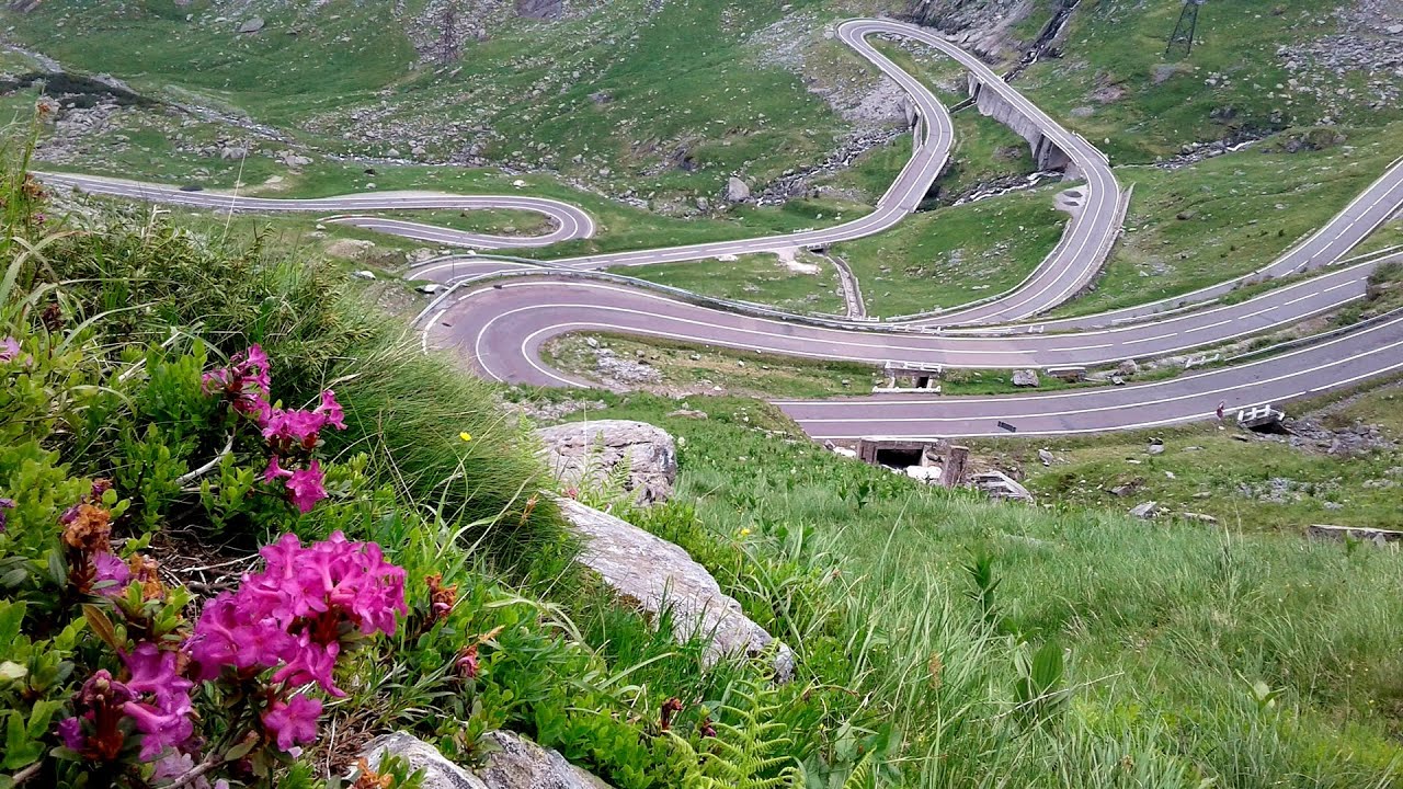
Balea waterfall and the Transfagarasan mountain_road 2.9 km away. Balea waterfall and the Transfagarasan mountain road - blue triangle marked trail, Balea valley, Fagaras Mountains, Southern Carpathians.
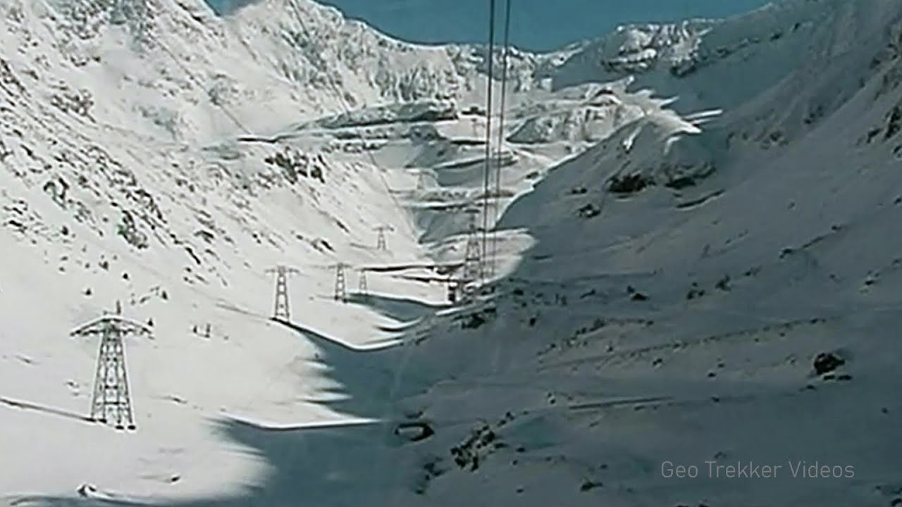
Snow-covered valley of Balea and the Transfagarasan in winter - The ascent 3.3 km away. The Fagarasi Mountains can be easily approached from the north, mainly by using the Transfagarasan Road. This high altitude mountain road is only accessible during the summer months (throughout its entire length).
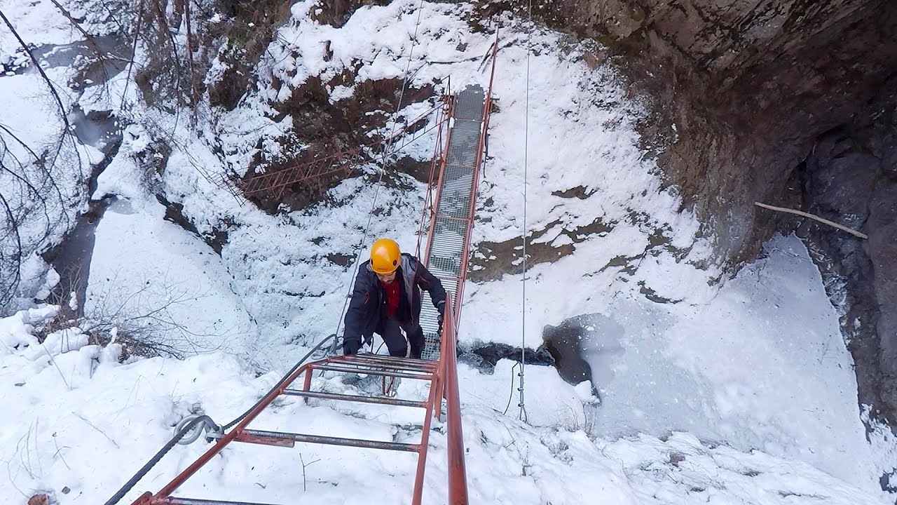
Stan Valley Canyon in winter 27.1 km away. The Stan Valley is a picturesque canyon, even in winter. In fact, when the stream is frozen and covered with a layer of snow, exploring the canyon becomes much quicker and easier.

Stan Valley Canyon 27.4 km away. The Stan Valley is located near Lake Vidraru, southwest of it, in the Fruntii Mountains. Those who have visited the Seven Ladders Waterfall will appreciate this canyon, outfitted with infrastructure for tourist accessibility.
Other places
Roman bridge Nenkovo 433.5 km away. Along the Borovitsa River, near the village of Nenkovo, there is a Roman Bridge. It connects the two banks of the Borovitsa River.
Via ferrata Peja 360 Peja 478.3 km away.
Searching for rhododendrons Ciucas Boulevard 106.3 km away. Red Mountain (Muntele Rosu), Gropsoarele-Zaganu ridge - Ciucas Mountains
Berim via ferrata Zubin Potok 439.8 km away. Difficulty level D, total length: 4 km, height difference: 520 m, year of construction: 2015. Climbing season: May 1 - October 30.
Via ferrata Bear Cave adventure and climbing zone Borsec 167.7 km away. The Bear Cave in Borsec is a vast natural formation, scattered with rocks and deep crevices. Access to the cave's cavities is through a series of narrow formations resembling canyons, surrounded by giant fir trees and rocks with interesting shapes.
Canyon of Waterfalls Smolyan 447.4 km away. The eco-trail known as the Canyon of Waterfalls is located in Bulgaria, within the Rhodope Mountains and the Soskovcheto Nature Reserve. It begins at the edge of the Sredoka suburb of the city of Smolyan.
TV-radio amplifying station Harghita Ciceu 117.1 km away. The hiking trail marked with a blue stripe starts at the Uz Bence shelter and runs from Harghita-Bai to Harghita Madaras. Our destination today is the Harghita Ciceu plateau.
Siklós castle 491.2 km away. The Siklós Castle is an important historical landmark in Hungary. Its fortress walls were laid around 1260, with the first written record dating back to 1294.
Abandoned copper mine Tsar Asen, Pazardzhik 362.1 km away. The turquoise waters of this mine lake are extremely beautiful but dangerously poisonous. Do not descend to the shore or touch the water!
Prohodna cave Karlukovo 273.9 km away. The Prohodna cave nicknamed The Eyes of God is located in Bulgaria, in the Iskar Gorge, on one of the largest karst areas in Bulgaria, 2 km from the town of Karlukovo. It is essentially a 262-meter-long natural stone bridge, with a large (45 m high) and a small (35 m high) entrance.
Sleeping Beauty cave 469 km away. Shpella e Radacit (Sleeping Beauty) cave.
Big Cave Nochevo 417.4 km away. Kodzha in (Golyamata Peshtera, Big Cave) - Nochevo.
Neviastata ecopath and iron path Smolyan 446.2 km away. The Neviastata eco-trail is located in Bulgaria, nestled in the heart of the Rhodope Mountains, between Smolyan and Pamporovo. Here, you will find a small, paid adventure park.
Ski Gyimes ski slope Lunca de Sus 144.9 km away. The Ski Gyimes ski slope is located in Lunca de Sus, right next to the main road. It is 800 m long, the level difference is 160 m.
Lednica iron path Brestnitsa 286.9 km away. The Lednica via ferrata is located next to the Saeva Dupka Cave, near the village of Brestnitsa in Bulgaria. The trail leading to the via ferrata, which opened in 2007, starts from the cave parking lot next to a covered resting area.
[ Top ↑ ]
Copyright © 2003-2026 Trekkingklub and friends. Reproduction of any text, picture or video from this website, either in printed or electronic form, is prohibited without prior written permission.
The given distances are to be understood as straight line distances, and are approximate. Website made in Miercurea Ciuc  .
.