Cavities near Cadiseni | Photos


Page no. 1, photos: 1-5, 5 photos in total.

Copyright © 2003 - 2026 Trekkingklub.com. Please register for full and ad-free access.
Airport nearby: Transilvania International Airport (TGM - Recea, Ro), 72 km away.
Photos of nearby places


The Rock with a Hole - Corund (6 photos) 15.5 km away. The Likas Stone (The Rock with a Hole) is located near Corund, on a meadow next to the road and four graves. In the middle of the conglomerate rock block, there is a perfectly drilled, heart-shaped hole.

Rák lake - Porumbenii Mari (15 photos) 15.7 km away. The Rak lake is located 2 km north of the village Porumbenii Mari, at 600 m altitude. The circumference of the lake is 800 m, the length 250 m, width 150 m, maximum depth 7 m, and the surface is 28000 m2 (10 ha together with the joined area).


[ Top ↑ ]
Videos of nearby places

The Heart of Jesus look-out - Lupeni 8.4 km away. Through the mud on Gordon Mountain, above Farkaslaka (Lupeni commune, Harghita county, Transilvania), on a cloudy afternoon, at the end of February. The destination is the Heart of Jesus lookout, nicknamed as Pléhkrisztus (The Tin Christ).
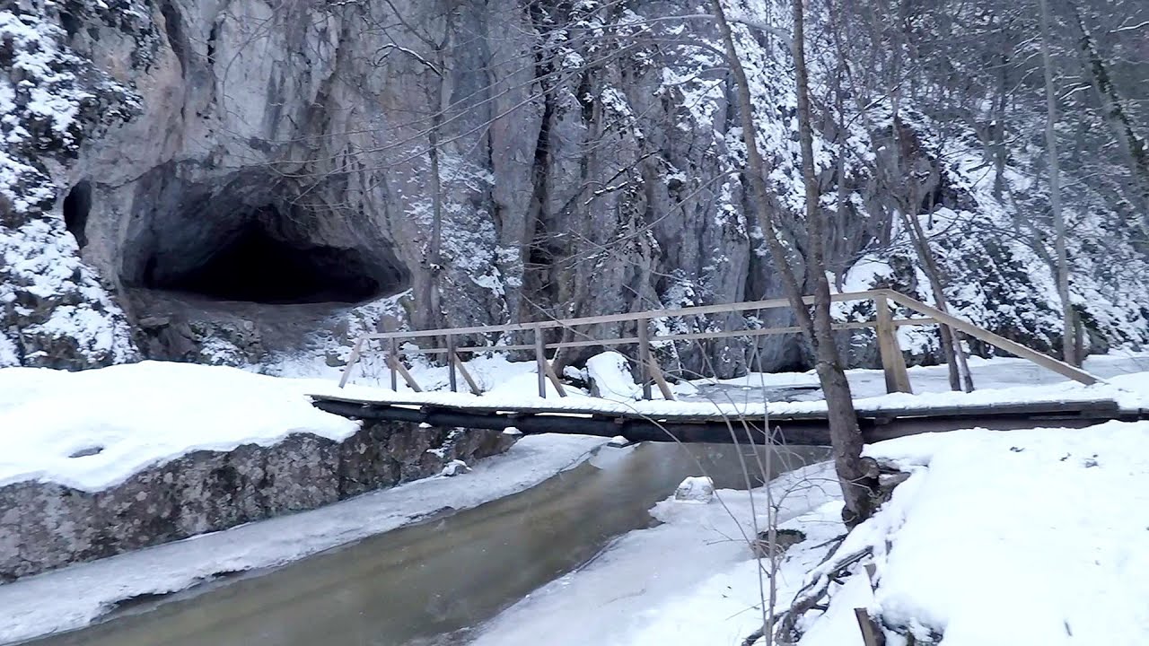
Varghis gorges in winter 21.2 km away. I went out to admire the ice stalagmites (standing icicles) in the Varghis Gorge. Anyone arriving here at the end of winter can observe meter-high ice stalagmites in the entrance area of Meresti Cave (now known as Orban Balazs Cave).

Iron path - Harghita-Madaras 22.3 km away. Amateur filming in Harghita-Madaras, holding the camera by hand in the car, and helmet-mounted on the via ferrata. I climbed an iron path for the first time in my life on the Nyerges cliffs (Stancile Seii), I didn't have the right equipment yet.

Iron path in winter - Harghita Madaras 22.3 km away. This is already the sixth time I've climbed the via ferrata route set up on the rocky cliffs of Seii Peak near Harghita Madaras. Although the forecast suggests that the weather should be nice, I am greeted by a sky covered in clouds.

TV-radio amplifying station - Harghita Ciceu 23.3 km away. The hiking trail marked with a blue stripe starts at the Uz Bence shelter and runs from Harghita-Bai to Harghita Madaras. Our destination today is the Harghita Ciceu plateau.
Other places
Via Ferrata Fairy Castle Vadu Crisului 226.2 km away. Via Ferrata Fairy Castle (Castelul Zanelor, Casa Zmeului, The House of the Dragon) - Vadu Crisului. South of Vadu Crisului, in the Padurea Craiului Mountains, lies the Vadu Crisului Gorge, a section of the Crisul Repede river that narrows between rocky walls.
Abandoned Sports Hall Varna 404.3 km away. An abandoned sports hall in Varna, with an unfinished dormitory and tennis courts across three levels.
Suspension bridge Aries river, Salciua de Sus 151.1 km away.
Womens Spiral via ferrata, climbing fun Baia de Fier 176.6 km away. The Women's Spiral (Spirala Muierilor) via ferrata is set up on the rock that conceals the Women's Cave (Pestera Muierii). It is one of the seven routes near Baia de Fier as of now (2018).
Searching for rhododendrons Ciucas Boulevard 105.5 km away. Red Mountain (Muntele Rosu), Gropsoarele-Zaganu ridge - Ciucas Mountains
Turcinovac via ferrata and cave Ovcar Banja 484.9 km away. Difficulty level B, total length: 60 m, height difference: 45 m, year of construction: 2010. Climbing the via ferrata is only permitted with the approval of the Extreme Sports Club Armadillo from Cacak, and there is a fee for it.
Hilis cave Turda Gorge via ferrata 129.1 km away. While the first time I climbed this via ferrata (Sky Fly) in the morning, now I climbed it in the light of the setting sun. The red-dressed rocks created a special atmosphere, and I could admire the sunset from the top of the climbing route.
Fairy Cliff via ferrata route Vadu Crisului 226.1 km away. Fairy Cliff (Peretele Zanelor) via ferrata route - Vadu Crisului. In Vadu Crisului, in the Padurea Craiului Mountains, on the right bank of the Crisul Repede, you can find the newest, in chronological order (2015) the fifth Transylvanian, new type of via ferrata route.
Devetashka cave Devetaki 346.9 km away. The Devetashka Cave is located in Bulgaria, near the village of Devetaki. After the entrance portal, which measures 30 m by 35 m, there is a vast open chamber that is 110 meters wide and 359 meters long.
The Gorge of the Creek of the Gorge Buila-Vanturarita National Park 151.3 km away. The Gorges of the Creek of the Gorge (Cheii Gorge, Cheile Cheii) is located in the Buila-Vanturarita National Park within the Capatana Mountains. It is one of the most beautiful and picturesque gorges in Romania.
Byala Reka eco-trail Kalofer 410.2 km away. The Byala Reka eco-trail is situated at the foot of the Stara Planina mountain range, 8 km from the town of Kalofer. A 1,830-meter-long hiking trail has been established along the White Creek within the Central Balkan National Park.
Borov Kamak waterfall Zgorigrad, Vratsa 382.4 km away. The Vratsa eco-trail starts from the village of Zgorigrad, located 6 km from the city of Vratsa in Bulgaria, and ends at the Parshevitza hut. It is also known as the Zgorigradska or Borov Kamak eco-trail.
Hodoaba Valley iron path Suncuius 222.4 km away. The Hodoaba Valley iron path is Romania's shortest and easiest (official) via ferrata route. It is located near Suncuius, in the Padurea Craiului Mountains, on the left bank of the Crisul Repede River.
Tureni Gorge iron path 127.7 km away. Tureni Gorge iron path visiting route (Via ferrata Cheile Tureni), Trascau Mountains.
Skaklya waterfall Vratsa 378 km away. The largest seasonal waterfall in Bulgaria plunges down from a height of 141 meters. It is located in the Vratsa Mountain National Park, just one and a half kilometers away from the city of Vratsa.
[ Top ↑ ]
Copyright © 2003-2026 Trekkingklub and friends. Reproduction of any text, picture or video from this website, either in printed or electronic form, is prohibited without prior written permission.
The given distances are to be understood as straight line distances, and are approximate. Website made in Miercurea Ciuc  .
.