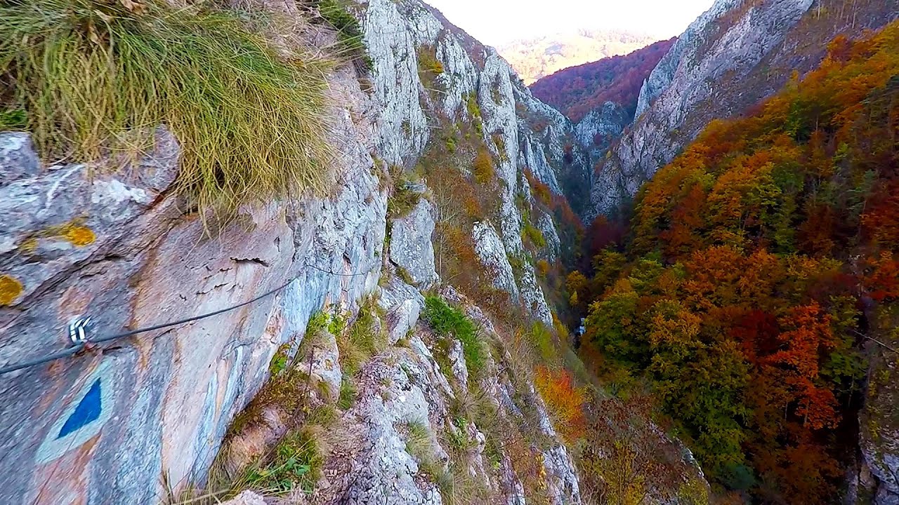
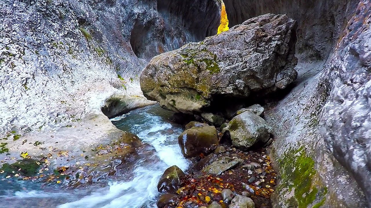
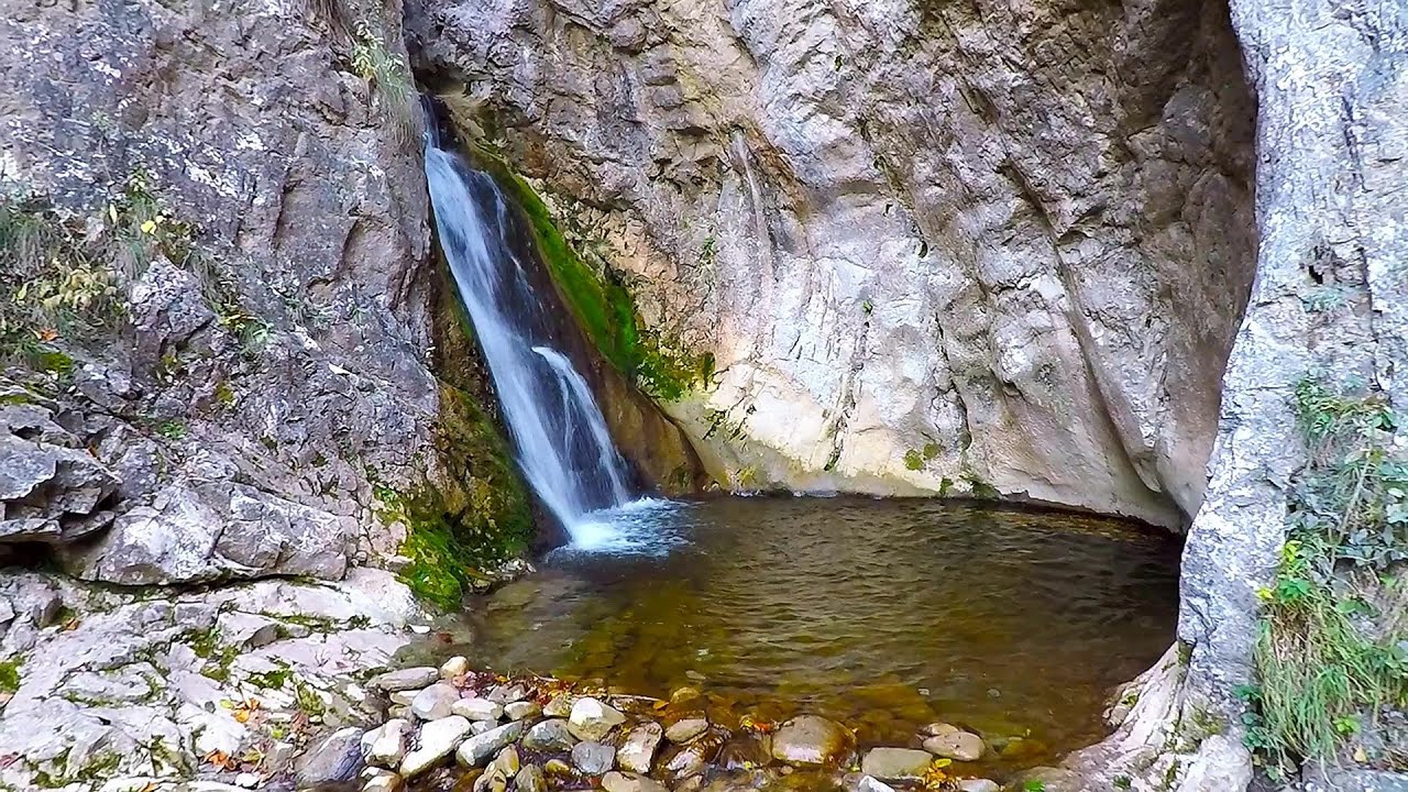
Ardeu Gorge - Metaliferi Mountains | Photos


Page no. 1, photos: 1-6, 8 photos in total. >>>

Copyright © 2011 - 2026 Trekkingklub.com. Please register for full and ad-free access.
Airport nearby: Sibiu International Airport (SBZ - Sibiu, Ro), 78 km away.
Photos of nearby places


Goat Stone - Craiva, Trascau Mountains (18 photos) 32.8 km away. Goat Stone (Piatra Craivii, Piatra Craivei, Apulon) - Craiva, Trascau Mountains.


Stone of Cetea, Horse Pit - Trascau (16 photos) 36.8 km away. Stone of Cetea, Horse Pit (The pit cave from the Stone of Cetea) - Trascau Mountains.

Goats Ledge - Trascau Mountains (10 photos) 38 km away. Goats Ledge (Brana Caprei, Kecskék párkánya) - Trascau Mountains .


Dark Blue Bruises of the Ponor - Trascau Mountains (16 photos) 44.4 km away. The Dark Blue Bruises of the Ponor (Vanatarile Ponorului) is a polje-type protected area. Polje is a Slovenian word meaning plain, and it refers to a surface karst form.


Dark Blue Bruises of the Ponor, Bedeleu (24 photos) 47.2 km away. Dark Blue Bruises of the Ponor (Vanatarile Ponorului), Bedeleu - Trascau Mountains.
[ Top ↑ ]
Videos of nearby places


Goats Ledge iron path - Ramet Gorge 38 km away. Via ferrata Goats Ledge (Brana Caprei) iron path - Ramet Gorge, Trascau Mountains.
Ramet Gorge - Goagiu Creek 38.1 km away. Ramet Gorge (Cheile Rametului) - Goagiu Creek (Paraul Goagiu), Trascau Mountains. The Ramet Gorge is the wildest canyon in the Trascau Mountains.
Roman Baths - Cetea, Trascau Mountains 39.6 km away. Roman Baths (Baile Romane) - Cetea, Trascau Mountains. Among the valleys of the Trascau Mountains, the Cetea Gorge best deserves the name of a crevice valley.
Other places
Seven Ladder Canyon in Winter Piatra Mare Mountain 200.8 km away. Seven Ladder Canyon and Waterfall in Winter - Piatra Mare Mountain
Poenari citadel Arges valley 138.6 km away. The Poenari citadel is located on the southern slope of the Fagaras Mountains, on the western side of the Transfagaras road, in the Arges Valley, about 4 km from the Vidraru Lake dam. Along a steep incline, a concrete staircase leads up to the castle, which is built atop a mountain.
Via Ferrata Pink Panther Baia de Fier 105.4 km away. In the area of Baia de Fier in Gorj County, several via ferrata routes have been set up on the rock above the Women's Cave (Muierii Cave) and on the other side of the road. At that time (2018), there were a total of seven.
Cherven, a medieval fortified town Bulgaria 351.6 km away. Located about 30 km south of the city of Ruse in Bulgaria, the Cherven medieval fortress can be found in the Rusenski Lom Nature Park. Originally a Byzantine fortification from the 6th century, it reached the height of its development in the 14th century.
Eagles Eye Yagodina 497.9 km away. Orlovo Oko (Eagle's Eye) is a lookout viewpoint located in the Rhodope Mountains, near the peak of Saint Ilia and close to the village of Yagodina, Bulgaria. The steel structure, built at an altitude of 1,563 meters, rises 670 meters above the spectacular Buynovsko Gorge, along with the winding river and road that traverse it.
Loreley and Pink Panther iron path Baia de Fier 105.3 km away. The Loreley via ferrata (graded B/C, with an elevation difference of approximately 100 m and a length of about 100 m) is located on the rock wall on the opposite side of the road. A branch from its upper section leads to the Pink Panther (Pantera Roz, graded A/B/C, approximately 200 meters long, with an elevation difference of about 50 meters).
Kossuth Rock Harghita Bath 197.6 km away. Kossuth Rock - Harghita Bath (Harghita-Bai), Harghita Mountains.
Stan Valley Canyon in winter 135.8 km away. The Stan Valley is a picturesque canyon, even in winter. In fact, when the stream is frozen and covered with a layer of snow, exploring the canyon becomes much quicker and easier.
Sumuleu-Ciuc in winter 211.2 km away. Sumuleu-Ciuc (Csíksomlyó) in winter.
Laura iron path Baia de Fier 105.6 km away. Laura iron path (E) - Baia de Fier.
Balea waterfall and the Transfagarasan mountain_road 122.2 km away. Balea waterfall and the Transfagarasan mountain road - blue triangle marked trail, Balea valley, Fagaras Mountains, Southern Carpathians.
Via ferrata Mat Peja 440.1 km away.
Sugau Stone lookout point and iron path, Sugau Gorge Munticelu 225.2 km away. Sugau Stone lookout point and iron path (B/C), Sugau Gorge - Munticelu Nature Reserve.
White Drin waterfall 430.4 km away. Drini i Bardhe (White Drin) waterfall.
Drina river house Bajina Bašta 361.9 km away. The house visible on the Drina River (Kućica na Drini) is a unique wooden structure built on a rock in the middle of the river, near Bajina Bašta, Serbia. The house is located on the border between Serbia and Bosnia-Herzegovina, close to the border line between the two countries.
[ Top ↑ ]
Copyright © 2003-2026 Trekkingklub and friends. Reproduction of any text, picture or video from this website, either in printed or electronic form, is prohibited without prior written permission.
The given distances are to be understood as straight line distances, and are approximate. Website made in Miercurea Ciuc  .
.