Dofteana Gorge - Nemira Mica peak | Photos


Page no. 1, photos: 1-6, 16 photos in total. >>>

Copyright © 2013 - 2026 Trekkingklub.com. Please register for full and ad-free access.
Airport nearby: Bacău George Enescu International Airport (BCM - Bacău, Ro), 55 km away.
Photos of nearby places

The waterfalls of Velnita stone-quarry - Right side (16 photos) 19.9 km away. The waterfall from the quarry, Green waterfall, Water-jet waterfall, Run down waterfall.

The waterfalls of Velnita stone-quarry - Left side (18 photos) 20.1 km away. Fan waterfall, Side waterfall, Double-decked waterfall, Waterfall with stairs, Hammock waterfall, Terrrace waterfall, The waterfall behind the arch, Suspended rock cube, Brown waterfall, Ceiling waterfall.


Round rocks from Viisoara - Berzunti (12 photos) 26 km away. Round rocks are quite a common curiosity, apart from those in Costesti, Valcea county, there are numerous other locations with similar rock formations. The round rocks from Viisoara are located northwest of the village, at a distance of approximately 700 meters from DC152 road.

Beer waterfall - Gosmanu Ridge (12 photos) 27.7 km away. Beer waterfall (Cascada Berea) - Gosmanu Ridge, Tarcau Mountains.


The sources of the river Trotus - Fagetel (10 photos) 34.4 km away. Fagetel, Piposz property, The sources of the river Trotus (Tatros).
[ Top ↑ ]
Videos of nearby places
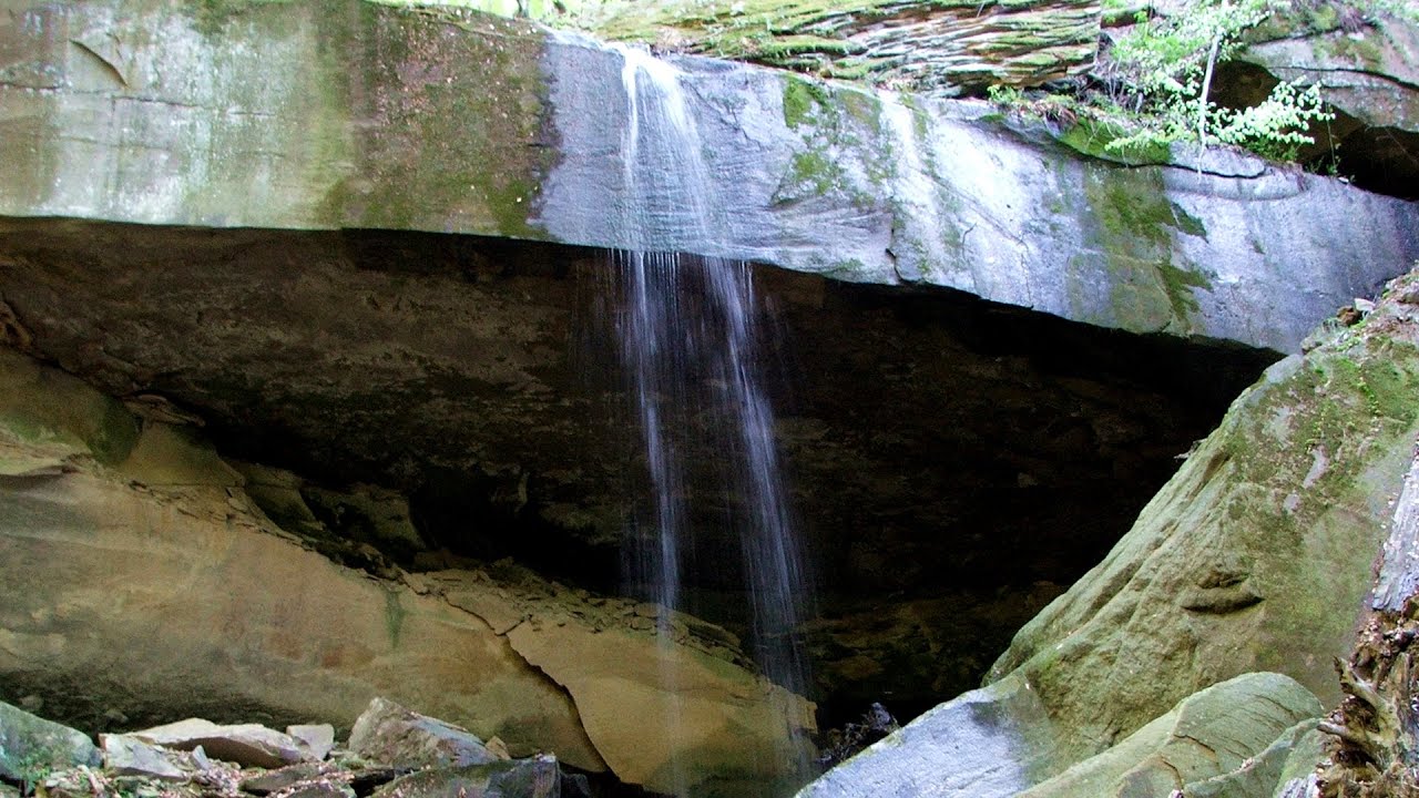
Waterfalls of Velnita stone-quarry - Targu Ocna 20 km away. Starting from the Velnita quarry, an adventurous nature enthusiast, accustomed to wild and rugged terrains, will discover a true waterfall paradise. At the upper part of the quarry, two streams converge.

Saint Anne lake - Ciomat-Puturosu 35.7 km away. Lake Saint Anna is the only well-preserved volcanic crater lake in Eastern Europe. Here are some images from an afternoon outing.

Walking to the top of Sumuleul Mare - Sumuleu Ciuc 40.2 km away. This was my first attempt at shooting a video.


Other places
Doabra Stones Brezoi, Lotru Mountains 188.4 km away. The DN7A road branches off west from the Olt Valley, from the main road between Sibiu and Ramnicu Valcea, leading towards Voineasa and Lake Vidra. The first settlement is a small town, Brezoi, which is located at the confluence of the Lotru and Olt rivers.
Dalbina waterfall, Dark Blue Bruises of the Ponor 220.7 km away. Dalbina waterfall, Dark Blue Bruises of the Ponor (Vanatarile Ponorului).
Little Spiral via ferrata Baia de Fier 230.6 km away.
Hot air balloon parade 2015 Campu Cetatii 112.3 km away. This year, the Hot Air Balloon Parade was organized in Campu Cetatii for the tenth time. Unfortunately, the weather only allowed for flying on Saturday morning and evening.
Parmak Kaya Nochevo, Panichkovo 493.9 km away. Between the villages of Nochevo and Panichkovo in Chernoochene Municipality, Kardzhali Province, lies Parmak Kaya (Finger Rock). The site features ancient carvings and rock formations within an old pine forest.
Bovska Skaklya waterfall Iskar gorge 427 km away. The Bovska Skaklya waterfall is located near the town of Svoge in Bulgaria. The waterfall formed on the Zaselska River has several reported heights online (120 m, 85 m).
Saeva Dupka cave Brestnitsa 392.4 km away. The Saeva Dupka Cave is located 2 km south of the village of Brestnitsa. In its five chambers and 400 meters of passageways, you can see the most beautiful cave formations in Bulgaria.
Suspension bridge Aries river, Salciua de Sus 228.3 km away.
Lednica iron path Brestnitsa 392.5 km away. The Lednica via ferrata is located next to the Saeva Dupka Cave, near the village of Brestnitsa in Bulgaria. The trail leading to the via ferrata, which opened in 2007, starts from the cave parking lot next to a covered resting area.
Stone Mushrooms Beli Plast 499.4 km away. The Stone Mushrooms (Kamenni Gabi) nature reserve in Bulgaria is situated east of the village of Beli Plast, along the road that connects Kardzhali to Haskovo. Spanning an area of 3 hectares, the reserve is home to several mushroom-shaped rock formations.
Hodoaba Valley iron path Suncuius 299 km away. The Hodoaba Valley iron path is Romania's shortest and easiest (official) via ferrata route. It is located near Suncuius, in the Padurea Craiului Mountains, on the left bank of the Crisul Repede River.
Mill of the Devils Tasna Gorge 328.3 km away. Mill of the Devils (Moara Dracilor) - Tasna Gorge (Cheile Tasnei). The Tasna Gorges are located in the Mehedinti Mountains, approximately 15 km from the resort of Baile Herculane.
The Trovants Museum in Winter Costesti 213.3 km away.
Deubels path Piatra Craiului Mountains 117 km away. Deubels path - Piatra Craiului Mountains (Kings Rock).
Devils Mill Gorge Campulung Moldovenesc 148.6 km away. The Devil's Mill Gorge is relatively short, measuring only 60 to 70 meters in length. It was formed in yellowish-gray-white dolomite by the work of a stream that crosses the gorge, as a result of erosion and the dissolution characteristic of limestone.
[ Top ↑ ]
Copyright © 2003-2026 Trekkingklub and friends. Reproduction of any text, picture or video from this website, either in printed or electronic form, is prohibited without prior written permission.
The given distances are to be understood as straight line distances, and are approximate. Website made in Miercurea Ciuc  .
.