Bran | Photos


Page no. 1, photos: 1-4, 4 photos in total.

Copyright © 2004 - 2026 Trekkingklub.com. Please register for full and ad-free access.
Airport nearby: Ghimbav International Airport (GHV - Brașov (Ghimbav), Ro), 24 km away.
Photos of nearby places


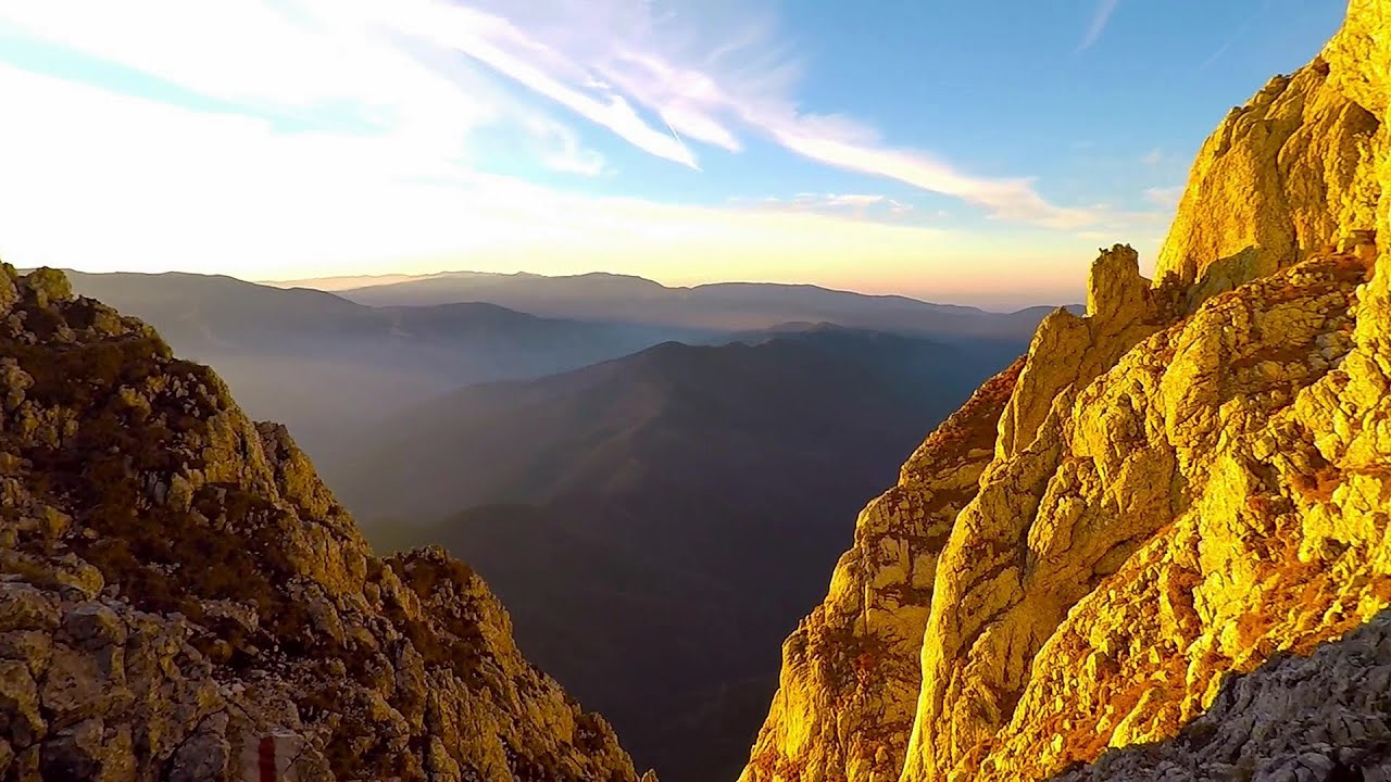
Zarnesti precipice - Piatra Craiului Mountains (16 photos) 7.3 km away. Zarnesti precipice (Prapastiile Zarnestilor) - Piatra Craiului Mountains (King Rock).

Zarnesti Gorge - Piatra Craiului Mountains (6 photos) 7.3 km away. Zarnesti Gorge (Prapastiile Zarnestilor) - Piatra Craiului Mountains.

Little King Rock - Piatra Craiului Mountains (14 photos) 8.9 km away. Little King Rock (Piatra Mica) - Piatra Craiului Mountains (King Rock).

Ciubotea-Scara - Bucegi Mountains (24 photos) 9 km away. Ciubotea clearing - Scara peak - Omu peak - Gaura sheepfold.


The Cats Gorge - Curmatura Cabin (20 photos) 9.5 km away. The Cat's Gorge - Valley of the Gorge Stream - Curmatura Cabin - Rift Saddle.


Great Bucsoi Mountain, Omu Peak - Bucegi (24 photos) 9.9 km away. Great Bucsoi Mountain (Bucsoiul Mare), Omu Peak (Varful Omu) - Bucegi Mountains.

Tower of King Rock - Piatra Craiului Mountains (15 photos) 10.1 km away. Border Ravine Valley (Padina Hotarului), Turm des Königstein (Turnul Pietrei Craiului).

Omu Peak, chamois - Bucegi Mountains (18 photos) 10.4 km away. Omu Peak (Varful Omu), chamois - Bucegi Mountains.

Turkish Mosque Rock - Bucegi Mountains (6 photos) 10.7 km away. Turkish Mosque Rock (Mecetul Turcesc) - Bucegi Mountains.
[ Top ↑ ]
Videos of nearby places

Dino Parc Rasnov 11.9 km away. On June 12, 2015, one of the largest dinosaur theme parks in the region opened in Rasnov, where we can see 45 life-sized dinosaurs. The facility is located directly next to the Rasnov Fortress, which is one of the best-preserved Transylvanian Saxon peasant fortresses.

Small Via ferrata - Rasnoavei Gorge 12.2 km away. In the past few days, it has snowed, so I climbed the two climbing routes in the Rasnoavei Gorge under winter conditions. While the lower part of the challenging Big via ferrata was dry, the upper section had patches of snow and icicles.

Big Via ferrata Rasnoavei Gorge 12.2 km away. The most dangerous Eastern European iron path, and also one of the most beautiful via ferrata routes in Romania, is in the Rasnoavei Gorges, Postavaru Mountains.The route is 450 m long, with a level difference of 220 m.
Deubels path - Piatra Craiului Mountains 12.9 km away. Deubels path - Piatra Craiului Mountains (Kings Rock).

Ski resort - Poiana Brasov - Postavarul Mountains 15.9 km away. Shining sun and an Austria-feeling on the impeccable slopes of the ski paradise Poiana Brasov above Brasov. Sunbathing, coffee and refreshing drinks on the terrace of Julius Römer chalet.
Other places
Suspension bridge Aries river, Salciua de Sus 183.7 km away.
The Bears Jump iron path Baia de Fier 131 km away. The Bear's Jump (Saritoarea Ursului) is a fantasy-named via ferrata that opened in May 2018 near Baia de Fier, alongside the Middle Belt (Spirala Medie). Both routes begin from the G zone of the rock face that conceals the Women's Cave (Pestera Muierilor).
Laura iron path Baia de Fier 131 km away. Laura iron path (E) - Baia de Fier.
Middle Belt via ferrata route Baia de Fier 131 km away. Middle Belt (Spirala Medie) via ferrata route - Baia de Fier. In May 2018, two new via ferrata routes were inaugurated in Baia de Fier.
Corcoaia Gorge Gorj county 213.3 km away. The Corcoaia Gorge is one of the most beautiful tourist attractions in the Cerna Valley. It can be reached by car, 43 km away from Baile Herculane, of which about 17 km is on a dusty gravel road.
Goats Ledge iron path Ramet Gorge 171.3 km away. Via ferrata Goats Ledge (Brana Caprei) iron path - Ramet Gorge, Trascau Mountains.
Roman Baths Geoagiu-Bai, Metaliferi Mountains 177.5 km away.
Lonely Stone Hasmas Mountains 134.7 km away. On June 1, 2003, with a small group of friends, I left Balan, walking along the valley of the Sep (Beautiful) stream towards the Lonely Stone (Piatra Singuratica). Those who were with me at the time fell behind, and then other people joined for the hike.
Ramet Gorge Goagiu Creek 170.4 km away. Ramet Gorge (Cheile Rametului) - Goagiu Creek (Paraul Goagiu), Trascau Mountains. The Ramet Gorge is the wildest canyon in the Trascau Mountains.
Skaklya waterfall Vratsa 296.9 km away. The largest seasonal waterfall in Bulgaria plunges down from a height of 141 meters. It is located in the Vratsa Mountain National Park, just one and a half kilometers away from the city of Vratsa.
Shipka pass Shipka 307.7 km away. The Shipka Pass is one of the most spectacular crossings of the Balkan Mountains, and is part of the Bulgarka Nature Park. It separates the provinces of Gabrovo and Stara Zagora, and provides a connection between the cities of Gabrovo and Kazanlak.
Roman Baths Cetea, Trascau Mountains 162.4 km away. Roman Baths (Baile Romane) - Cetea, Trascau Mountains. Among the valleys of the Trascau Mountains, the Cetea Gorge best deserves the name of a crevice valley.
Big Cave Nochevo 404.6 km away. Kodzha in (Golyamata Peshtera, Big Cave) - Nochevo.
Hodoaba Valley iron path Suncuius 268 km away. The Hodoaba Valley iron path is Romania's shortest and easiest (official) via ferrata route. It is located near Suncuius, in the Padurea Craiului Mountains, on the left bank of the Crisul Repede River.
Thracian stone sharapani Nochevo 404.7 km away. Sharapani is a traditional stone container used by ancient Thracians for processing grapes in wine production. Two well-preserved sharapani containers are located about 200 meters apart.
[ Top ↑ ]
Copyright © 2003-2026 Trekkingklub and friends. Reproduction of any text, picture or video from this website, either in printed or electronic form, is prohibited without prior written permission.
The given distances are to be understood as straight line distances, and are approximate. Website made in Miercurea Ciuc  .
.