Tourist attractions near Novaci (Novaci, Gorj county, Romania)
Photos of nearby places

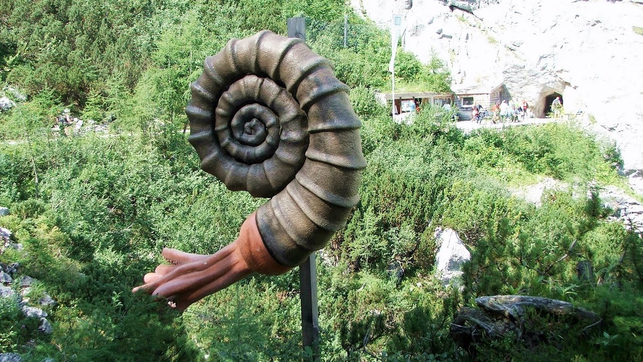
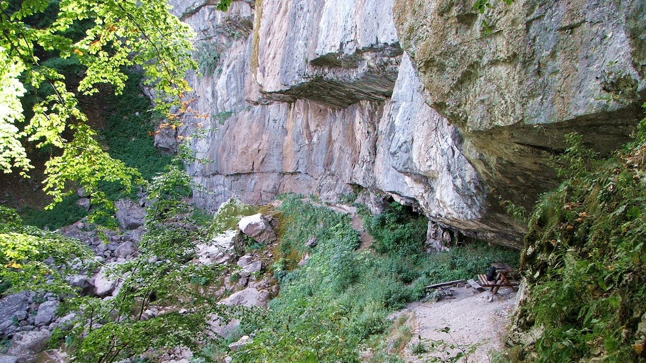
Womens Cave - Parang Mountains (11 photos) 6.7 km away. The Cave of Women (Pestera Muierii, Pestera Muierilor) is located at the southern foot of the Parang Mountains, in the area of Baia de Fier in Gorj County. There are several climbing routes established on the rocks above the cave and on the other side of the road.


Parangul Mare peak (16 photos) 20.8 km away. Chamois saddle (Saua Caprelor), Carja mountain shelter (Refugiul Carja) - Carja peak (Varful Carja) - Stoienita peak (Varful Stoienita) - Gemanarea - Parangul Mare peak.


Ledge path of the chamois - Cheii Gorge (40 photos) 37 km away. Ledge path of the chamois (Brana Caprelor) - Cheii Gorge (Cheile Cheii).

Boli Cave - Banita (20 photos) 41.2 km away. The main cave passage is approximately 460 m long, with an entrance portal that is 10 m high and 20 m wide at its base. In the 1960s, bridges were built over the underground stream flowing through the cave.

Banita Gorge - Banita (16 photos) 41.4 km away. The approximately 250 m long gorge, similar to the Corcoaia Gorge, is truly spectacular. According to assumptions, it was formed by the collapse of a cave passage ceiling, and then the erosion formed spectacular karst formations in the limestone.

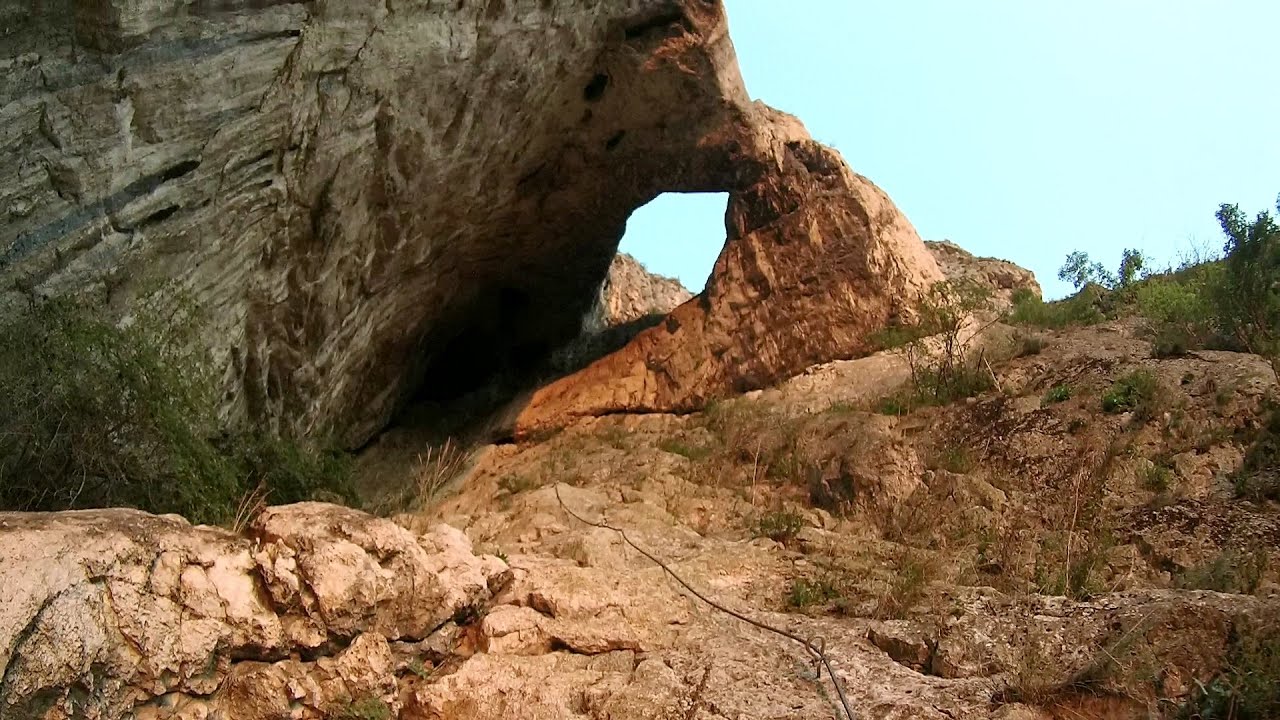
Natural bridge next to the Banita Stone Quarry (12 photos) 43.7 km away. Although the Banita Stone Bridge is not far from the road that passes through the village, it is located beyond the railway line, so its approach is a bit cumbersome. We can go around the railway line on Carierei Street, and then we have to walk a few meters from the stone quarry.

Doabra Snail Shells - Brezoi (12 photos) 48.9 km away. Doabra Valley - Calinesti-Brezoi forest - Lotru Valley, Cozia National Park


Circular hiking tour in Cozia Mountain (48 photos) 54.5 km away. Arutela - Turnu monastery - Rosiei Rocks - Turneanu ridge - Cozia peak - Stone portal - Stanisoara monastery - Gardului waterfall.


[ Top ↑ ]
Videos of nearby places
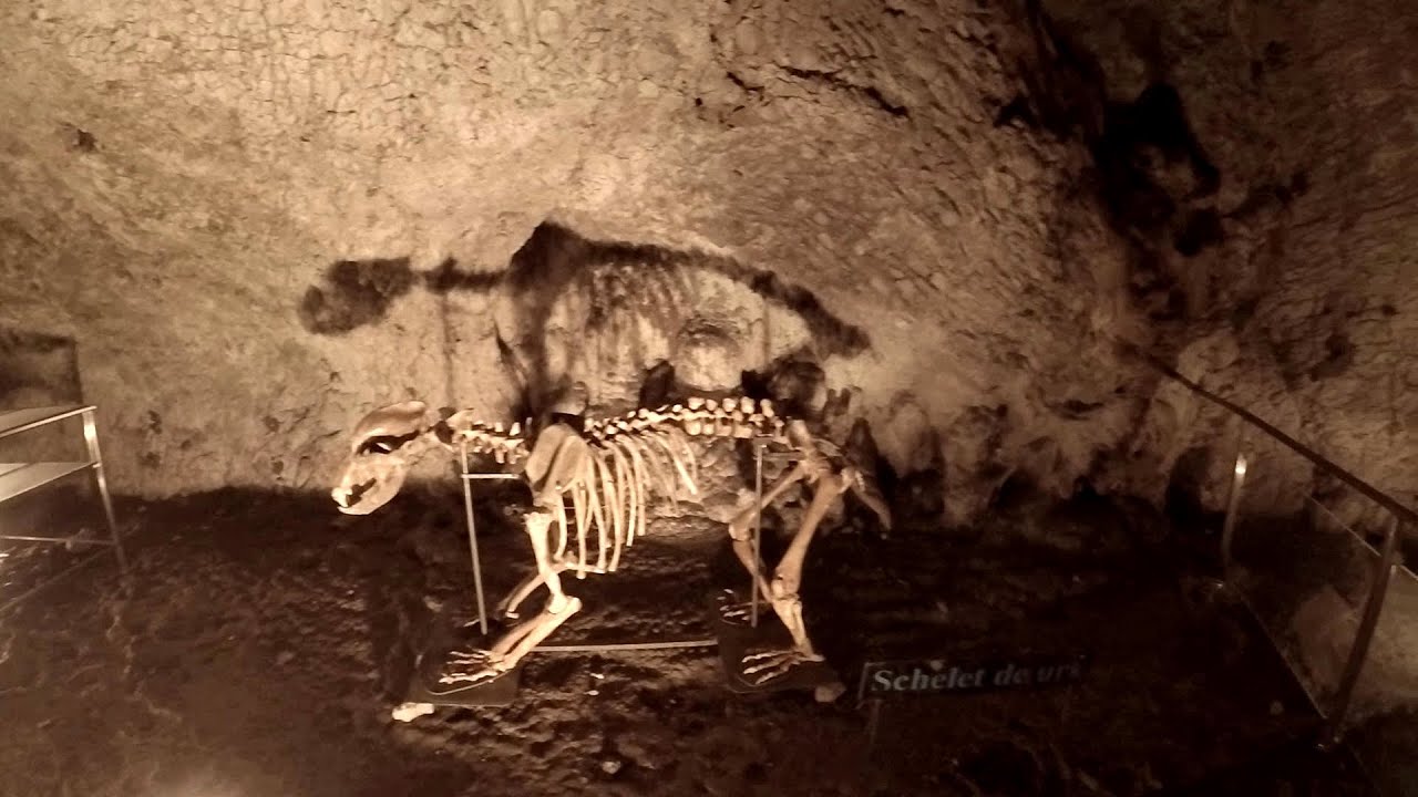
Muierii Cave - Baia de Fier 6.7 km away. We visited the Baia de Fier area, and climbed on the rock that also conceals the Women's Cave (Pestera Muierilor). Between two via ferrata routes, we also participated in one of the guided cave tours, which depart every hour.
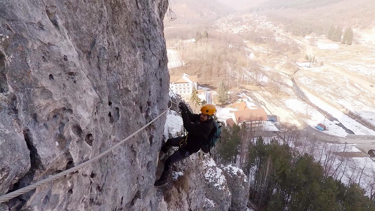
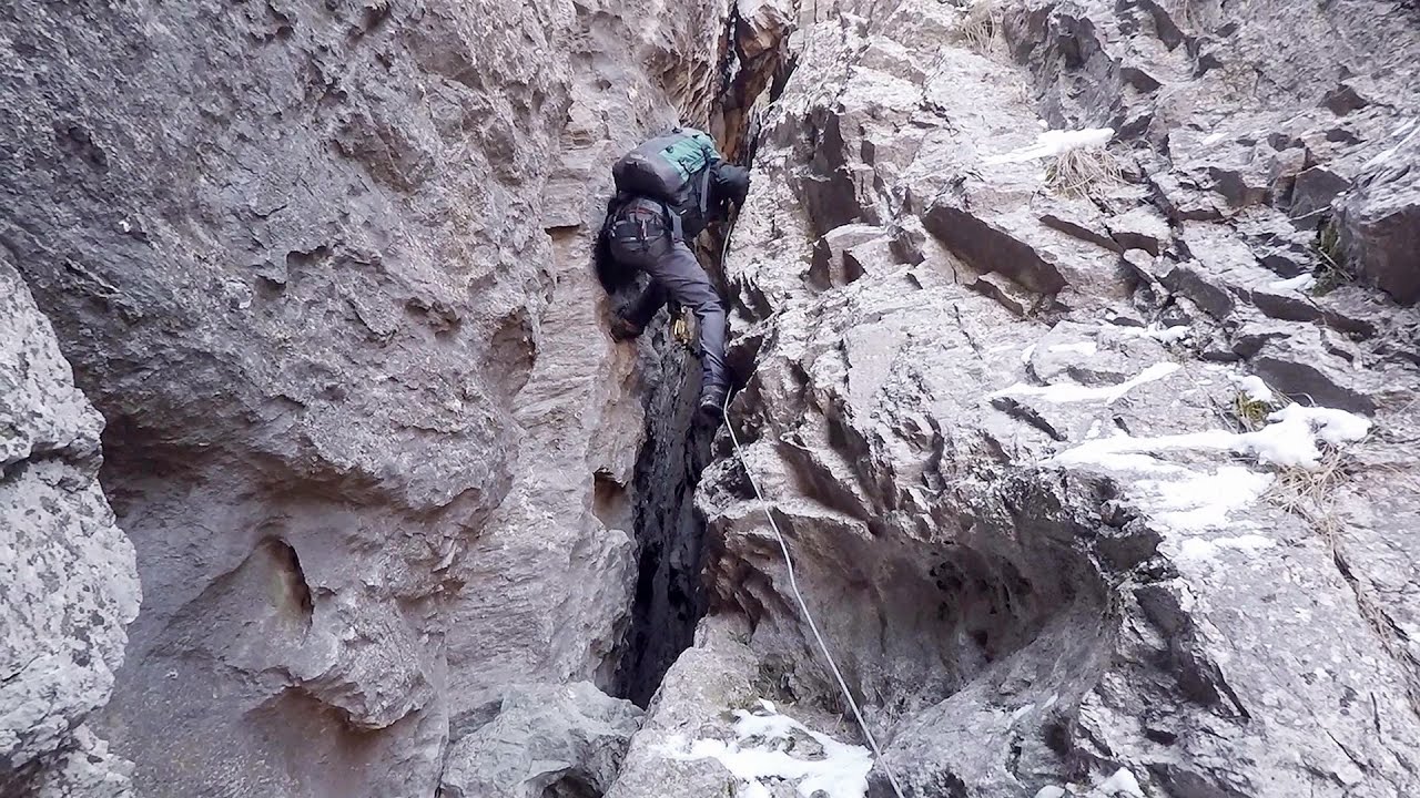
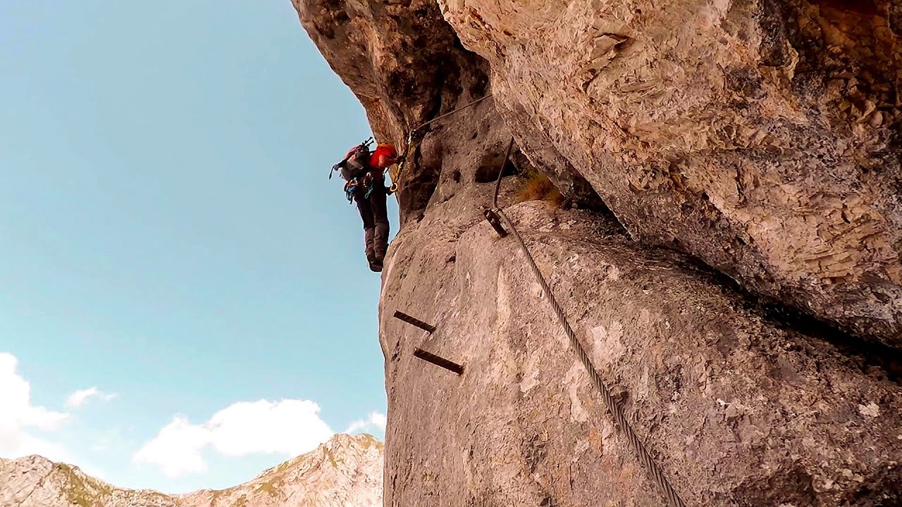
Womens Spiral, Cave Ridge, and The Great Crack iron paths - Baia de Fier 6.7 km away. Perhaps the most interesting via ferrata among the routes in the Baia de Fier area is the Womens Spiral. After completing it, I can say that it is the second most thrilling via ferrata in Romania, following the Big Via Ferrata at Rasnov.
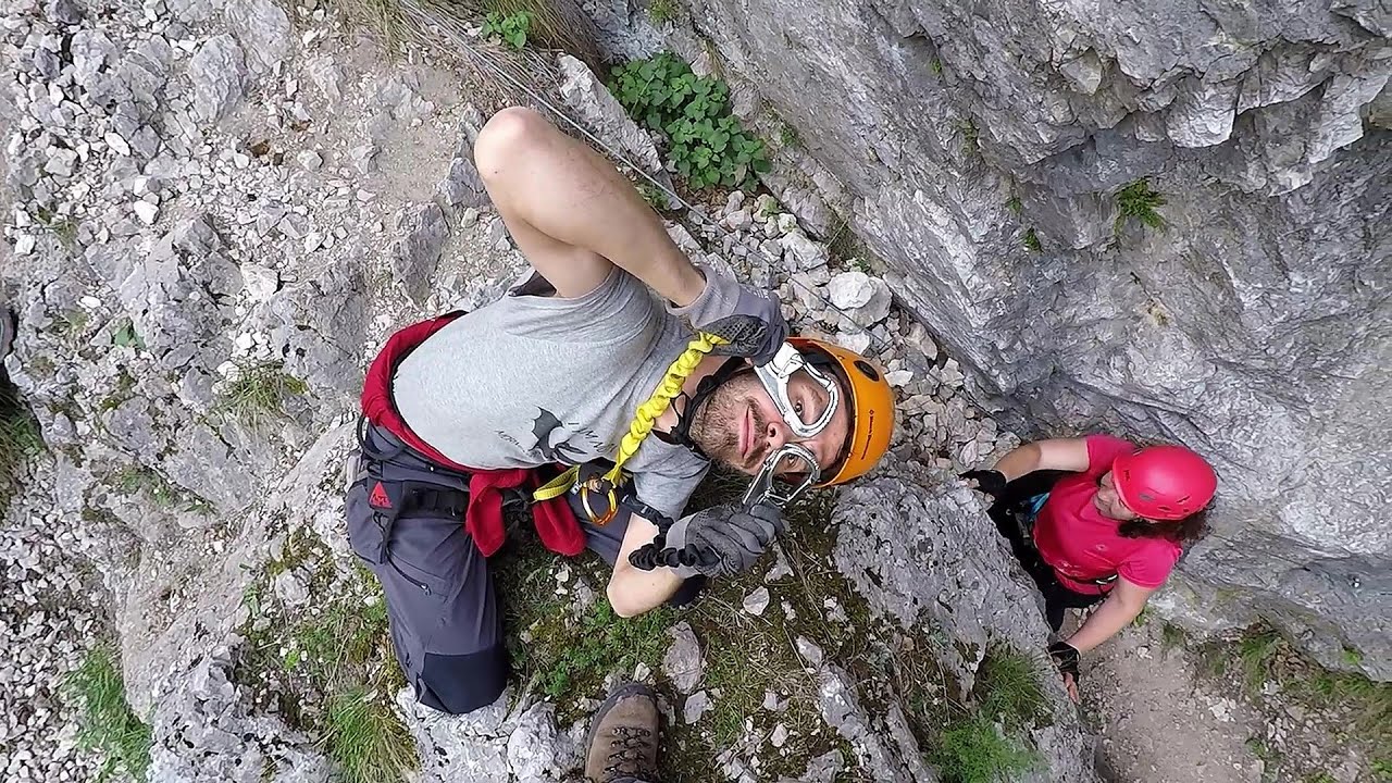
Womens Spiral via ferrata, climbing fun - Baia de Fier 6.8 km away. The Women's Spiral (Spirala Muierilor) via ferrata is set up on the rock that conceals the Women's Cave (Pestera Muierii). It is one of the seven routes near Baia de Fier as of now (2018).

Winds iron path - Baia de Fier 6.8 km away. The Wind's iron path (Via ferrata Vanturilor, D) is the via ferrata route number 11 in the Baia de Fier - Polovragi area. The sign at the base of the route was installed on February 9, 2020.
Other places

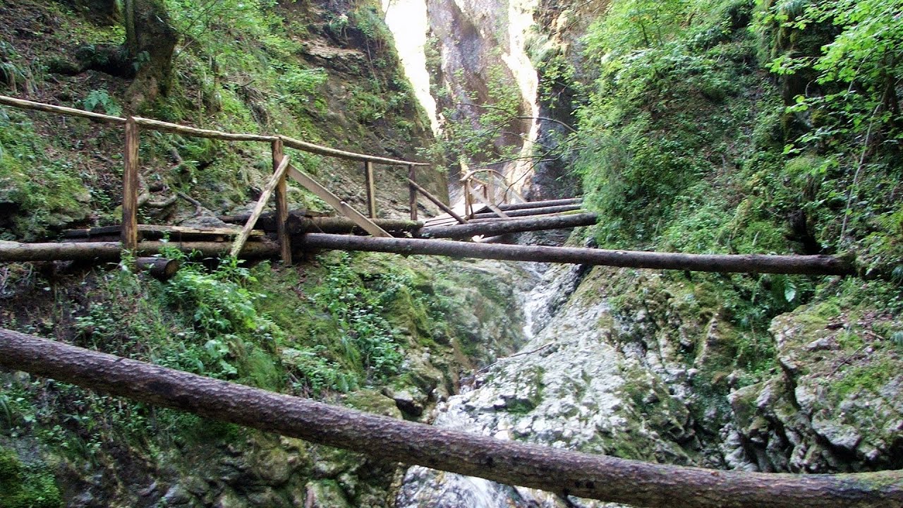
Hias via ferrata Silberkarklamm, Ramsau am Dachstein The Hias via ferrata in the Silberkar Gorge (Silberkarklamm) is the first of the three via ferrata routes, and perhaps the easiest to complete. Two cable bridges and a few trickier sections make it interesting, but it is truly impressive due to the view of the narrow gorge.
Durdevica via ferrata and the canyon of the Ibar river Ribarice 356.5 km away. Difficulty level C/D (D/E), total length: 700 m, height difference: 200 m, year of construction: 2024. For experienced climbers with their own equipment, the registration fee is 5 euros per person.
Mammoth Cave Dachstein Salzkammergut, Obertraun am Hallstättersee The first station of the Dachstein Krippenstein cable car, which starts in Obertraun, in the southern part of Lake Hallstatt, is Schönbergalm. Here you can find the Giant Ice Cave (Rieseneishöhle) and the Mammoth Cave (Mammuthöhle).

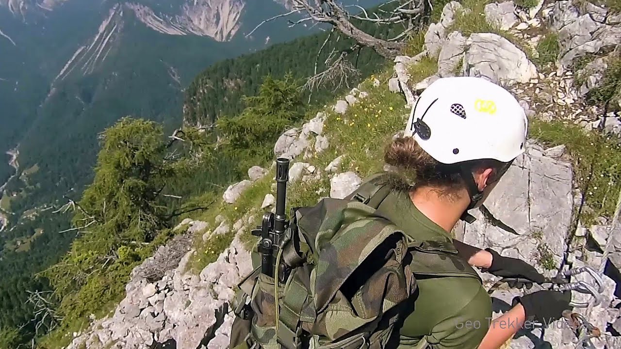
Via ferrata Adventure Climb Varmost Forni di Sopra, Cima Clap Varmost, Alpi Carniche I participated in a joint, Szekler-Italian 'military exercise' :-) on the Adventure Climb Varmost via ferrata. The iron climbing route is located in the Friuli-Venezia Giulia region, in the Carnic Alps, and it leads up to the summit of Clap Varmost above Forni di Sopra.
Devils Mill Gorge Campulung Moldovenesc 295.7 km away. The Devil's Mill Gorge is relatively short, measuring only 60 to 70 meters in length. It was formed in yellowish-gray-white dolomite by the work of a stream that crosses the gorge, as a result of erosion and the dissolution characteristic of limestone.
Sleeping Beauty cave 382.2 km away. Shpella e Radacit (Sleeping Beauty) cave.

Big Via ferrata Rasnoavei Gorge 150 km away. The most dangerous Eastern European iron path, and also one of the most beautiful via ferrata routes in Romania, is in the Rasnoavei Gorges, Postavaru Mountains.The route is 450 m long, with a level difference of 220 m.

Stone Mushrooms Beli Plast 403 km away. The Stone Mushrooms (Kamenni Gabi) nature reserve in Bulgaria is situated east of the village of Beli Plast, along the road that connects Kardzhali to Haskovo. Spanning an area of 3 hectares, the reserve is home to several mushroom-shaped rock formations.
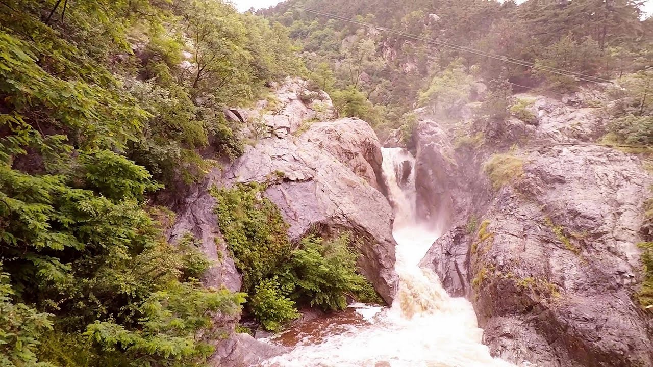
Borov Kamak waterfall Zgorigrad, Vratsa 225.6 km away. The Vratsa eco-trail starts from the village of Zgorigrad, located 6 km from the city of Vratsa in Bulgaria, and ends at the Parshevitza hut. It is also known as the Zgorigradska or Borov Kamak eco-trail.
Hilis cave Turda Gorge via ferrata 154.3 km away. While the first time I climbed this via ferrata (Sky Fly) in the morning, now I climbed it in the light of the setting sun. The red-dressed rocks created a special atmosphere, and I could admire the sunset from the top of the climbing route.
Kaiserschild Klettersteig Eisenerzer Ramsau The 2,085-meter-high Kaiserschild peak is situated on the northern edge of the Eisenerz Alps in Styria, Austria. It forms a double summit with the slightly taller Hochkogel peak, which stands at 2,105 meters.
Suchurum waterfall Karlovo 295.1 km away. The 15-meter-high Suchurum Waterfall is located at the foot of the Stara Planina mountain range, 1 km north of the town of Karlovo in Bulgaria. It is situated below the Karlovo hydroelectric power plant, on the waters of the Stara Reka stream.
Gornjak via ferrata and Kudelinovs fortress Zdrelo 196.9 km away. Difficulty level C/D, total length: 400 m, height difference: 330 m, year of construction: 2019, total length of the route to Kudelinov's fortress: 1100 m. Access to the via ferrata is free.
Other destinations
Gornjak via ferrata and Kudelinovs fortress Zdrelo 196.9 km away. Difficulty level C/D, total length: 400 m, height difference: 330 m, year of construction: 2019, total length of the route to Kudelinov's fortress: 1100 m. Access to the via ferrata is free.
[ Top ↑ ]
Copyright © 2003-2026 Trekkingklub and friends. Reproduction of any text, picture or video from this website, either in printed or electronic form, is prohibited without prior written permission. Website made with love  in Miercurea Ciuc.