Tourist attractions near Corund (Corund, Harghita county, Romania)
Photos of nearby places

The Rock with a Hole - Corund (6 photos) 2.9 km away. The Likas Stone (The Rock with a Hole) is located near Corund, on a meadow next to the road and four graves. In the middle of the conglomerate rock block, there is a perfectly drilled, heart-shaped hole.

Small Pine Stone - Gurghiu Mountains (8 photos) 10.2 km away. Small Pine Stone (Kisfenyős Stone) - Gurghiu Mountains.

Shepherd Stone - Gurghiu Mountains (8 photos) 13.2 km away. Shepherd Stone (Pakulárkő, Piatra Pacurarului) - Gurghiu Mountains.

Rák lake - Porumbenii Mari (15 photos) 20.2 km away. The Rak lake is located 2 km north of the village Porumbenii Mari, at 600 m altitude. The circumference of the lake is 800 m, the length 250 m, width 150 m, maximum depth 7 m, and the surface is 28000 m2 (10 ha together with the joined area).


Table Rock - Gurghiu Mountains (10 photos) 23.1 km away. Table Rock (Asztal-kő, Stanca Mesei) - Gurghiu Mountains.

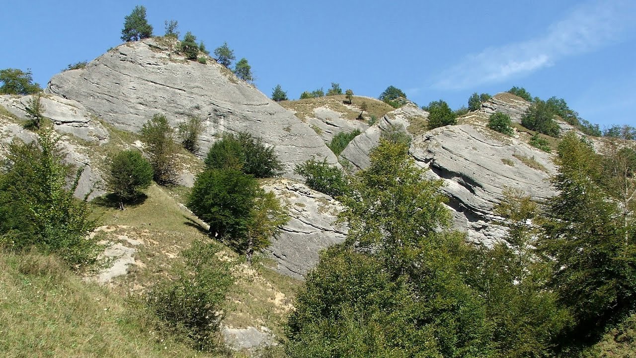
Isuica Valley - Becheci Peak (12 photos) 23.6 km away. Isuica (Iszulyka) Valley - Becheci (Bekecs) Peak.

Hollow Stone - Gurghiu Mountains (5 photos) 28.5 km away. Hollow Stone (Likas Stone) - Gurghiu Mountains.

Harghita Bath - Harghita Mountains (15 photos) 35.6 km away. Harghita Bath (Harghita-Bai) - Harghita Mountains.


The Old Women of Gurghiu stone mushrooms, Batrana Peak (16 photos) 43.5 km away. The Old Women of Gurghiu (Babele Gurghiului) stone mushrooms, Batrana Peak (Varful Batrana). In the Gurghiu Mountains, 10 km from Toplita, near the peak Batrana, there are several groups of strange rocks.

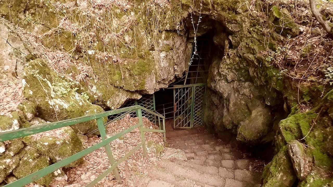
Sugo Cave - Giurgeu Mountains (60 photos) 44 km away. The Sugó Cave is located at the western foot of Sipos Stone (1566 m) at an altitude of 1064 m above sea level. It consists of a system of passages with four levels, totaling 1021 m in length and a level difference of -60 m.


Ruins of the Harom fortress - Jigodin Bath (10 photos) 48.9 km away. The Harom Fortress was built around the beginning of the 12th century and was part of the system of fortifications that protected Transylvania from the east. It is located south of Miercurea Ciuc, east of Harom Peak, which has an altitude of 1079 m, near the southwestern limits of Jigodin Bath (Baile Jigodin).


Watchstone and the Lonely Stone in March (18 photos) 54.2 km away. Watchstone (Stanca La Panda) and the Lonely Stone (Piatra Singuratica) in March.

Lonely Stone - Hasmas Mountains (9 photos) 54.2 km away. Lonely Stone (Piatra Singuratica) - Hasmas Mountains.

White Glade - Hasmas Mountains (6 photos) 54.6 km away. White Glade (Poiana Alba) - Hasmas Mountains.

Cavities in Tipia of Ormenis - Persani Mountains (24 photos) 54.7 km away. Cavities in Tipia of Ormenis - Persani Mountains (Muntii Persani).

Brother Mountain - Hasmas Mountains (15 photos) 54.7 km away. Brother Mountain (Fratele, Ecem, Ecsém) - Hasmas Mountains.

Brother Mountain - Hasmas Mountains (11 photos) 54.7 km away. Brother Mountain (Ecsém-tető, Muntele Fratele, Muntele Ecem) - Hasmas Mountains.

[ Top ↑ ]
Videos of nearby places

The Heart of Jesus look-out - Lupeni 10 km away. Through the mud on Gordon Mountain, above Farkaslaka (Lupeni commune, Harghita county, Transilvania), on a cloudy afternoon, at the end of February. The destination is the Heart of Jesus lookout, nicknamed as Pléhkrisztus (The Tin Christ).
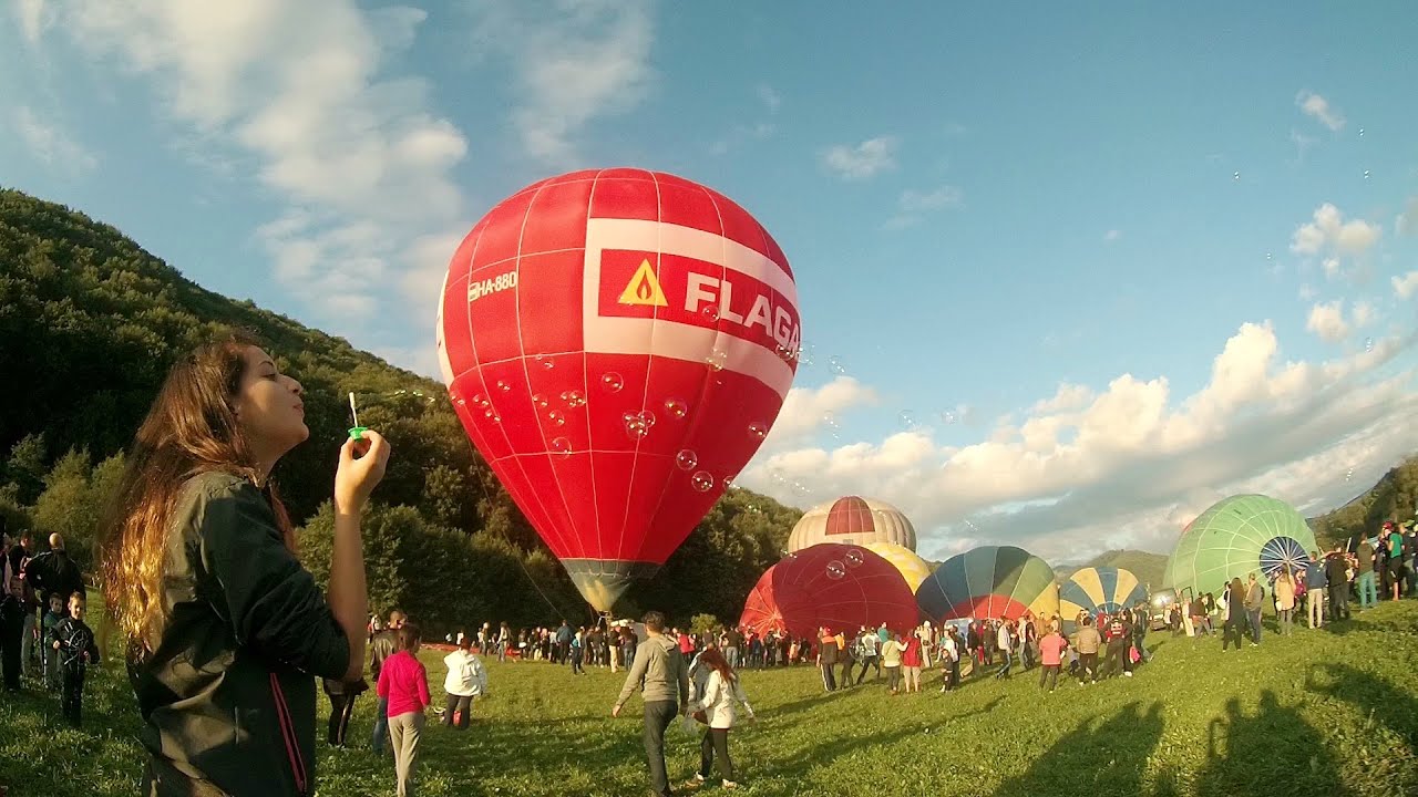
Hot air balloon parade 2015 - Campu Cetatii 26.1 km away. This year, the Hot Air Balloon Parade was organized in Campu Cetatii for the tenth time. Unfortunately, the weather only allowed for flying on Saturday morning and evening.
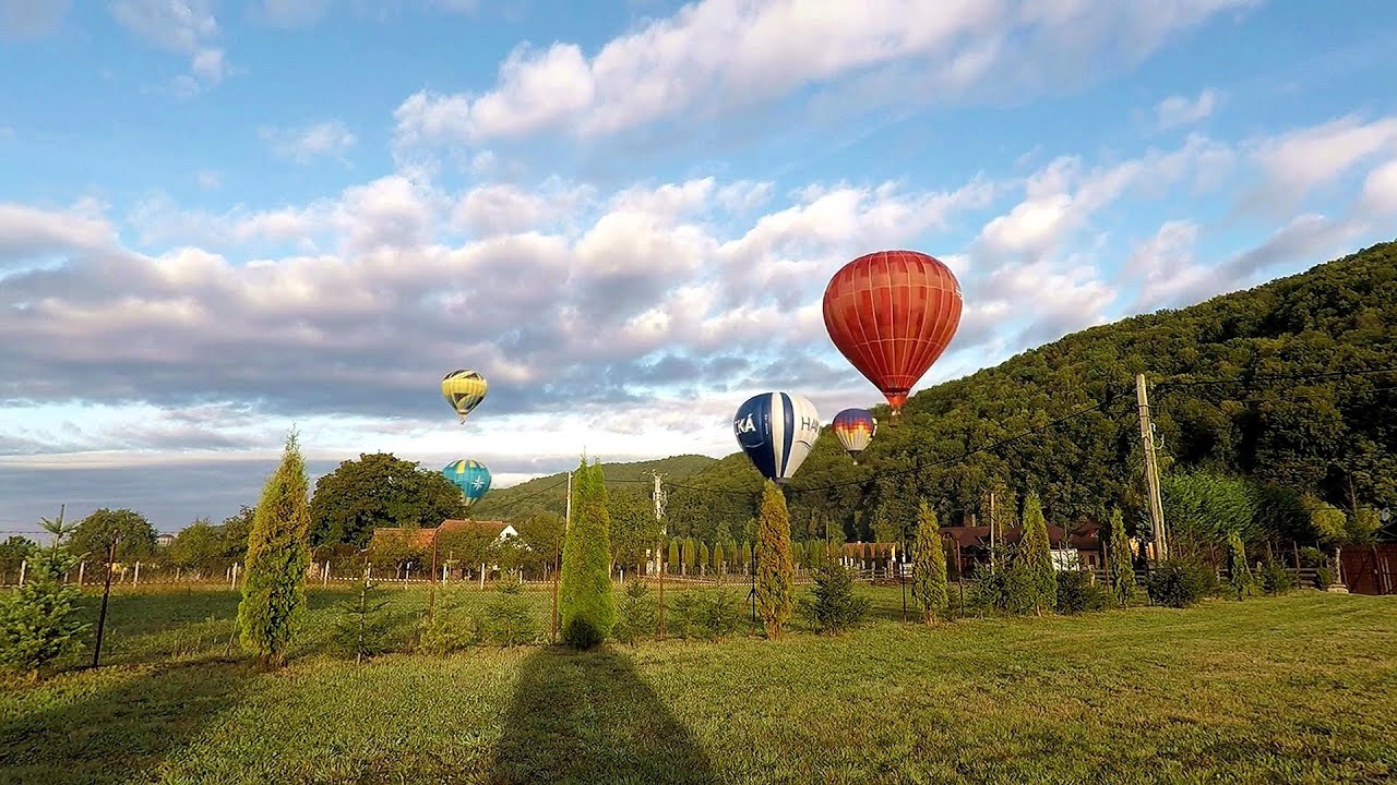
Hot Air Balloon Parade 2018 - Campu Cetatii 26.1 km away. This year, the hot air balloons flew low over Campu Cetatii. The weather did not really favor the parade.

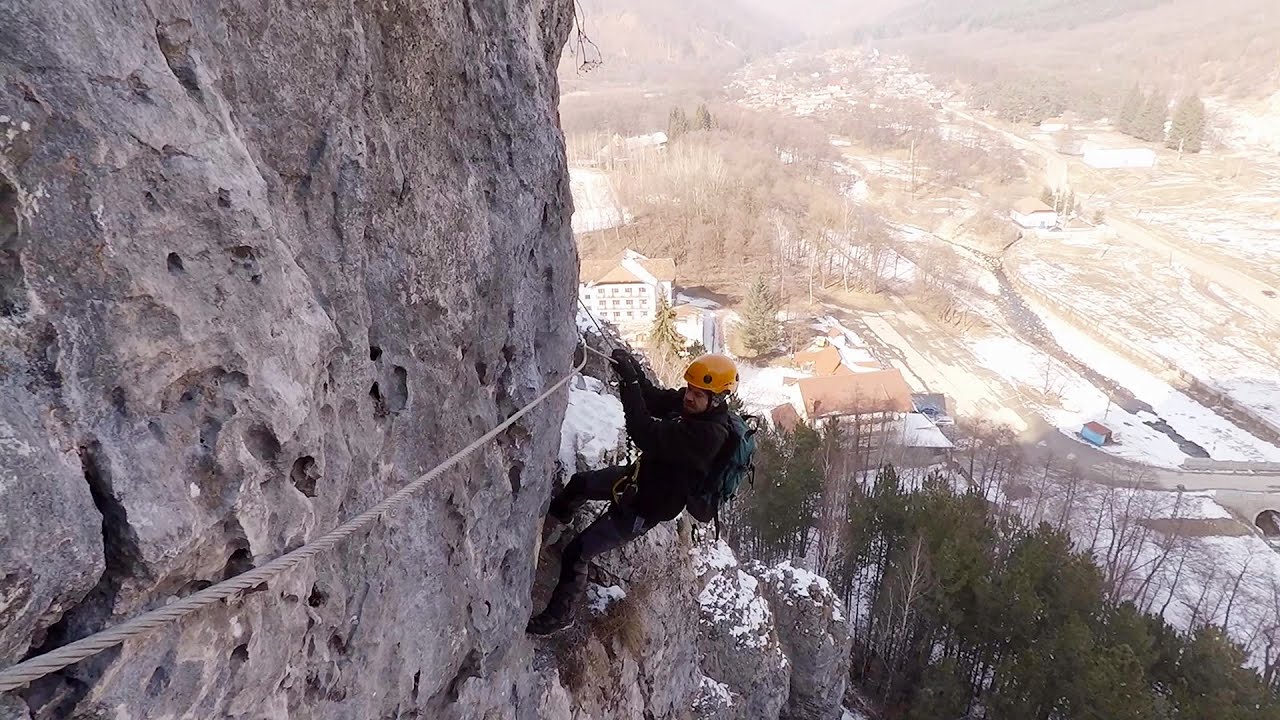
Iron path - Harghita-Madaras 28.8 km away. Amateur filming in Harghita-Madaras, holding the camera by hand in the car, and helmet-mounted on the via ferrata. I climbed an iron path for the first time in my life on the Nyerges cliffs (Stancile Seii), I didn't have the right equipment yet.

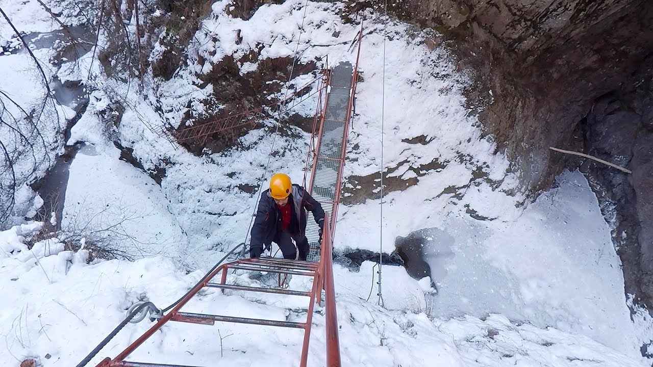
Iron path in winter - Harghita Madaras 28.8 km away. This is already the sixth time I've climbed the via ferrata route set up on the rocky cliffs of Seii Peak near Harghita Madaras. Although the forecast suggests that the weather should be nice, I am greeted by a sky covered in clouds.
Other places
Belintash Ridge of Dobrostan, Rhodope Mountains Belintash is a mysterious monolithic complex located approximately 50 km from Plovdiv, passing through the scenic Rhodope Mountains. It is situated southeast of the village of Vrata and west of the village of Sini Vruh.

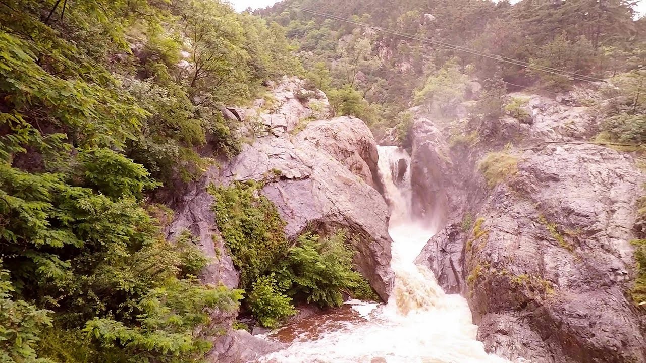
Corcoaia Gorge Gorj county 243.9 km away. The Corcoaia Gorge is one of the most beautiful tourist attractions in the Cerna Valley. It can be reached by car, 43 km away from Baile Herculane, of which about 17 km is on a dusty gravel road.
Doabra Stones Brezoi, Lotru Mountains 143.9 km away. The DN7A road branches off west from the Olt Valley, from the main road between Sibiu and Ramnicu Valcea, leading towards Voineasa and Lake Vidra. The first settlement is a small town, Brezoi, which is located at the confluence of the Lotru and Olt rivers.
Saeva Dupka cave Brestnitsa 388.8 km away. The Saeva Dupka Cave is located 2 km south of the village of Brestnitsa. In its five chambers and 400 meters of passageways, you can see the most beautiful cave formations in Bulgaria.
Womens Spiral, Cave Ridge, and The Great Crack iron paths Baia de Fier 180.4 km away. Perhaps the most interesting via ferrata among the routes in the Baia de Fier area is the Womens Spiral. After completing it, I can say that it is the second most thrilling via ferrata in Romania, following the Big Via Ferrata at Rasnov.
Stan Valley Canyon in winter 131 km away. The Stan Valley is a picturesque canyon, even in winter. In fact, when the stream is frozen and covered with a layer of snow, exploring the canyon becomes much quicker and easier.

Buzludzha monument Kazanluk 415.6 km away. Buzludzha is a historically significant mountain located in the Central Balkan Mountains of Bulgaria. At its summit, at an altitude of 1432 meters above sea level, there is an abandoned monument.
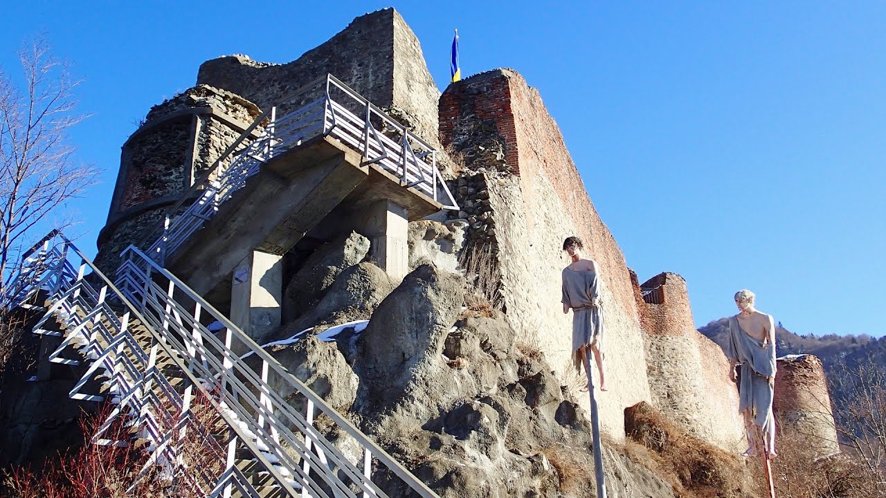
Poenari citadel Arges valley 131.4 km away. The Poenari citadel is located on the southern slope of the Fagaras Mountains, on the western side of the Transfagaras road, in the Arges Valley, about 4 km from the Vidraru Lake dam. Along a steep incline, a concrete staircase leads up to the castle, which is built atop a mountain.
Suchurum waterfall Karlovo 425.5 km away. The 15-meter-high Suchurum Waterfall is located at the foot of the Stara Planina mountain range, 1 km north of the town of Karlovo in Bulgaria. It is situated below the Karlovo hydroelectric power plant, on the waters of the Stara Reka stream.
[ Top ↑ ]
Copyright © 2003-2026 Trekkingklub and friends. Reproduction of any text, picture or video from this website, either in printed or electronic form, is prohibited without prior written permission. Website made with love  in Miercurea Ciuc.