Tourist attractions near Bejan-Tarnavita (Soimus, Hunedoara county, Romania)
Photos of nearby places


Goat Stone - Craiva, Trascau Mountains (18 photos) 59.3 km away. Goat Stone (Piatra Craivii, Piatra Craivei, Apulon) - Craiva, Trascau Mountains.

Stone of Cetea, Horse Pit - Trascau (16 photos) 62.6 km away. Stone of Cetea, Horse Pit (The pit cave from the Stone of Cetea) - Trascau Mountains.

Goats Ledge - Trascau Mountains (10 photos) 63.2 km away. Goats Ledge (Brana Caprei, Kecskék párkánya) - Trascau Mountains .

Natural bridge next to the Banita Stone Quarry (12 photos) 64.7 km away. Although the Banita Stone Bridge is not far from the road that passes through the village, it is located beyond the railway line, so its approach is a bit cumbersome. We can go around the railway line on Carierei Street, and then we have to walk a few meters from the stone quarry.

Banita Gorge - Banita (16 photos) 66.4 km away. The approximately 250 m long gorge, similar to the Corcoaia Gorge, is truly spectacular. According to assumptions, it was formed by the collapse of a cave passage ceiling, and then the erosion formed spectacular karst formations in the limestone.

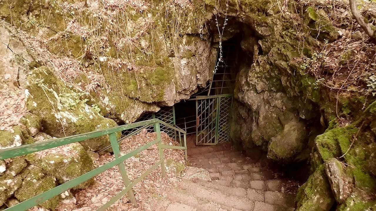
Boli Cave - Banita (20 photos) 66.5 km away. The main cave passage is approximately 460 m long, with an entrance portal that is 10 m high and 20 m wide at its base. In the 1960s, bridges were built over the underground stream flowing through the cave.


Dark Blue Bruises of the Ponor - Trascau Mountains (16 photos) 68.5 km away. The Dark Blue Bruises of the Ponor (Vanatarile Ponorului) is a polje-type protected area. Polje is a Slovenian word meaning plain, and it refers to a surface karst form.

Dark Blue Bruises of the Ponor, Bedeleu (24 photos) 70.9 km away. Dark Blue Bruises of the Ponor (Vanatarile Ponorului), Bedeleu - Trascau Mountains.


Balcony Clearing - Trascau Mountains (6 photos) 71.6 km away. Balcony Clearing (Erkély-tisztás, Balconul Sipotelor) - Trascau Mountains.

Aries valley - Trascau Mountains (10 photos) 72.7 km away. Aries (Golden) valley - Trascau Mountains.


Szekler Stone North - Trascau Mountains (8 photos) 81.4 km away. Szekler Stone North (Piatra Secuilor Nord) - Trascau Mountains.

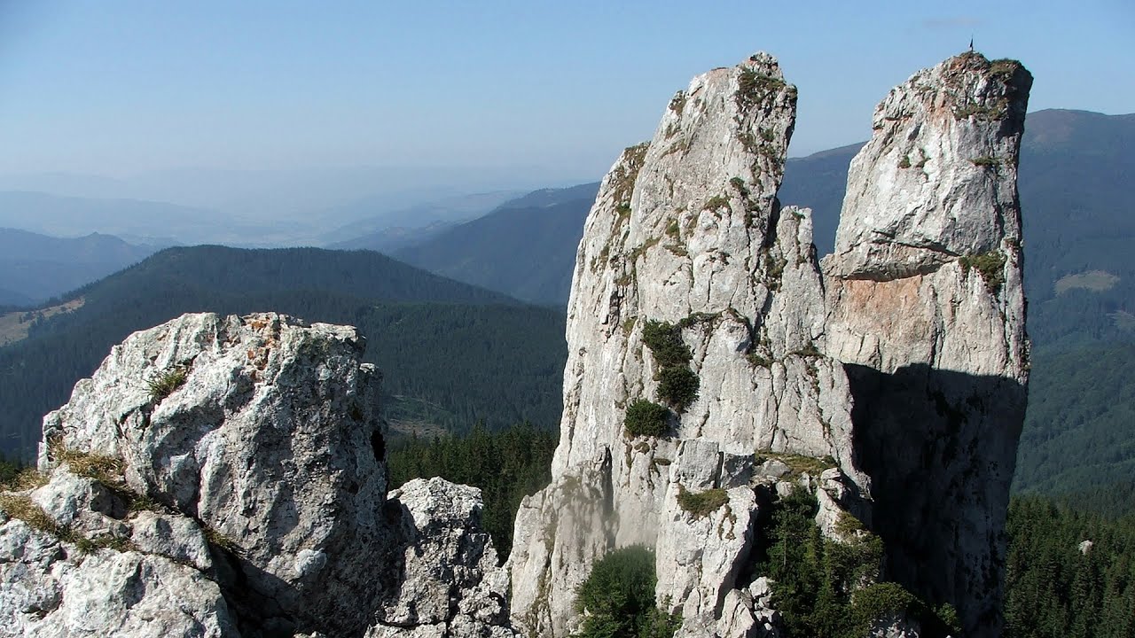
Szekler Stone - Trascau Mountains (42 photos) 81.4 km away. Szekler Stone (Székely-kő, Piatra Secuilor) - Trascau Mountains.

Parangul Mare peak (16 photos) 87 km away. Chamois saddle (Saua Caprelor), Carja mountain shelter (Refugiul Carja) - Carja peak (Varful Carja) - Stoienita peak (Varful Stoienita) - Gemanarea - Parangul Mare peak.


Turda Gorge - Trascau Mountains (9 photos) 95.5 km away. Turda Gorge (Cheile Turzii) - Trascau Mountains.

Turda Gorge - Trascau Mountains (11 photos) 95.5 km away. Turda Gorge (Cheile Turzii) - Trascau Mountains.

Turda Gorge via ferrata (24 photos) 95.6 km away. Turda Gorge iron path (Via ferrata Cheile Turzii) - Trascau Mountains.
[ Top ↑ ]
Videos of nearby places


Pisoaia waterfall - Vidra 47 km away. Pisoaia waterfall (Pisoaia Vidrii, Urine of the otter) - Nemesi, Vidra.

The palm of God and the Heavens door - Fundatura Ponorului mountain village 51.1 km away. One of the most picturesque places in Romania, one of the most beautiful mountain villages, and a photographer's paradise. Fundatura Ponorului is located in the Ponor Stream Valley, part of the Gradistea Muncelului - Cioclovina National Park, in the Sureanu Mountains.

Crivadia Gorge 61.1 km away. The Crivadia Gorge is located next to the village of Crivadia, which belongs to Banita. Access is difficult, and the hike is made through the streambed, with water up to the waist at its narrowest point.
Other places
Saeva Dupka cave Brestnitsa 339.4 km away. The Saeva Dupka Cave is located 2 km south of the village of Brestnitsa. In its five chambers and 400 meters of passageways, you can see the most beautiful cave formations in Bulgaria.
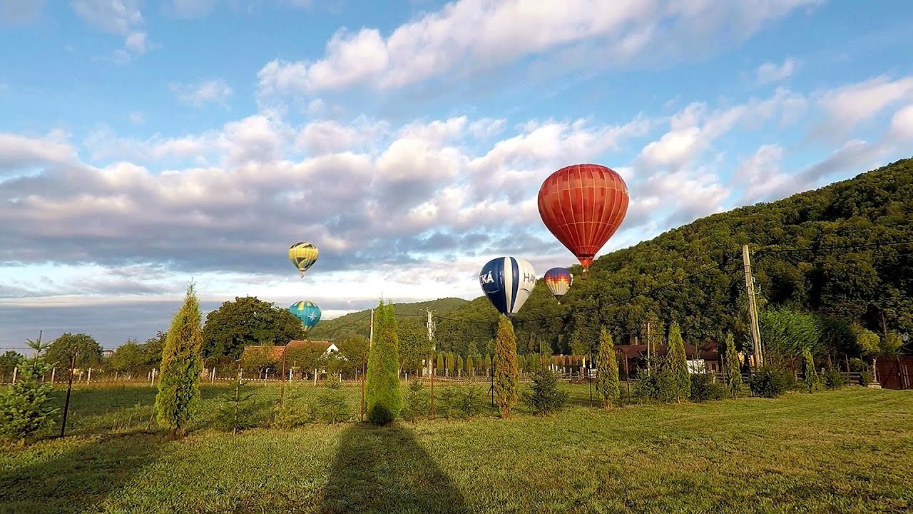
Hot Air Balloon Parade 2018 Campu Cetatii 186 km away. This year, the hot air balloons flew low over Campu Cetatii. The weather did not really favor the parade.

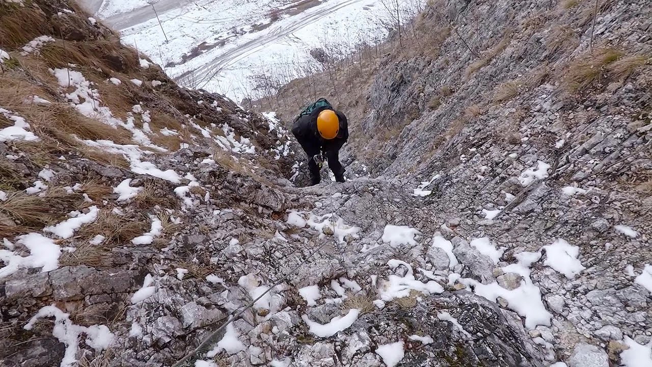
Virus and Antivirus iron paths Baia de Fier 110.6 km away. With Virus (B/C) and Antivirus (C), the number of via ferrata routes at Baia de Fier has increased to thirteen. In fact, it is a Y-shaped route that starts near the entrance of the Laura via ferrata, and the exits are located just a few meters from the Laura exit.
Ladys Stones Rarau Mountains 267.8 km away. The Lady's Stones represent the heart, the mind, and the soul. The first two only help to understand the world when one possesses knowledge (they can be climbed with rock climbing gear), as emotions and thoughts (the two rock towers) obscure reality (the view).
Loreley and Pink Panther iron path Baia de Fier 110.4 km away. The Loreley via ferrata (graded B/C, with an elevation difference of approximately 100 m and a length of about 100 m) is located on the rock wall on the opposite side of the road. A branch from its upper section leads to the Pink Panther (Pantera Roz, graded A/B/C, approximately 200 meters long, with an elevation difference of about 50 meters).

SkiGyimes ski slope Lunca de Sus 249.5 km away. It is well-known that in Rimetea, due to the Piatra Secuiului (Szekler's Rock) mountain, the Sun rises twice. However, perhaps few know that in Lunca de Sus, the Sun sets three times.
Thracian stone sharapani Nochevo 490.4 km away. Sharapani is a traditional stone container used by ancient Thracians for processing grapes in wine production. Two well-preserved sharapani containers are located about 200 meters apart.
Durdevica via ferrata and the canyon of the Ibar river Ribarice 381 km away. Difficulty level C/D (D/E), total length: 700 m, height difference: 200 m, year of construction: 2024. For experienced climbers with their own equipment, the registration fee is 5 euros per person.

Dino Parc Rasnov 209.3 km away. On June 12, 2015, one of the largest dinosaur theme parks in the region opened in Rasnov, where we can see 45 life-sized dinosaurs. The facility is located directly next to the Rasnov Fortress, which is one of the best-preserved Transylvanian Saxon peasant fortresses.
[ Top ↑ ]
Copyright © 2003-2026 Trekkingklub and friends. Reproduction of any text, picture or video from this website, either in printed or electronic form, is prohibited without prior written permission. Website made with love  in Miercurea Ciuc.