Tourist attractions near Curpenii Silvasului (Toplita, Hunedoara county, Romania)
Photos of nearby places


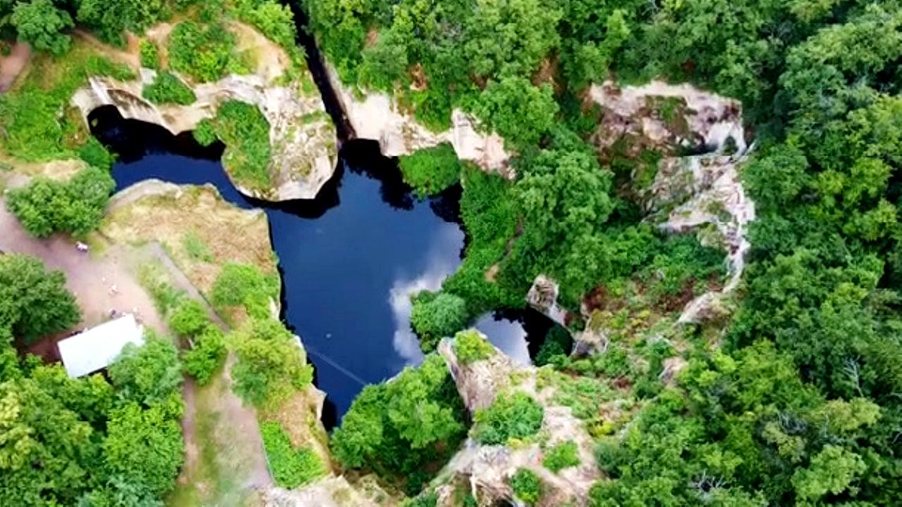
Natural bridge next to the Banita Stone Quarry (12 photos) 41.4 km away. Although the Banita Stone Bridge is not far from the road that passes through the village, it is located beyond the railway line, so its approach is a bit cumbersome. We can go around the railway line on Carierei Street, and then we have to walk a few meters from the stone quarry.


Banita Gorge - Banita (16 photos) 44.4 km away. The approximately 250 m long gorge, similar to the Corcoaia Gorge, is truly spectacular. According to assumptions, it was formed by the collapse of a cave passage ceiling, and then the erosion formed spectacular karst formations in the limestone.

Boli Cave - Banita (20 photos) 44.7 km away. The main cave passage is approximately 460 m long, with an entrance portal that is 10 m high and 20 m wide at its base. In the 1960s, bridges were built over the underground stream flowing through the cave.


Parangul Mare peak (16 photos) 66 km away. Chamois saddle (Saua Caprelor), Carja mountain shelter (Refugiul Carja) - Carja peak (Varful Carja) - Stoienita peak (Varful Stoienita) - Gemanarea - Parangul Mare peak.
[ Top ↑ ]
Videos of nearby places

The palm of God and the Heavens door - Fundatura Ponorului mountain village 29.5 km away. One of the most picturesque places in Romania, one of the most beautiful mountain villages, and a photographer's paradise. Fundatura Ponorului is located in the Ponor Stream Valley, part of the Gradistea Muncelului - Cioclovina National Park, in the Sureanu Mountains.

Sheepdogs - Govora sheepfold - Retezat mountains 31.2 km away. On the second day of my weekend Retezat hike, I visited a sheepfold on the Lancita Ridge. To my great disappointment, they didn't make cheese or curd here.

Billy-goat lake, Closed Gates - Retezat Mountains 32.1 km away. The most unique ridge trail of the Retezat Mountains is the Closed Gates.Below, at an altitude of 2070 m above sea level, is the Billy-goat lake.

Crivadia Gorge 37 km away. The Crivadia Gorge is located next to the village of Crivadia, which belongs to Banita. Access is difficult, and the hike is made through the streambed, with water up to the waist at its narrowest point.

Other places
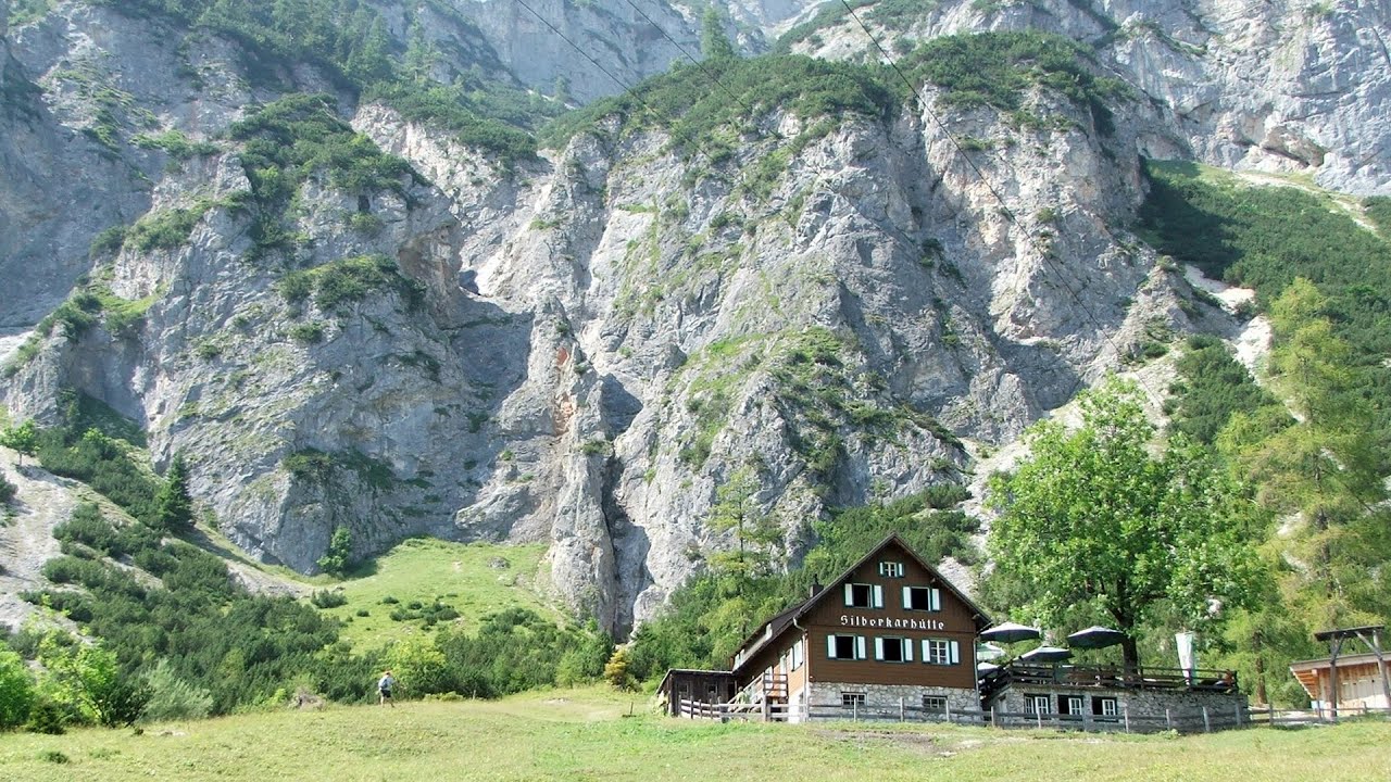
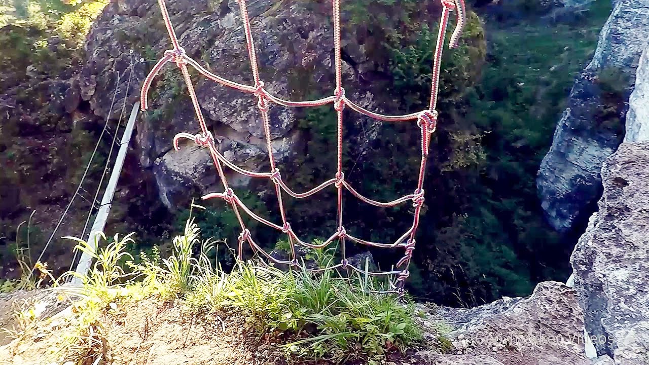
Siega via ferrata Silberkar Gorge, Ramsau am Dachstein The Siega via ferrata, categorized as a C/D level of difficulty, is perhaps the least interesting of the three via ferrata routes in the Silberkar Gorge (Silberkarklamm). This doesn't mean that it's not good, just that the other two are even better.

Nobodys lake Miercurea Ciuc 240 km away. The passage of time (time lapse), dusk at Nobody's Lake. Miercurea Ciuc and the Sumuleu mountain can be seen in the background.
Via ferrata Bear Cave adventure and climbing zone Borsec 256.3 km away. The Bear Cave in Borsec is a vast natural formation, scattered with rocks and deep crevices. Access to the cave's cavities is through a series of narrow formations resembling canyons, surrounded by giant fir trees and rocks with interesting shapes.
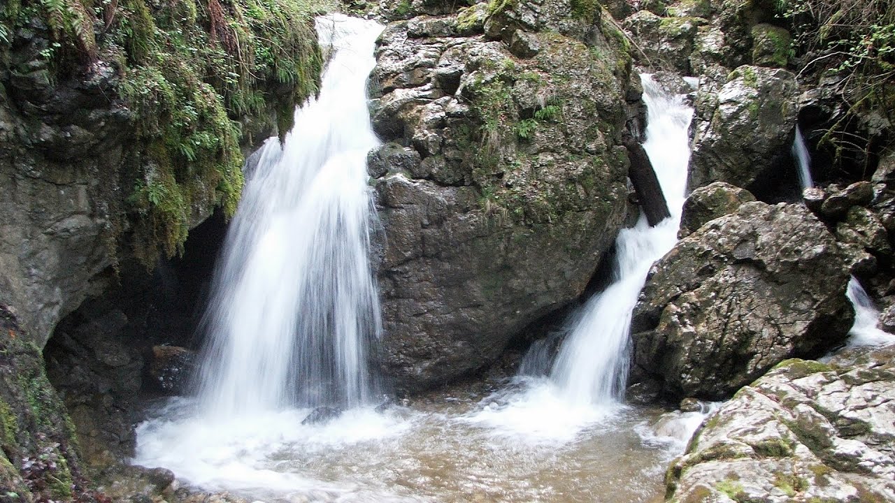
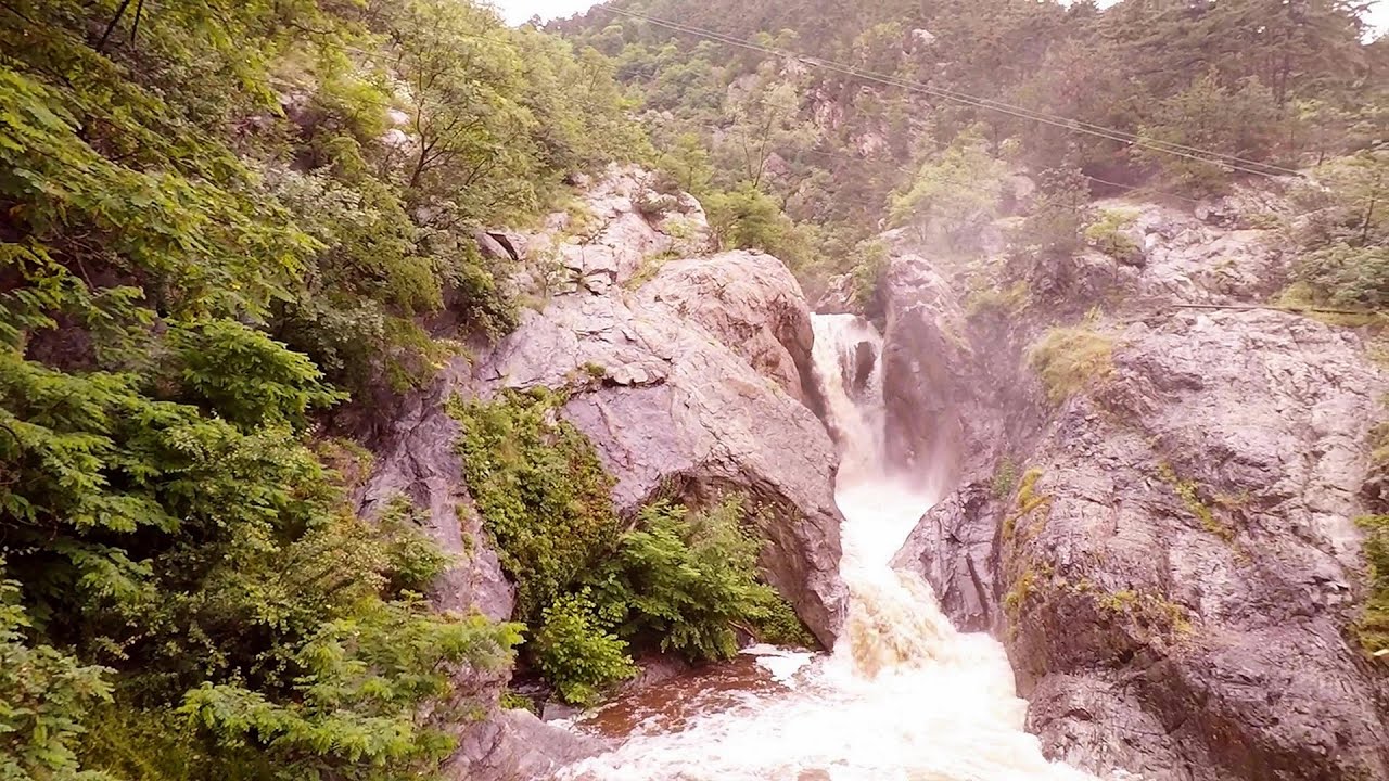
Waterfalls of Lapos creek Bicaz Gorge 263.6 km away. One of the lesser-known attractions of the Bicaz Gorges is the series of waterfalls along Lapos Creek. This creek flows between Cupas Stone and Bardos Stone before eventually merging with Bicaz Creek, forming spectacular waterfalls beneath the Altar Stone.
Mine lake Megyer mountain, Sárospatak 315 km away. The via ferrata routes of the Megyer mountain mine lake. The geologists' path E 25 m, Szabó József-memorial path C 200 m, Amphitheater D 40 m, Devil's Cauldron E 70 m, Sweet aquatic life D 150 m, Velociraptor C 35 m.
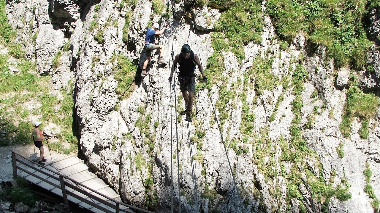
Rosina via ferrata Silberkar Gorge, Ramsau am Dachstein The Rosina via ferrata is the most difficult via ferrata in the Silberkar Gorge (Silberkarklamm), has a D difficulty rating, and it is a vertical masterpiece. After a short suspension bridge above the stream, it leads up the rock wall next to the gorge waterfall, all the way vertically.

Preachers Rock Bodoc Mountains 241.3 km away. In the Bodoc Mountains, west-southwest from the Henter peak, we find a rock formation shaped like a mushroom by erosion, called Preacher's Rock. This 2-meter high rock probably got its name from the pagan Hungarian priests, who preached here in the past.
Suchurum waterfall Karlovo 369.5 km away. The 15-meter-high Suchurum Waterfall is located at the foot of the Stara Planina mountain range, 1 km north of the town of Karlovo in Bulgaria. It is situated below the Karlovo hydroelectric power plant, on the waters of the Stara Reka stream.
Astragalus iron path in winter Glod Stone, Munticelu 266.9 km away. The official website of the Sugau Gorge published information about a new via ferrata climbing route named Astragalus. Sugau Gorges - Munticelu is a nature conservation area part of Natura 2000 located in Neamt County, which borders Harghita County.
Other destinations
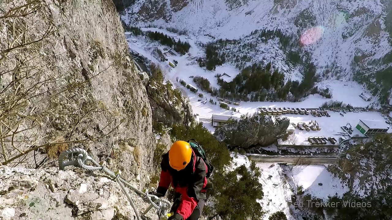
Gornjak via ferrata and Kudelinovs fortress Zdrelo 184.2 km away. Difficulty level C/D, total length: 400 m, height difference: 330 m, year of construction: 2019, total length of the route to Kudelinov's fortress: 1100 m. Access to the via ferrata is free.
[ Top ↑ ]
Copyright © 2003-2026 Trekkingklub and friends. Reproduction of any text, picture or video from this website, either in printed or electronic form, is prohibited without prior written permission. Website made with love  in Miercurea Ciuc.