Lomasita waterfall, Lomasel rock, Iezerul Calimanilor lake | Photos


Page no. 1, photos: 1-6, 23 photos in total. >>>

Copyright © 2013 - 2026 Trekkingklub.com. Please register for full and ad-free access.
Airport nearby: Transilvania International Airport (TGM - Recea, Ro), 92 km away.
Photos of nearby places


The Old Women of Gurghiu stone mushrooms, Batrana Peak (16 photos) 23.9 km away. The Old Women of Gurghiu (Babele Gurghiului) stone mushrooms, Batrana Peak (Varful Batrana). In the Gurghiu Mountains, 10 km from Toplita, near the peak Batrana, there are several groups of strange rocks.

Borsec spa resort (9 photos) 25.8 km away. Borsec is one of the most beautifully situated resorts in the Eastern Carpathians. It consists of two parts: Lower Borsec and Upper Borsec, the latter being the actual resort area.

[ Top ↑ ]
Videos of nearby places
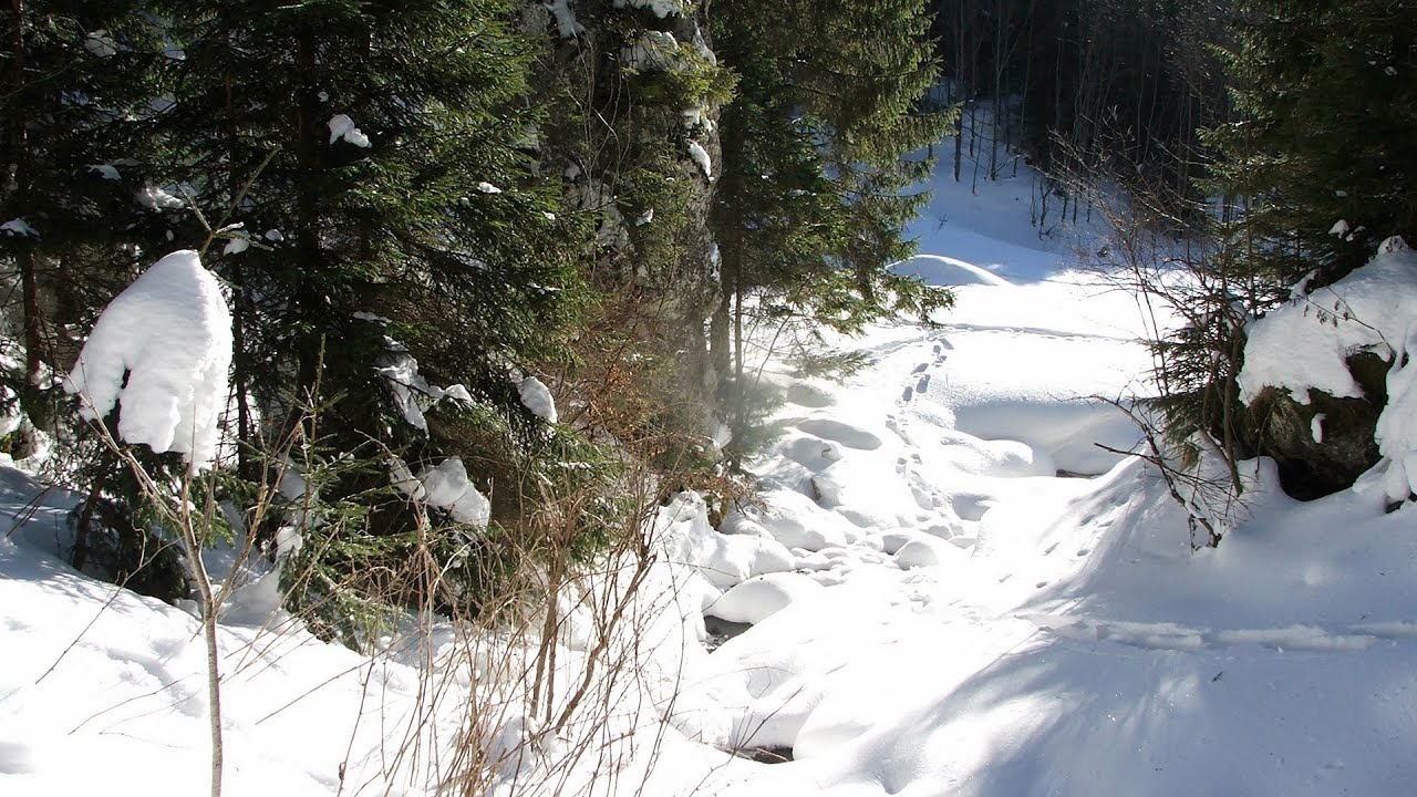
With snowshoes in the Tihu creek valley - Rastolita 11.1 km away. We met geotrekking treasure hunters from Gheorgheni, Miercurea Ciuc and Targu Mures in Rastolita. We entered the Calimani Mountains with an off-road vehicle, along the Rastolita and Tihu streams.
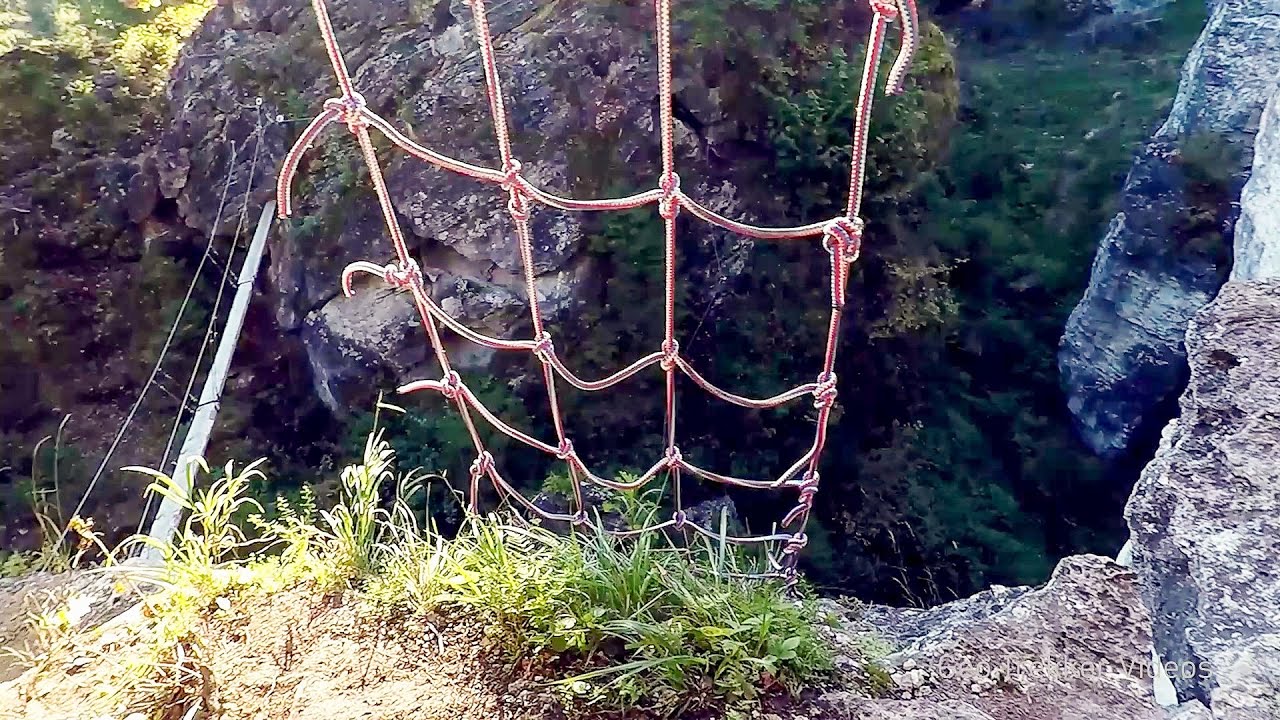
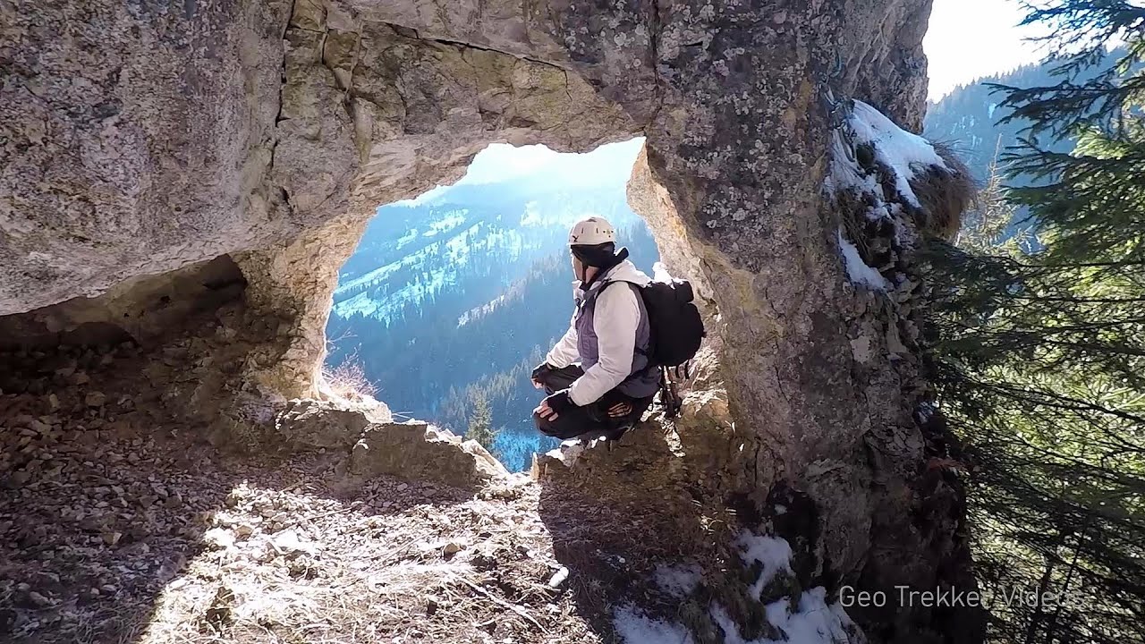
Via ferrata Bear Cave adventure and climbing zone - Borsec 26.3 km away. The Bear Cave in Borsec is a vast natural formation, scattered with rocks and deep crevices. Access to the cave's cavities is through a series of narrow formations resembling canyons, surrounded by giant fir trees and rocks with interesting shapes.
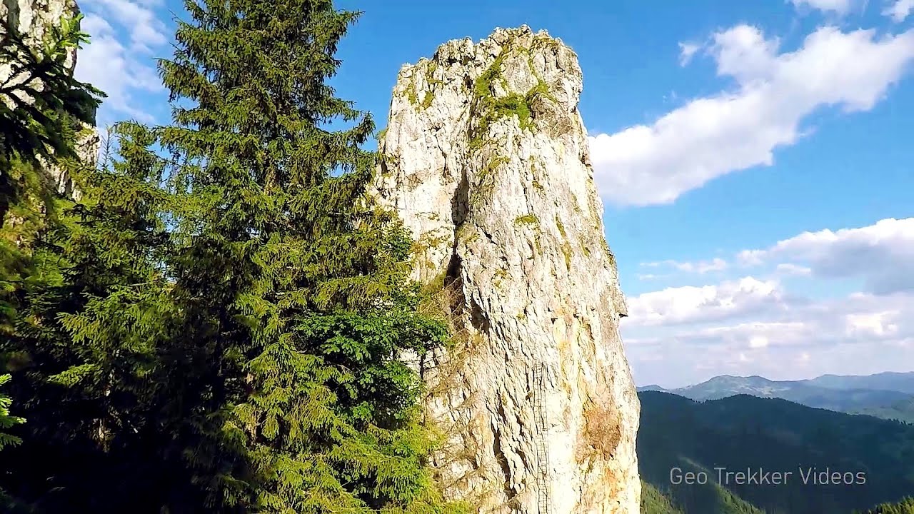
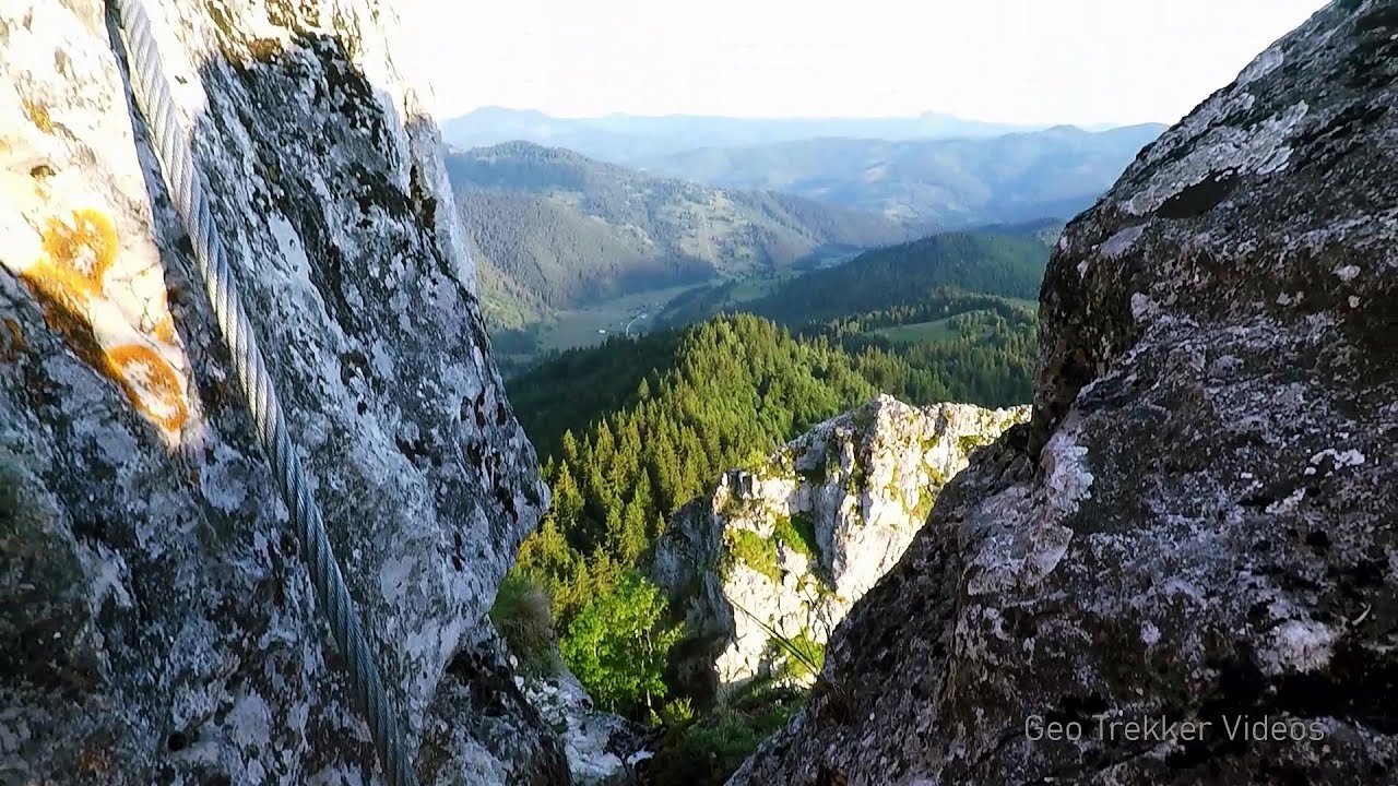
Falco Tinnunculus via ferrata, the ascent - Falcons Rock, Corbu 34.2 km away. Falco Tinnunculus (Common kestrel) via ferrata (E), the ascent - Falcon's Rock, Corbu. Over Corbu village in Harghita County, on the rocks of Falcon's Rock (Piatra Soimilor), which belong to the Bistrita Mountains, five via ferrata routes have been established.
Falco Peregrinus 2 via ferrata - Falcons Rock, Corbu 34.2 km away. Falco Peregrinus (Peregrine falcon) 2 via ferrata (D) - Falcon's Rock, Corbu.
Falco Peregrinus via ferrata - Falcons Rock, Corbu 34.3 km away. Falco Peregrinus (Peregrine falcon) via ferrata (B/C) - Falcon's Rock, Corbu.
Other places
Middle Belt via ferrata route Baia de Fier 238.3 km away. Middle Belt (Spirala Medie) via ferrata route - Baia de Fier. In May 2018, two new via ferrata routes were inaugurated in Baia de Fier.
Via Ferrata Pink Panther Baia de Fier 238.1 km away. In the area of Baia de Fier in Gorj County, several via ferrata routes have been set up on the rock above the Women's Cave (Muierii Cave) and on the other side of the road. At that time (2018), there were a total of seven.
Acapulcos spur via ferrata 205.7 km away. Acapulco's spur (Pintenul lui Acapulco) via ferrata (B/C) - Montana Land, Suncuius.
Piticot iron path for children Suncuius 205.7 km away.
Clocota waterfall Geoagiu-Bai, Metaliferi Mountains 203.1 km away.
Preachers Rock Bodoc Mountains 126.7 km away. In the Bodoc Mountains, west-southwest from the Henter peak, we find a rock formation shaped like a mushroom by erosion, called Preacher's Rock. This 2-meter high rock probably got its name from the pagan Hungarian priests, who preached here in the past.
Black Rocks iron path Bihor Mountains 208.7 km away. Black Rocks is located in the Bihor Mountains, near the Vartop Saddle, to the west of it. It is interesting that the locals (if I understood correctly) do not know this name, but use the name Piatra Buna (meaning Good Stone) for this spectacular rock.
Roman Baths Geoagiu-Bai, Metaliferi Mountains 203.6 km away.
Lednica iron path Brestnitsa 454.8 km away. The Lednica via ferrata is located next to the Saeva Dupka Cave, near the village of Brestnitsa in Bulgaria. The trail leading to the via ferrata, which opened in 2007, starts from the cave parking lot next to a covered resting area.
Transalpina Ski Resort Vidra lake 218.7 km away.
Stone Forest Slanchevo 468.1 km away. The Stone Forest (Stones stuck in the ground, Pobiti Kamani) of Bulgaria is located 18 km west of Varna, at the foothills of the Eastern Balkan Mountains. Its Bulgarian name, Pobiti Kamani, translates to planted stones, and it is referred to in English as the Stone Desert or Stone Forest.
Cherven, a medieval fortified town Bulgaria 387.6 km away. Located about 30 km south of the city of Ruse in Bulgaria, the Cherven medieval fortress can be found in the Rusenski Lom Nature Park. Originally a Byzantine fortification from the 6th century, it reached the height of its development in the 14th century.
Pisoaia waterfall Vidra 197.4 km away. Pisoaia waterfall (Pisoaia Vidrii, Urine of the otter) - Nemesi, Vidra.
Foamy valley waterfall Bucegi Mountains 185.5 km away. Access to the Foamy valley waterfall (Cascada Valea Spumoasa) is made from the town of Busteni. The starting point is the lower station of the cable car that ascends to the Babele cabin.
The Gorge of the Creek of the Gorge Buila-Vanturarita National Park 218.2 km away. The Gorges of the Creek of the Gorge (Cheii Gorge, Cheile Cheii) is located in the Buila-Vanturarita National Park within the Capatana Mountains. It is one of the most beautiful and picturesque gorges in Romania.
[ Top ↑ ]
Copyright © 2003-2026 Trekkingklub and friends. Reproduction of any text, picture or video from this website, either in printed or electronic form, is prohibited without prior written permission.
The given distances are to be understood as straight line distances, and are approximate. Website made in Miercurea Ciuc  .
.