Tourist attractions near Lunca de Jos (Lunca de Jos, Harghita county, Romania)
Photos of nearby places

Condra cross - Three rocks peak (24 photos) 4.4 km away. Condra cross - Trei Pietre (Three rocks) peak.

The sources of the river Trotus - Fagetel (10 photos) 13.4 km away. Fagetel, Piposz property, The sources of the river Trotus (Tatros).

Brother Mountain - Hasmas Mountains (15 photos) 16.1 km away. Brother Mountain (Fratele, Ecem, Ecsém) - Hasmas Mountains.

Brother Mountain - Hasmas Mountains (11 photos) 16.9 km away. Brother Mountain (Ecsém-tető, Muntele Fratele, Muntele Ecem) - Hasmas Mountains.


Watchstone and the Lonely Stone in March (18 photos) 17.7 km away. Watchstone (Stanca La Panda) and the Lonely Stone (Piatra Singuratica) in March.

Lonely Stone - Hasmas Mountains (9 photos) 17.7 km away. Lonely Stone (Piatra Singuratica) - Hasmas Mountains.

Valley of the Lazarus-creek - Hasmas Mountains (15 photos) 18.7 km away. Valley of the Lazarus-creek (Valea paraului Lazar), Log Slide - Hasmas Mountains.

Lazar peak - Hasmas Mountains (18 photos) 20.5 km away. The pit under the Lazar peak 2004-09-02, 2014-11-27.

Dry Valley canyon - Hasmas Mountains (9 photos) 22.4 km away. Dry Valley (Paraului Sec) canyon - Hasmas Mountains.

White Glade - Hasmas Mountains (6 photos) 22.7 km away. White Glade (Poiana Alba) - Hasmas Mountains.

Black Hasmas - Hasmas Mountains (27 photos) 23.1 km away. Hasmasul Negru (Black Hasmas) - Hasmas Mountains.

White Glade, Horseshoe Rock (17 photos) 23.3 km away. White Glade (Poiana Alba), Horseshoe Rock (Piatra Potcoavei) - Hasmas Mountains.

Horseshoe Rock - Hasmas Mountains (9 photos) 23.3 km away. Horseshoe Rock (Piatra Potcoavei) - Hasmas Mountains.

Pit cave with three entrances - Hasmas Mountains (3 photos) 24.3 km away. Pit cave with three entrances (Avenul cu trei intrari) - Hasmas Mountains.


Sugo Cave - Giurgeu Mountains (60 photos) 26.4 km away. The Sugó Cave is located at the western foot of Sipos Stone (1566 m) at an altitude of 1064 m above sea level. It consists of a system of passages with four levels, totaling 1021 m in length and a level difference of -60 m.


Ruins of the Harom fortress - Jigodin Bath (10 photos) 30.9 km away. The Harom Fortress was built around the beginning of the 12th century and was part of the system of fortifications that protected Transylvania from the east. It is located south of Miercurea Ciuc, east of Harom Peak, which has an altitude of 1079 m, near the southwestern limits of Jigodin Bath (Baile Jigodin).

Harghita Bath - Harghita Mountains (15 photos) 32.6 km away. Harghita Bath (Harghita-Bai) - Harghita Mountains.

Beer waterfall - Gosmanu Ridge (12 photos) 32.9 km away. Beer waterfall (Cascada Berea) - Gosmanu Ridge, Tarcau Mountains.

Altar, Handprint Rock - Gosmanu Ridge (17 photos) 36.4 km away. Altar, Handprint Rock (Stanca La deget) - Gosmanu Ridge, Tarcau Mountains.
[ Top ↑ ]
Videos of nearby places
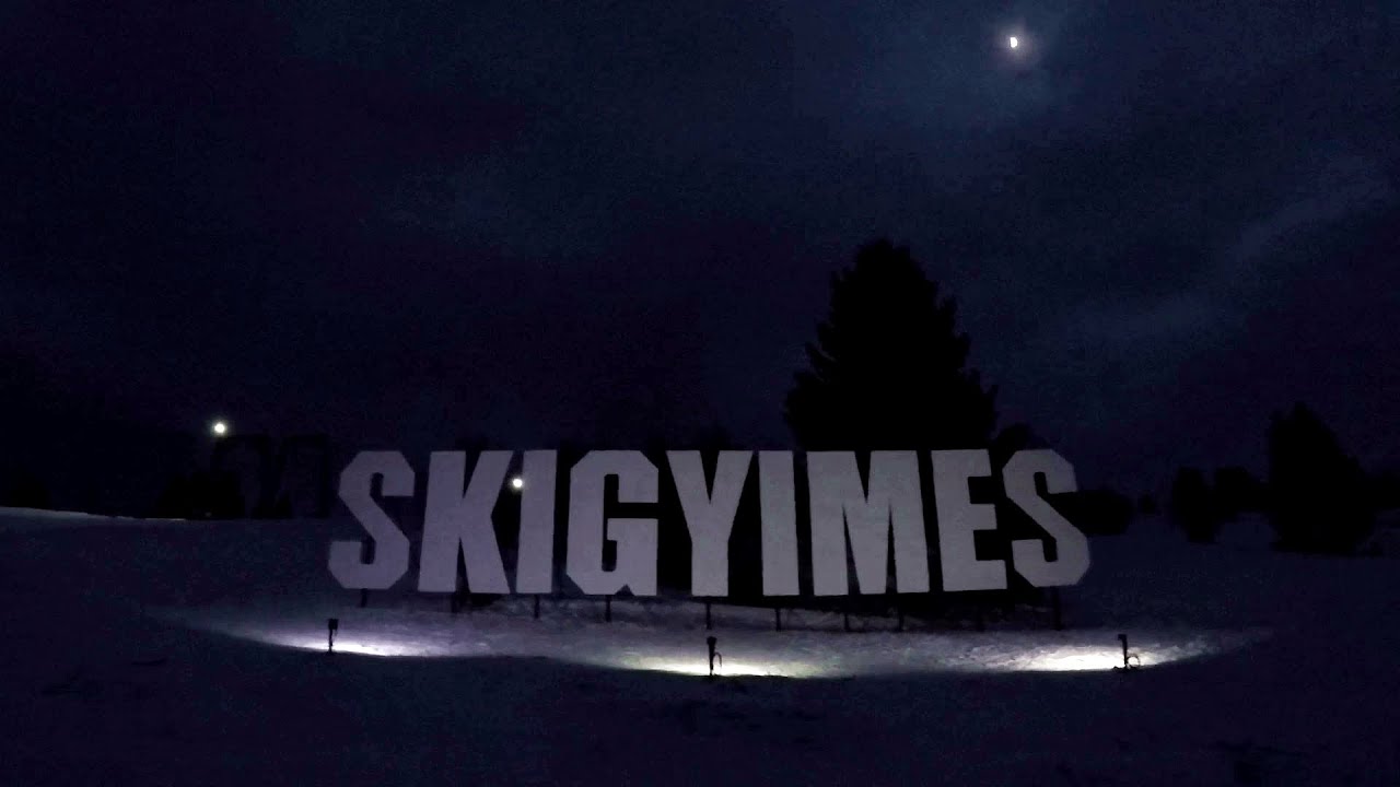
Ski Gyimes ski slope - Lunca de Sus 4.8 km away. The Ski Gyimes ski slope is located in Lunca de Sus, right next to the main road. It is 800 m long, the level difference is 160 m.

SkiGyimes ski slope - Lunca de Sus 4.8 km away. It is well-known that in Rimetea, due to the Piatra Secuiului (Szekler's Rock) mountain, the Sun rises twice. However, perhaps few know that in Lunca de Sus, the Sun sets three times.
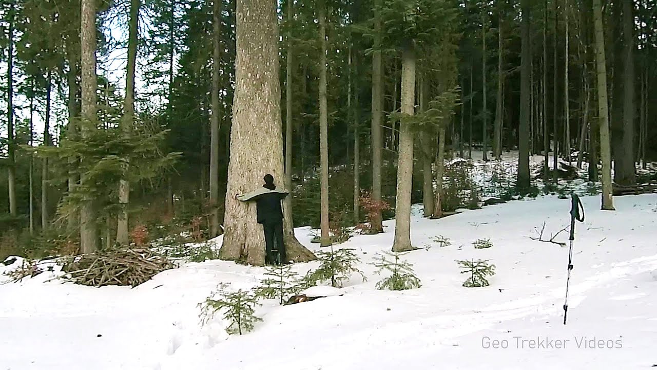
Giant fir trees - Ghimes 11.8 km away. One of the lesser-known attractions of Ghimes is the two giant-sized common fir trees. They are 42 meters tall, and have diameters of 110 cm and 130 cm at chest height.
Lonely Stone - Hasmas Mountains 17.7 km away. On June 1, 2003, with a small group of friends, I left Balan, walking along the valley of the Sep (Beautiful) stream towards the Lonely Stone (Piatra Singuratica). Those who were with me at the time fell behind, and then other people joined for the hike.

Other places
Eagles Eye Yagodina Orlovo Oko (Eagle's Eye) is a lookout viewpoint located in the Rhodope Mountains, near the peak of Saint Ilia and close to the village of Yagodina, Bulgaria. The steel structure, built at an altitude of 1,563 meters, rises 670 meters above the spectacular Buynovsko Gorge, along with the winding river and road that traverse it.
The two niches with the visor Nochevo Dvete nishi s kozirkata (The two niches with the visor) - Nochevo.
Belintash Ridge of Dobrostan, Rhodope Mountains Belintash is a mysterious monolithic complex located approximately 50 km from Plovdiv, passing through the scenic Rhodope Mountains. It is situated southeast of the village of Vrata and west of the village of Sini Vruh.
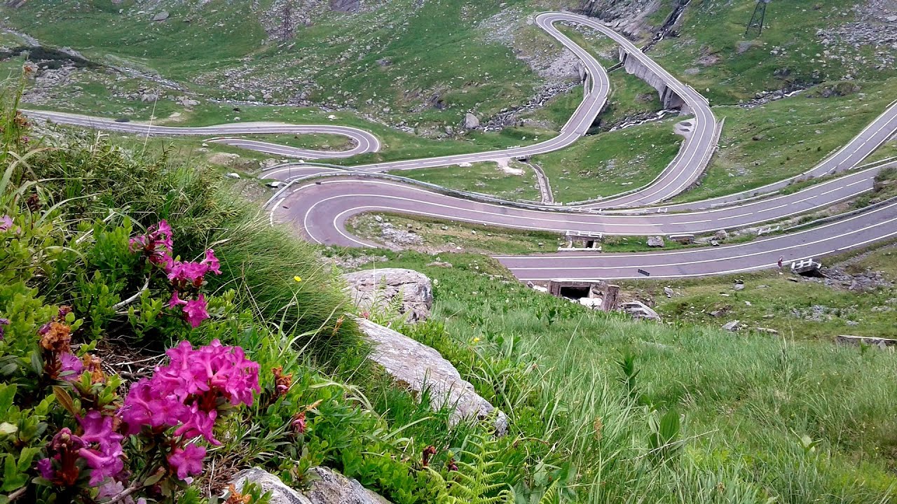
Balea waterfall and the Transfagarasan mountain_road 147.5 km away. Balea waterfall and the Transfagarasan mountain road - blue triangle marked trail, Balea valley, Fagaras Mountains, Southern Carpathians.

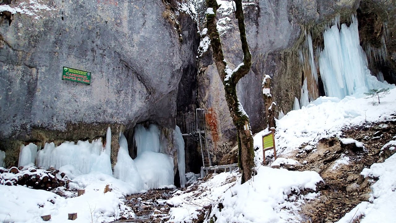
Small Via ferrata Rasnoavei Gorge 118.4 km away. In the past few days, it has snowed, so I climbed the two climbing routes in the Rasnoavei Gorge under winter conditions. While the lower part of the challenging Big via ferrata was dry, the upper section had patches of snow and icicles.
Seven Ladder Canyon in Winter Piatra Mare Mountain 113.5 km away. Seven Ladder Canyon and Waterfall in Winter - Piatra Mare Mountain
Skaklya waterfall Vratsa 421.6 km away. The largest seasonal waterfall in Bulgaria plunges down from a height of 141 meters. It is located in the Vratsa Mountain National Park, just one and a half kilometers away from the city of Vratsa.
[ Top ↑ ]
Copyright © 2003-2026 Trekkingklub and friends. Reproduction of any text, picture or video from this website, either in printed or electronic form, is prohibited without prior written permission. Website made with love  in Miercurea Ciuc.