Tourist attractions near Cartisoara (Cartisoara, Sibiu county, Romania)
Photos of nearby places

Chamois saddle - Fagaras Mountains (12 photos) 14.6 km away. Chamois saddle (Saua Caprei) - Fagaras Mountains.


Circular hiking tour in Cozia Mountain (48 photos) 48.9 km away. Arutela - Turnu monastery - Rosiei Rocks - Turneanu ridge - Cozia peak - Stone portal - Stanisoara monastery - Gardului waterfall.

Doabra Snail Shells - Brezoi (12 photos) 49.1 km away. Doabra Valley - Calinesti-Brezoi forest - Lotru Valley, Cozia National Park

The shoulder of Piatra Craiului Mountains (36 photos) 53.2 km away. The shoulder of Piatra Craiului Mountains (King Rock's Shoulder).

Deubels path - Piatra Craiului Mountains (36 photos) 53.3 km away. Plaiul Foii - Deubel cavities (La Zaplaz) - Grind saddle. Deubel's path - Piatra Craiului Mountains (King Rock).

Middle Belt Trail - Piatra Craiului Mountains (114 photos) 53.5 km away. Ravine valley of Calinet (Padina lui Calinet) - Thermopylae - Anghelide's canyon, Piatra Craiului Mountains (King Rock).

Cave of Stanciu - Piatra Craiului Mountains (10 photos) 53.7 km away. Cave of Stanciu (Pestera Stanciului) - Piatra Craiului Mountains (King Rock).

Stanciu rock porch - Piatra Craiului Mountains (18 photos) 53.8 km away. Stancius rock porch (Ceardacul Stanciului) - Piatra Craiului Mountains (King Rock).

Southern ridge - Piatra Craiului Mountains (42 photos) 53.8 km away. Southern ridge - Piatra Craiului Mountains (King Rock).

Border Ravine Valley, Northern ridge (53 photos) 54.3 km away. Border Ravine Valley (Padina Hotarului), Northern ridge - Piatra Craiului Mountains (King Rock).

Northern ridge - Piatra Craiului (11 photos) 54.3 km away. Northern ridge - Piatra Craiului Mountains (King Rock).

Tower of King Rock - Piatra Craiului Mountains (15 photos) 55.6 km away. Border Ravine Valley (Padina Hotarului), Turm des Königstein (Turnul Pietrei Craiului).

The Cats Gorge - Curmatura Cabin (20 photos) 56.1 km away. The Cat's Gorge - Valley of the Gorge Stream - Curmatura Cabin - Rift Saddle.

Little King Rock - Piatra Craiului Mountains (14 photos) 56.8 km away. Little King Rock (Piatra Mica) - Piatra Craiului Mountains (King Rock).

Zarnesti precipice - Piatra Craiului Mountains (16 photos) 58.6 km away. Zarnesti precipice (Prapastiile Zarnestilor) - Piatra Craiului Mountains (King Rock).

Zarnesti Gorge - Piatra Craiului Mountains (6 photos) 58.6 km away. Zarnesti Gorge (Prapastiile Zarnestilor) - Piatra Craiului Mountains.

Shells Cave - Persani Mountains (33 photos) 61.1 km away. Shells Cave (Pestera Scoicilor) - Persani Mountains (Muntii Persani).

Ledge path of the chamois - Cheii Gorge (40 photos) 61.9 km away. Ledge path of the chamois (Brana Caprelor) - Cheii Gorge (Cheile Cheii).

Ciubotea-Scara - Bucegi Mountains (24 photos) 73.3 km away. Ciubotea clearing - Scara peak - Omu peak - Gaura sheepfold.

The source region of the Jalomita River - Bucegi Mountains (14 photos) 74.8 km away. The source region of the Jalomita River (Obarsia Ialomitei) - Bucegi Mountains.

Turkish Mosque Rock - Bucegi Mountains (6 photos) 74.8 km away. Turkish Mosque Rock (Mecetul Turcesc) - Bucegi Mountains.
[ Top ↑ ]
Videos of nearby places
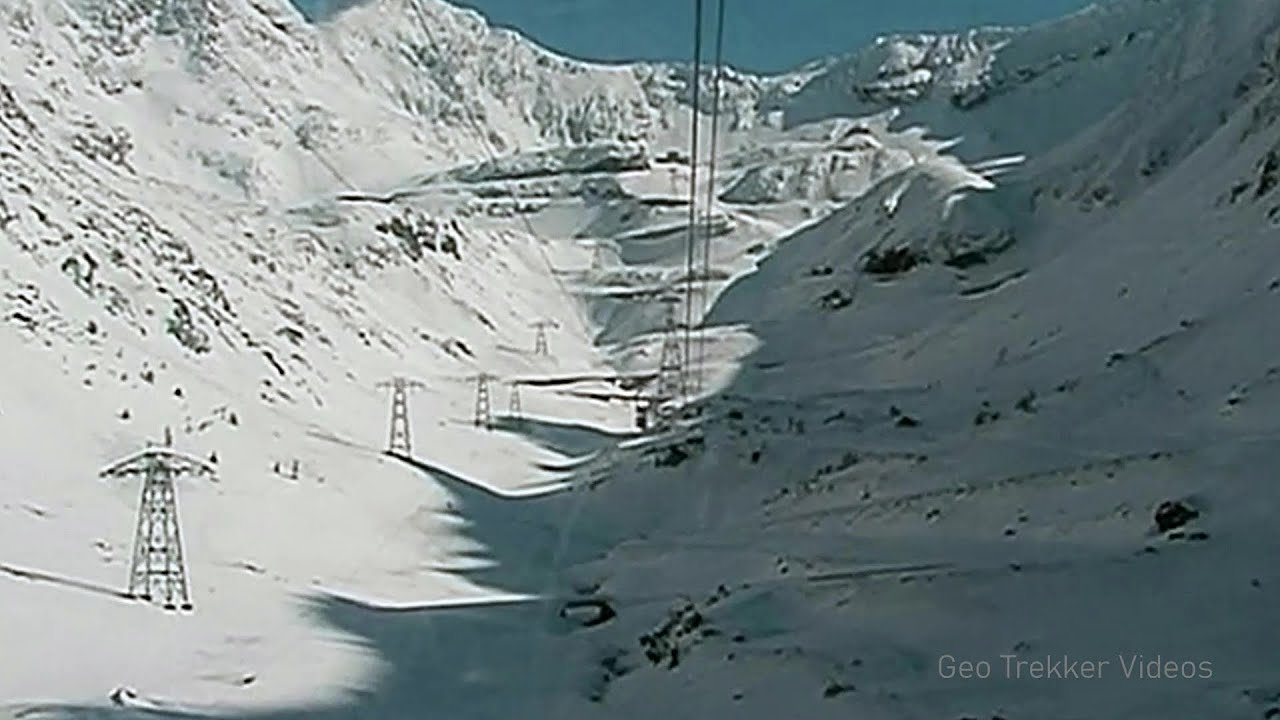
Snow-covered valley of Balea and the Transfagarasan in winter - The ascent 10.2 km away. The Fagarasi Mountains can be easily approached from the north, mainly by using the Transfagarasan Road. This high altitude mountain road is only accessible during the summer months (throughout its entire length).
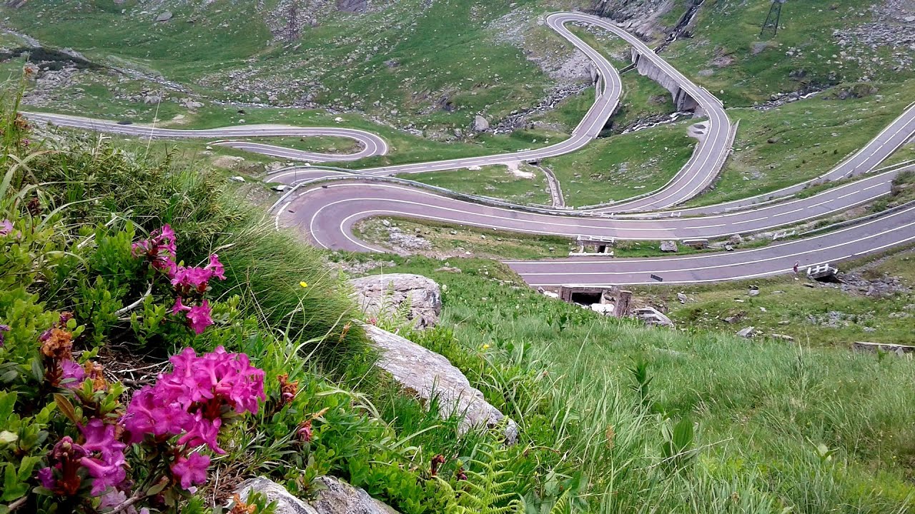
Balea waterfall and the Transfagarasan mountain_road 10.6 km away. Balea waterfall and the Transfagarasan mountain road - blue triangle marked trail, Balea valley, Fagaras Mountains, Southern Carpathians.
Stan Valley Canyon in winter 40.3 km away. The Stan Valley is a picturesque canyon, even in winter. In fact, when the stream is frozen and covered with a layer of snow, exploring the canyon becomes much quicker and easier.

Stan Valley Canyon 40.7 km away. The Stan Valley is located near Lake Vidraru, southwest of it, in the Fruntii Mountains. Those who have visited the Seven Ladders Waterfall will appreciate this canyon, outfitted with infrastructure for tourist accessibility.
Other places
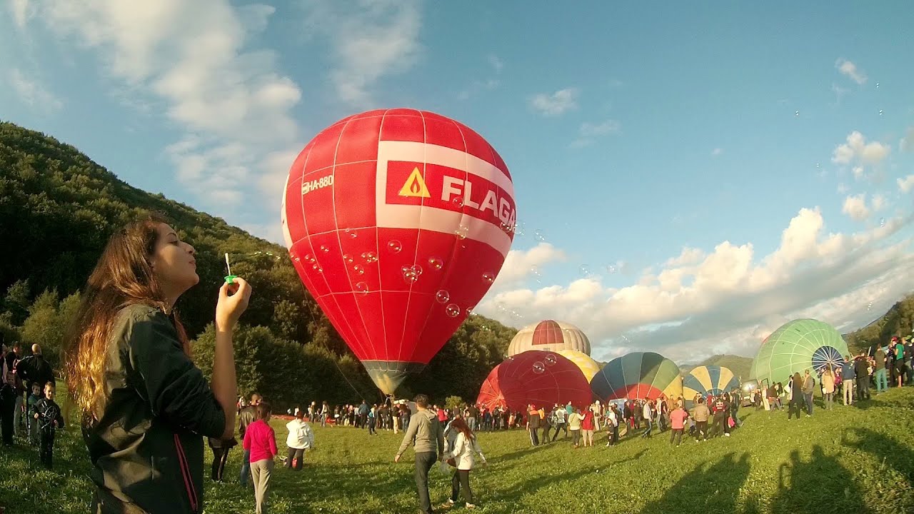
Hot air balloon parade 2015 Campu Cetatii 109.6 km away. This year, the Hot Air Balloon Parade was organized in Campu Cetatii for the tenth time. Unfortunately, the weather only allowed for flying on Saturday morning and evening.
Amazing Bridges Zabardo 434.5 km away. The Amazing Bridges (Chudni Mostove, Wonderful Bridges) are natural stone bridges. They are located in the Rhodope Mountains, in the Smolyan Province of Bulgaria, within the valley of the Erkyupriya River, at an altitude of 1,450 meters above sea level.
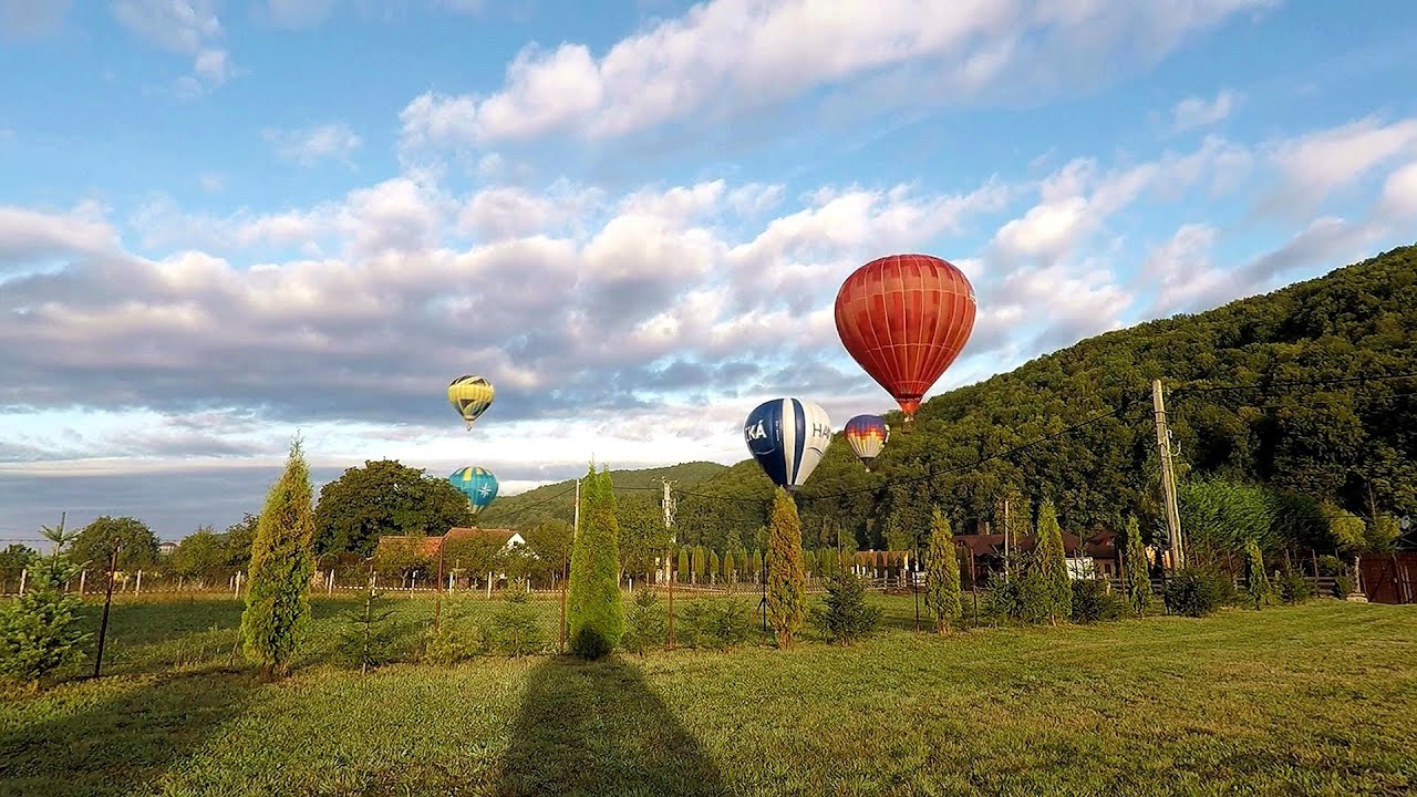
Hot Air Balloon Parade 2018 Campu Cetatii 109.6 km away. This year, the hot air balloons flew low over Campu Cetatii. The weather did not really favor the parade.

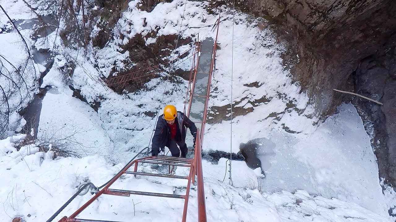
Iron path Harghita-Madaras 111.1 km away. Amateur filming in Harghita-Madaras, holding the camera by hand in the car, and helmet-mounted on the via ferrata. I climbed an iron path for the first time in my life on the Nyerges cliffs (Stancile Seii), I didn't have the right equipment yet.
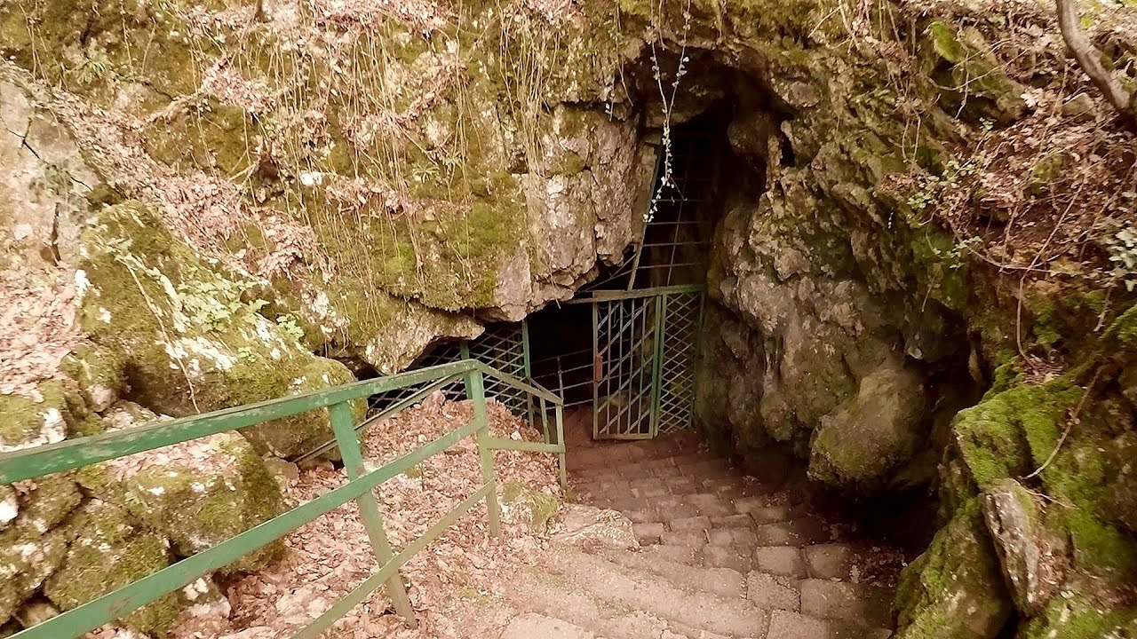
Saeva Dupka cave Brestnitsa 299.6 km away. The Saeva Dupka Cave is located 2 km south of the village of Brestnitsa. In its five chambers and 400 meters of passageways, you can see the most beautiful cave formations in Bulgaria.

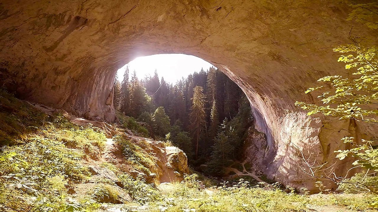
Vadu Crisului cave 209.9 km away. The Vadu Crisului Cave, with a total length of over 1000 meters, is located in the picturesque gorge of Crisul Repede creek. It consists of a gently meandering, long passage that features an active, stream level next to an upper, fossil level in its first section.
Great Canyon cave Peja 487.4 km away. Gryka e Madhe (Great Canyon) cave - Peja.

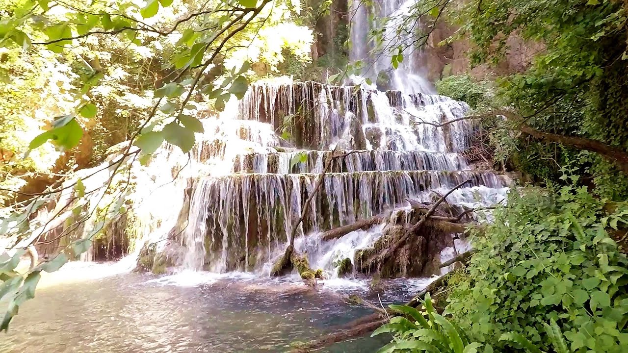
Krushuna waterfalls Krushuna 278.4 km away. The Krushuna Waterfalls are a series of karst cascades formed in travertine. They are located near the village of Krushuna, not far from the town of Lovech, and are Bulgaria's largest waterfall of this type.
[ Top ↑ ]
Copyright © 2003-2026 Trekkingklub and friends. Reproduction of any text, picture or video from this website, either in printed or electronic form, is prohibited without prior written permission. Website made with love  in Miercurea Ciuc.