Northern ridge - Piatra Craiului | Photos


Page no. 1, photos: 1-6, 11 photos in total. >>>

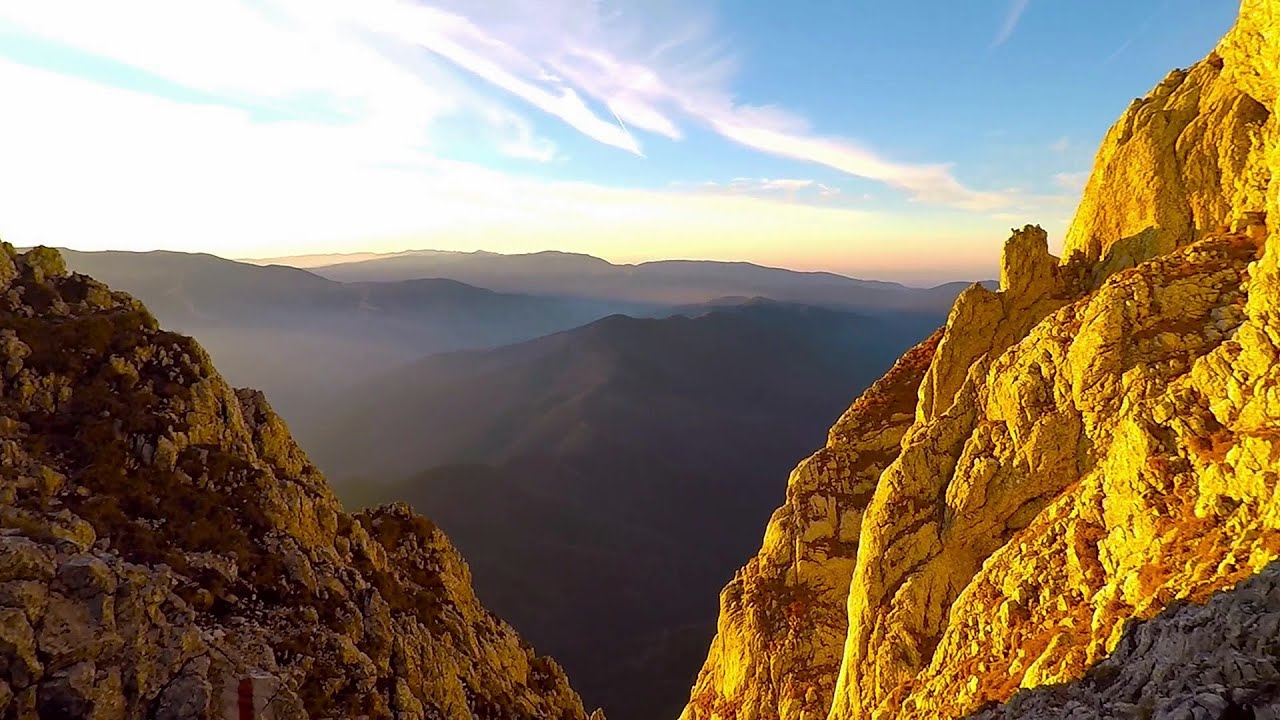
Northern ridge - Piatra Craiului Mountains (King Rock).
Copyright © 2003 - 2026 Trekkingklub.com. Please register for full and ad-free access.
Airport nearby: Ghimbav International Airport (GHV - Brașov (Ghimbav), Ro), 29 km away.
Photos of nearby places

Border Ravine Valley, Northern ridge (53 photos) 0 km away. Border Ravine Valley (Padina Hotarului), Northern ridge - Piatra Craiului Mountains (King Rock).

Middle Belt Trail - Piatra Craiului Mountains (114 photos) 0.9 km away. Ravine valley of Calinet (Padina lui Calinet) - Thermopylae - Anghelide's canyon, Piatra Craiului Mountains (King Rock).

The Cats Gorge - Curmatura Cabin (20 photos) 2.3 km away. The Cat's Gorge - Valley of the Gorge Stream - Curmatura Cabin - Rift Saddle.

Tower of King Rock - Piatra Craiului Mountains (15 photos) 2.4 km away. Border Ravine Valley (Padina Hotarului), Turm des Königstein (Turnul Pietrei Craiului).

Deubels path - Piatra Craiului Mountains (36 photos) 2.7 km away. Plaiul Foii - Deubel cavities (La Zaplaz) - Grind saddle. Deubel's path - Piatra Craiului Mountains (King Rock).

Little King Rock - Piatra Craiului Mountains (14 photos) 3.1 km away. Little King Rock (Piatra Mica) - Piatra Craiului Mountains (King Rock).

The shoulder of Piatra Craiului Mountains (36 photos) 3.4 km away. The shoulder of Piatra Craiului Mountains (King Rock's Shoulder).

Southern ridge - Piatra Craiului Mountains (42 photos) 3.7 km away. Southern ridge - Piatra Craiului Mountains (King Rock).

Zarnesti precipice - Piatra Craiului Mountains (16 photos) 4.4 km away. Zarnesti precipice (Prapastiile Zarnestilor) - Piatra Craiului Mountains (King Rock).

Zarnesti Gorge - Piatra Craiului Mountains (6 photos) 4.4 km away. Zarnesti Gorge (Prapastiile Zarnestilor) - Piatra Craiului Mountains.

Cave of Stanciu - Piatra Craiului Mountains (10 photos) 4.8 km away. Cave of Stanciu (Pestera Stanciului) - Piatra Craiului Mountains (King Rock).

Stanciu rock porch - Piatra Craiului Mountains (18 photos) 4.9 km away. Stancius rock porch (Ceardacul Stanciului) - Piatra Craiului Mountains (King Rock).
[ Top ↑ ]
Videos of nearby places
Deubels path - Piatra Craiului Mountains 2.7 km away. Deubels path - Piatra Craiului Mountains (Kings Rock).

Dino Parc Rasnov 19.9 km away. On June 12, 2015, one of the largest dinosaur theme parks in the region opened in Rasnov, where we can see 45 life-sized dinosaurs. The facility is located directly next to the Rasnov Fortress, which is one of the best-preserved Transylvanian Saxon peasant fortresses.

Small Via ferrata - Rasnoavei Gorge 22.6 km away. In the past few days, it has snowed, so I climbed the two climbing routes in the Rasnoavei Gorge under winter conditions. While the lower part of the challenging Big via ferrata was dry, the upper section had patches of snow and icicles.

Big Via ferrata Rasnoavei Gorge 22.7 km away. The most dangerous Eastern European iron path, and also one of the most beautiful via ferrata routes in Romania, is in the Rasnoavei Gorges, Postavaru Mountains.The route is 450 m long, with a level difference of 220 m.

Ski resort - Poiana Brasov - Postavarul Mountains 25.7 km away. Shining sun and an Austria-feeling on the impeccable slopes of the ski paradise Poiana Brasov above Brasov. Sunbathing, coffee and refreshing drinks on the terrace of Julius Römer chalet.
Other places
Buzludzha monument Kazanluk 312.5 km away. Buzludzha is a historically significant mountain located in the Central Balkan Mountains of Bulgaria. At its summit, at an altitude of 1432 meters above sea level, there is an abandoned monument.
Wild Ferenc iron path Suhardul Mic 146.2 km away. While I climbed the new iron path mostly in the dark for the first time, this time I managed to explore it during the day. But I still missed the sunset by a few minutes.
Falco Tinnunculus via ferrata, the ascent Falcons Rock, Corbu 168.1 km away. Falco Tinnunculus (Common kestrel) via ferrata (E), the ascent - Falcon's Rock, Corbu. Over Corbu village in Harghita County, on the rocks of Falcon's Rock (Piatra Soimilor), which belong to the Bistrita Mountains, five via ferrata routes have been established.
Poienii Rock, north-eastern lookout point Bicaz Gorge 148.1 km away. From the viewpoint at the top of the northeastern wall of Poienii Rock in the Bicaz Gorges, we can look down 300 meters to the mouth of the Bicajel stream. The Bridge of the Hungarians is hidden among pine trees.
Kaya Bunar Hotnitsa 267.6 km away. The Kaya Bunar Waterfall (Hotnishki Vodopadi, Hotnitsa Waterfall) is located 20 km from the city of Veliko Tarnovo in Bulgaria. The waterfall is 30 meters high, and there are several smaller cascades above it.
Astragalus iron path in winter Glod Stone, Munticelu 150.5 km away. The official website of the Sugau Gorge published information about a new via ferrata climbing route named Astragalus. Sugau Gorges - Munticelu is a nature conservation area part of Natura 2000 located in Neamt County, which borders Harghita County.
The Stone Wedding Zimzelen, Kardzhali 432.5 km away. The Stone Wedding (Kamenna Svatba, Petrified Wedding, Kardzhali Pyramids) is located near the village of Zimzelen, close to the city of Kardzhali, in the eastern part of the Rhodope Mountains in Bulgaria. This spectacular natural formation was declared a natural monument in 1974.
Stone Beach Sinemorets 450.5 km away. Stone Beach (Kamenniat plazh) - Sinemorets.
Piticot iron path for children Suncuius 258 km away.
Prohodna cave Karlukovo 278.9 km away. The Prohodna cave nicknamed The Eyes of God is located in Bulgaria, in the Iskar Gorge, on one of the largest karst areas in Bulgaria, 2 km from the town of Karlukovo. It is essentially a 262-meter-long natural stone bridge, with a large (45 m high) and a small (35 m high) entrance.
Lonely Stone Hasmas Mountains 135 km away. On June 1, 2003, with a small group of friends, I left Balan, walking along the valley of the Sep (Beautiful) stream towards the Lonely Stone (Piatra Singuratica). Those who were with me at the time fell behind, and then other people joined for the hike.
Bovska Skaklya waterfall Iskar gorge 317.1 km away. The Bovska Skaklya waterfall is located near the town of Svoge in Bulgaria. The waterfall formed on the Zaselska River has several reported heights online (120 m, 85 m).
Turcinovac via ferrata and cave Ovcar Banja 437 km away. Difficulty level B, total length: 60 m, height difference: 45 m, year of construction: 2010. Climbing the via ferrata is only permitted with the approval of the Extreme Sports Club Armadillo from Cacak, and there is a fee for it.
Oltet Gorge Capatana Mountains 119.2 km away. Oltet Gorge (Cheile Oltetului) - Capatana Mountains. That day, we had planned to ski at the Ranca resort, situated alongside the Transalpina high altitude mountain road in the Parang Mountains.
Virus and Antivirus iron paths Baia de Fier 121.4 km away. With Virus (B/C) and Antivirus (C), the number of via ferrata routes at Baia de Fier has increased to thirteen. In fact, it is a Y-shaped route that starts near the entrance of the Laura via ferrata, and the exits are located just a few meters from the Laura exit.
[ Top ↑ ]
Copyright © 2003-2026 Trekkingklub and friends. Reproduction of any text, picture or video from this website, either in printed or electronic form, is prohibited without prior written permission.
The given distances are to be understood as straight line distances, and are approximate. Website made in Miercurea Ciuc  .
.