The shoulder of Piatra Craiului Mountains | Photos


Page no. 1, photos: 1-6, 36 photos in total. >>>

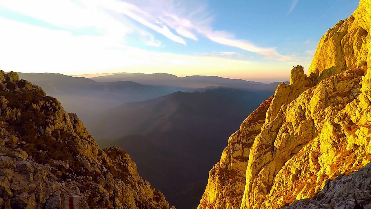
The shoulder of Piatra Craiului Mountains (King Rock's Shoulder).
Copyright © 2005 - 2026 Trekkingklub.com. Please register for full and ad-free access.
Airport nearby: Ghimbav International Airport (GHV - Brașov (Ghimbav), Ro), 33 km away.
Photos of nearby places

Southern ridge - Piatra Craiului Mountains (42 photos) 0.7 km away. Southern ridge - Piatra Craiului Mountains (King Rock).

Deubels path - Piatra Craiului Mountains (36 photos) 0.8 km away. Plaiul Foii - Deubel cavities (La Zaplaz) - Grind saddle. Deubel's path - Piatra Craiului Mountains (King Rock).

Cave of Stanciu - Piatra Craiului Mountains (10 photos) 1.5 km away. Cave of Stanciu (Pestera Stanciului) - Piatra Craiului Mountains (King Rock).

Stanciu rock porch - Piatra Craiului Mountains (18 photos) 1.6 km away. Stancius rock porch (Ceardacul Stanciului) - Piatra Craiului Mountains (King Rock).

Middle Belt Trail - Piatra Craiului Mountains (114 photos) 2.8 km away. Ravine valley of Calinet (Padina lui Calinet) - Thermopylae - Anghelide's canyon, Piatra Craiului Mountains (King Rock).

Border Ravine Valley, Northern ridge (53 photos) 3.4 km away. Border Ravine Valley (Padina Hotarului), Northern ridge - Piatra Craiului Mountains (King Rock).

Northern ridge - Piatra Craiului (11 photos) 3.4 km away. Northern ridge - Piatra Craiului Mountains (King Rock).

The Cats Gorge - Curmatura Cabin (20 photos) 5.6 km away. The Cat's Gorge - Valley of the Gorge Stream - Curmatura Cabin - Rift Saddle.

Tower of King Rock - Piatra Craiului Mountains (15 photos) 5.8 km away. Border Ravine Valley (Padina Hotarului), Turm des Königstein (Turnul Pietrei Craiului).

Zarnesti precipice - Piatra Craiului Mountains (16 photos) 6 km away. Zarnesti precipice (Prapastiile Zarnestilor) - Piatra Craiului Mountains (King Rock).

Zarnesti Gorge - Piatra Craiului Mountains (6 photos) 6 km away. Zarnesti Gorge (Prapastiile Zarnestilor) - Piatra Craiului Mountains.

Little King Rock - Piatra Craiului Mountains (14 photos) 6.3 km away. Little King Rock (Piatra Mica) - Piatra Craiului Mountains (King Rock).
[ Top ↑ ]
Videos of nearby places
Deubels path - Piatra Craiului Mountains 0.8 km away. Deubels path - Piatra Craiului Mountains (Kings Rock).

Dino Parc Rasnov 22.9 km away. On June 12, 2015, one of the largest dinosaur theme parks in the region opened in Rasnov, where we can see 45 life-sized dinosaurs. The facility is located directly next to the Rasnov Fortress, which is one of the best-preserved Transylvanian Saxon peasant fortresses.

Small Via ferrata - Rasnoavei Gorge 25.1 km away. In the past few days, it has snowed, so I climbed the two climbing routes in the Rasnoavei Gorge under winter conditions. While the lower part of the challenging Big via ferrata was dry, the upper section had patches of snow and icicles.

Big Via ferrata Rasnoavei Gorge 25.1 km away. The most dangerous Eastern European iron path, and also one of the most beautiful via ferrata routes in Romania, is in the Rasnoavei Gorges, Postavaru Mountains.The route is 450 m long, with a level difference of 220 m.
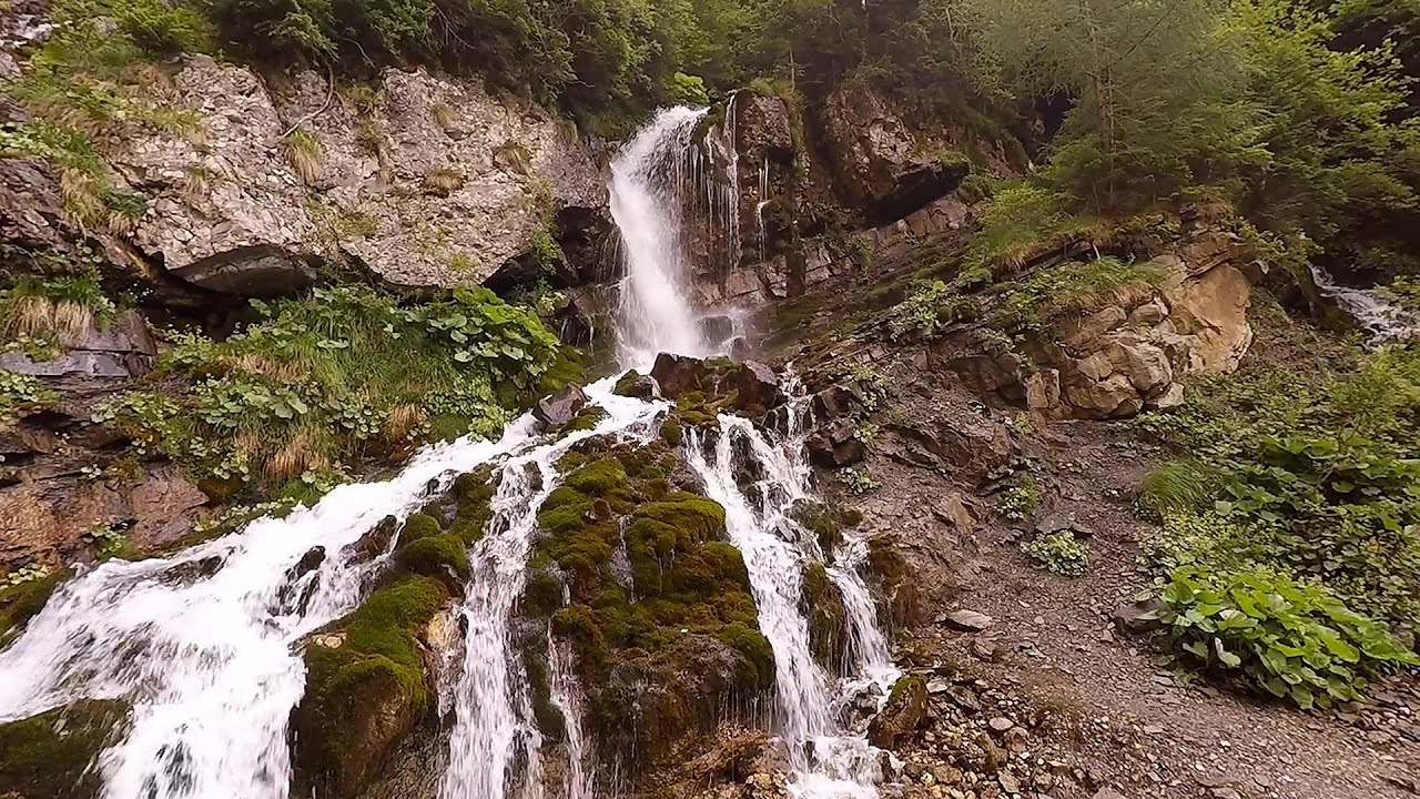
Foamy valley waterfall - Bucegi Mountains 27.4 km away. Access to the Foamy valley waterfall (Cascada Valea Spumoasa) is made from the town of Busteni. The starting point is the lower station of the cable car that ascends to the Babele cabin.
Other places
Crivadia Gorge 155.1 km away. The Crivadia Gorge is located next to the village of Crivadia, which belongs to Banita. Access is difficult, and the hike is made through the streambed, with water up to the waist at its narrowest point.
Boli Cave Banita 146.6 km away. The Boli Cave is located 6 km north of Petrosani, on the road that connects Hateg with the Jiu Valley. Here, the railway line that connects the two parts of Hunedoara County passes through, featuring a total of 66 curves and 8 tunnels.
Kossuth Rock Harghita Bath 102.5 km away. Kossuth Rock - Harghita Bath (Harghita-Bai), Harghita Mountains.
Dóczi stone-quarry Jigodin 102.6 km away.
Bovska Skaklya waterfall Iskar gorge 313.7 km away. The Bovska Skaklya waterfall is located near the town of Svoge in Bulgaria. The waterfall formed on the Zaselska River has several reported heights online (120 m, 85 m).
Goats Ledge iron path Ramet Gorge 159.8 km away. Via ferrata Goats Ledge (Brana Caprei) iron path - Ramet Gorge, Trascau Mountains.
Vulva cave Rhodope Mountains 424.3 km away. The Vulva Cave (Peshtera Utroba) is situated near the village of Nenkovo and the city of Kardzhali, in the Rhodope Mountains of Bulgaria. It derives its name from the shape of its entrance, which resembles a vulva.
Devils Bridge Ardino 433.7 km away. The Devil's Bridge (Dyavolski Most, in Turkish Sheytan Kyupriya) is located in the gorge of the Arda River, just north of the town of Ardino in Bulgaria. It was constructed in the early 16th century, between 1515 and 1518, by an architect named Dimitar, on the remains of an earlier Roman bridge.
Mucanj via ferrata and the Boze Javorca cave Ravna Gora 463.8 km away. Difficulty level C/D, total length: 500 m, height difference: 200 m, year of construction: 2022. The via ferrata is free to climb.
Lonely Stone Hasmas Mountains 138.2 km away. On June 1, 2003, with a small group of friends, I left Balan, walking along the valley of the Sep (Beautiful) stream towards the Lonely Stone (Piatra Singuratica). Those who were with me at the time fell behind, and then other people joined for the hike.
Sugau Stone lookout point and iron path, Sugau Gorge Munticelu 153.7 km away. Sugau Stone lookout point and iron path (B/C), Sugau Gorge - Munticelu Nature Reserve.
Belogradchik fortress 290.4 km away. Belogradchik is located in the northwestern part of Bulgaria, in the Vidin Province, at the foot of the Balkan Mountains, near the Serbian border. Its name means little white town.
Lednica iron path Brestnitsa 286.7 km away. The Lednica via ferrata is located next to the Saeva Dupka Cave, near the village of Brestnitsa in Bulgaria. The trail leading to the via ferrata, which opened in 2007, starts from the cave parking lot next to a covered resting area.
Prohodna cave Karlukovo 275.7 km away. The Prohodna cave nicknamed The Eyes of God is located in Bulgaria, in the Iskar Gorge, on one of the largest karst areas in Bulgaria, 2 km from the town of Karlukovo. It is essentially a 262-meter-long natural stone bridge, with a large (45 m high) and a small (35 m high) entrance.
Devils Mill Gorge Campulung Moldovenesc 219.6 km away. The Devil's Mill Gorge is relatively short, measuring only 60 to 70 meters in length. It was formed in yellowish-gray-white dolomite by the work of a stream that crosses the gorge, as a result of erosion and the dissolution characteristic of limestone.
[ Top ↑ ]
Copyright © 2003-2026 Trekkingklub and friends. Reproduction of any text, picture or video from this website, either in printed or electronic form, is prohibited without prior written permission.
The given distances are to be understood as straight line distances, and are approximate. Website made in Miercurea Ciuc  .
.