Tourist attractions near Jiet (Petrila, Hunedoara county, Romania)
Photos of nearby places

Boli Cave - Banita (20 photos) 9.1 km away. The main cave passage is approximately 460 m long, with an entrance portal that is 10 m high and 20 m wide at its base. In the 1960s, bridges were built over the underground stream flowing through the cave.

Banita Gorge - Banita (16 photos) 9.5 km away. The approximately 250 m long gorge, similar to the Corcoaia Gorge, is truly spectacular. According to assumptions, it was formed by the collapse of a cave passage ceiling, and then the erosion formed spectacular karst formations in the limestone.

Parangul Mare peak (16 photos) 13 km away. Chamois saddle (Saua Caprelor), Carja mountain shelter (Refugiul Carja) - Carja peak (Varful Carja) - Stoienita peak (Varful Stoienita) - Gemanarea - Parangul Mare peak.

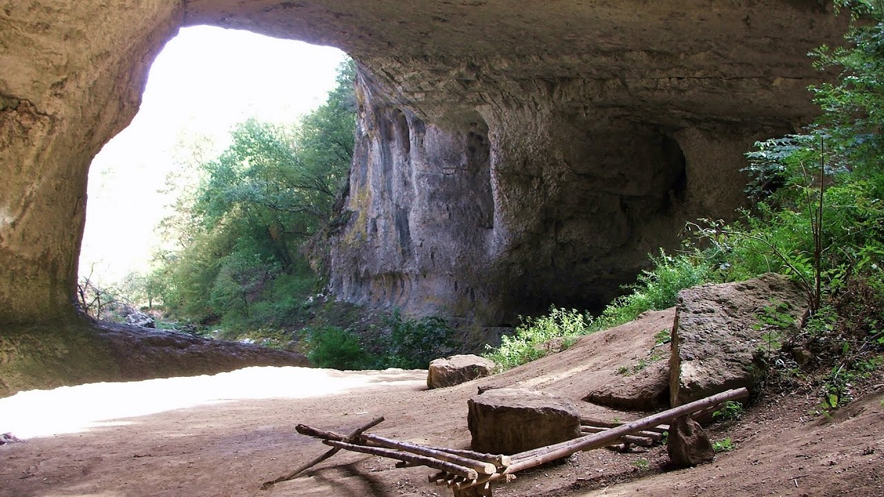
Natural bridge next to the Banita Stone Quarry (12 photos) 13.1 km away. Although the Banita Stone Bridge is not far from the road that passes through the village, it is located beyond the railway line, so its approach is a bit cumbersome. We can go around the railway line on Carierei Street, and then we have to walk a few meters from the stone quarry.

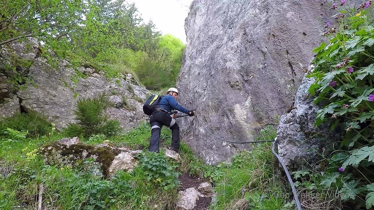
Womens Cave - Parang Mountains (11 photos) 36.5 km away. The Cave of Women (Pestera Muierii, Pestera Muierilor) is located at the southern foot of the Parang Mountains, in the area of Baia de Fier in Gorj County. There are several climbing routes established on the rocks above the cave and on the other side of the road.

Ledge path of the chamois - Cheii Gorge (40 photos) 57 km away. Ledge path of the chamois (Brana Caprelor) - Cheii Gorge (Cheile Cheii).

Doabra Snail Shells - Brezoi (12 photos) 64.2 km away. Doabra Valley - Calinesti-Brezoi forest - Lotru Valley, Cozia National Park

Circular hiking tour in Cozia Mountain (48 photos) 71.8 km away. Arutela - Turnu monastery - Rosiei Rocks - Turneanu ridge - Cozia peak - Stone portal - Stanisoara monastery - Gardului waterfall.


Goat Stone - Craiva, Trascau Mountains (18 photos) 87.2 km away. Goat Stone (Piatra Craivii, Piatra Craivei, Apulon) - Craiva, Trascau Mountains.

Stone of Cetea, Horse Pit - Trascau (16 photos) 93.3 km away. Stone of Cetea, Horse Pit (The pit cave from the Stone of Cetea) - Trascau Mountains.

Chamois saddle - Fagaras Mountains (12 photos) 95.4 km away. Chamois saddle (Saua Caprei) - Fagaras Mountains.

Goats Ledge - Trascau Mountains (10 photos) 96.9 km away. Goats Ledge (Brana Caprei, Kecskék párkánya) - Trascau Mountains .

Dark Blue Bruises of the Ponor - Trascau Mountains (16 photos) 104.9 km away. The Dark Blue Bruises of the Ponor (Vanatarile Ponorului) is a polje-type protected area. Polje is a Slovenian word meaning plain, and it refers to a surface karst form.

Dark Blue Bruises of the Ponor, Bedeleu (24 photos) 107.8 km away. Dark Blue Bruises of the Ponor (Vanatarile Ponorului), Bedeleu - Trascau Mountains.

Balcony Clearing - Trascau Mountains (6 photos) 108.8 km away. Balcony Clearing (Erkély-tisztás, Balconul Sipotelor) - Trascau Mountains.

Aries valley - Trascau Mountains (10 photos) 109.7 km away. Aries (Golden) valley - Trascau Mountains.

Szekler Stone North - Trascau Mountains (8 photos) 114 km away. Szekler Stone North (Piatra Secuilor Nord) - Trascau Mountains.

Szekler Stone - Trascau Mountains (42 photos) 114 km away. Szekler Stone (Székely-kő, Piatra Secuilor) - Trascau Mountains.


Turda Gorge via ferrata (24 photos) 128 km away. Turda Gorge iron path (Via ferrata Cheile Turzii) - Trascau Mountains.

Turda Gorge - Trascau Mountains (9 photos) 128.1 km away. Turda Gorge (Cheile Turzii) - Trascau Mountains.
[ Top ↑ ]
Videos of nearby places
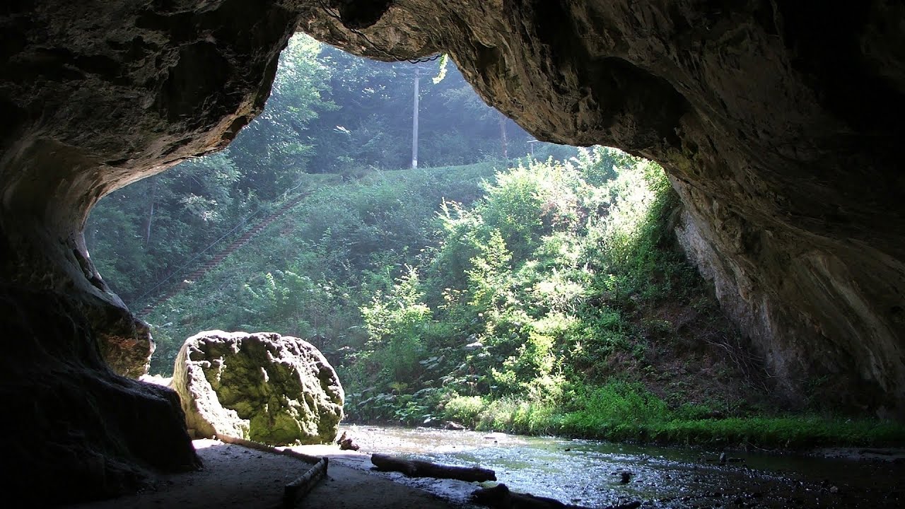
Boli Cave - Banita 9.1 km away. The Boli Cave is located 6 km north of Petrosani, on the road that connects Hateg with the Jiu Valley. Here, the railway line that connects the two parts of Hunedoara County passes through, featuring a total of 66 curves and 8 tunnels.

Banita Gorge and Banita rock bridge 9.5 km away. They say about this place that only very few people know about it, but that's not true. In fact, most nature lovers have heard of it, seen pictures taken here, even if not everyone has been able to come here.

Crivadia Gorge 17.6 km away. The Crivadia Gorge is located next to the village of Crivadia, which belongs to Banita. Access is difficult, and the hike is made through the streambed, with water up to the waist at its narrowest point.

The palm of God and the Heavens door - Fundatura Ponorului mountain village 24.4 km away. One of the most picturesque places in Romania, one of the most beautiful mountain villages, and a photographer's paradise. Fundatura Ponorului is located in the Ponor Stream Valley, part of the Gradistea Muncelului - Cioclovina National Park, in the Sureanu Mountains.
Other places

Huda lui Papara cave Salciua de Jos 106.1 km away. Huda lui Papara cave (Paparas Hole) - Salciua de Jos, Trascau Mountains.
Via ferrata Marimangat Peja 400.1 km away.
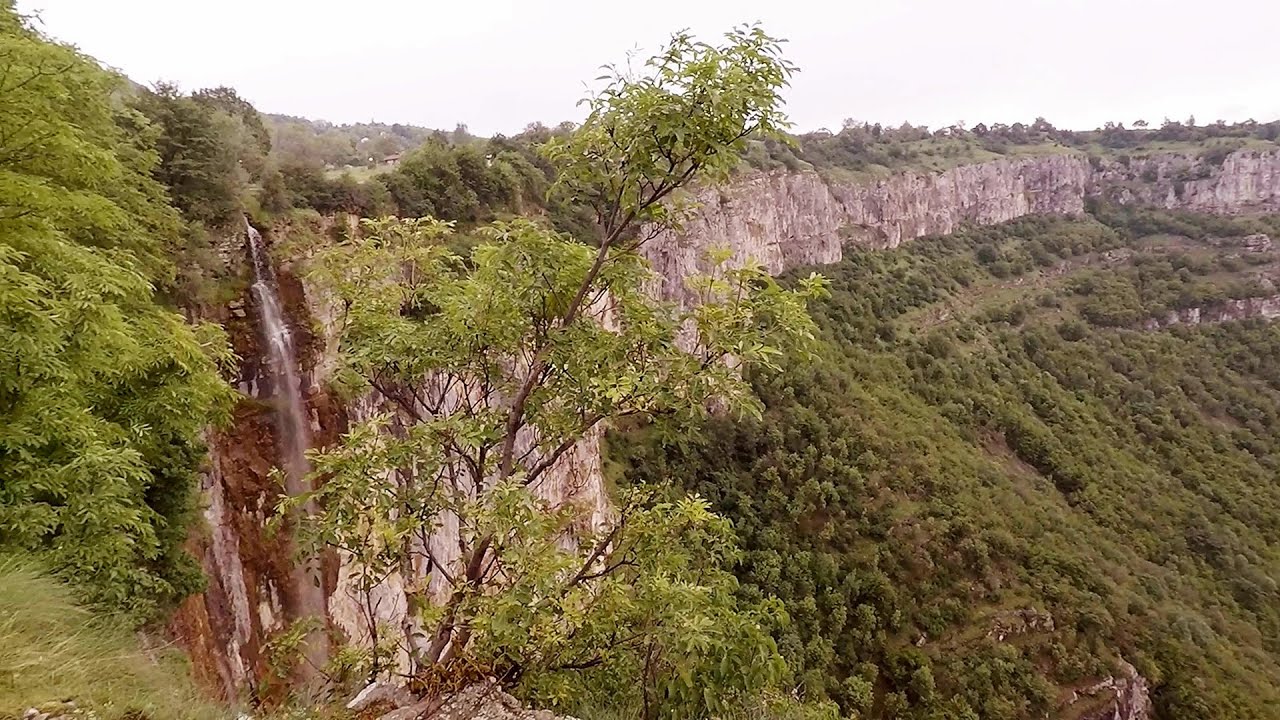
Bovska Skaklya waterfall Iskar gorge 266 km away. The Bovska Skaklya waterfall is located near the town of Svoge in Bulgaria. The waterfall formed on the Zaselska River has several reported heights online (120 m, 85 m).
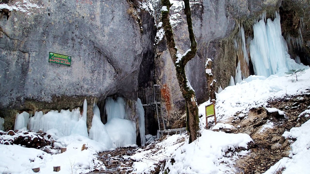
Seven Ladder Canyon in Winter Piatra Mare Mountain 173.3 km away. Seven Ladder Canyon and Waterfall in Winter - Piatra Mare Mountain
Wild Ferenc memorial path Suhardul Mic 237.7 km away. In recent days, this news has been everywhere: the via ferrata route built on the southwest wall of Suhardul Mic (Little Suhard) has finally been completed and inaugurated. The new route has been named after Ferenc Wild, in memory of the former mountain rescuer, sports writer, and one of the founders of the mountain rescue association in Gheorgheni.
Sugau Stone lookout point and iron path, Sugau Gorge Munticelu 242.9 km away. Sugau Stone lookout point and iron path (B/C), Sugau Gorge - Munticelu Nature Reserve.
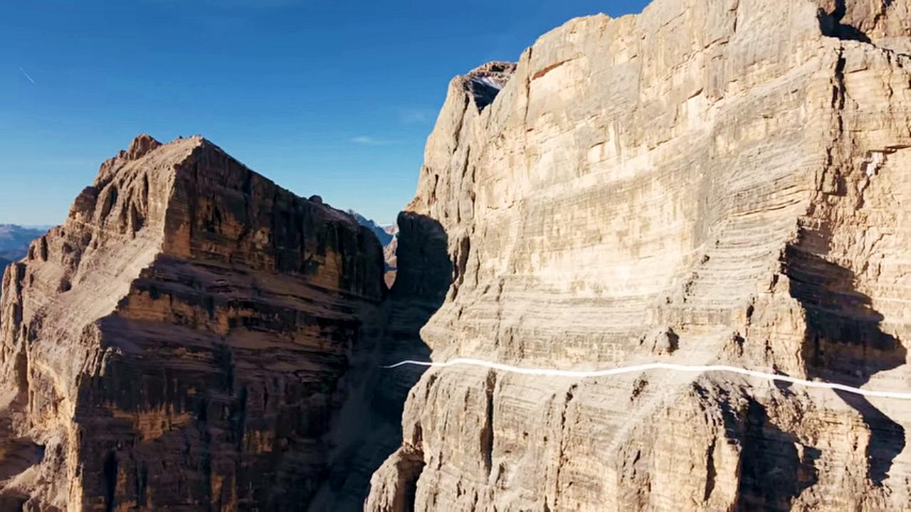
The Crack Grohmanns Ledge Monte Pelmo Monte Pelmo is nicknamed God's Armchair because its shape resembles a huge armchair. Between Monte Pelmo and Monte Pelmetto is The Crack (La Fessura).
Gods bridge Vratsa 235 km away. Anyone who has been to Bulgaria may be familiar with the Prohodna Cave, affectionately known as the Eyes of God; the Devetashka Cave, illuminated by seven windows in its ceiling. And perhaps they have also seen the Wonderful Bridges in the Rhodope Mountains.
Abandoned Sports Hall Varna 436.1 km away. An abandoned sports hall in Varna, with an unfinished dormitory and tennis courts across three levels.
Other destinations
Gornjak via ferrata and Kudelinovs fortress Zdrelo 197.2 km away. Difficulty level C/D, total length: 400 m, height difference: 330 m, year of construction: 2019, total length of the route to Kudelinov's fortress: 1100 m. Access to the via ferrata is free.
[ Top ↑ ]
Copyright © 2003-2026 Trekkingklub and friends. Reproduction of any text, picture or video from this website, either in printed or electronic form, is prohibited without prior written permission. Website made with love  in Miercurea Ciuc.