Tourist attractions near Sinaia (Sinaia, Prahova county, Romania)
Photos of nearby places

Saint Annes Rock - Bucegi Mountains (24 photos) 2.4 km away. Saint Annes Rock (Stanca Sfanta Ana) - Bucegi Mountains.

Zgarbura Valley, Vanturis waterfalls - Bucegi (18 photos) 4.6 km away. Shoe Valley (Zgarbura Valley, Valea Zgarburei), Vanturis waterfalls - Bucegi Mountains.

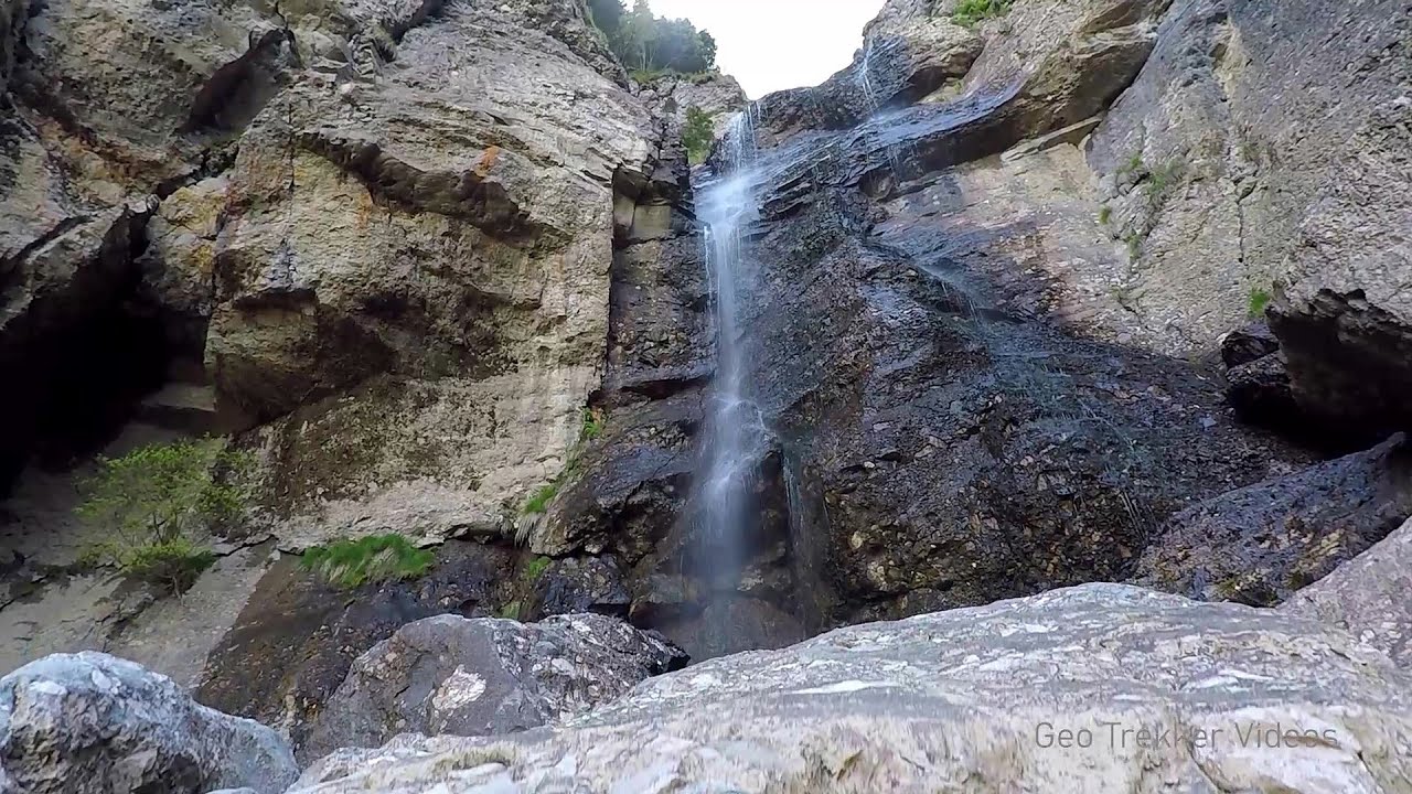
Peak of Longing - Waterfalls of the Vanturis stream (36 photos) 5.7 km away. Peak of Longing (Varful cu Dor) - Waterfalls of the Vanturis stream (Cascadele Vanturisului).

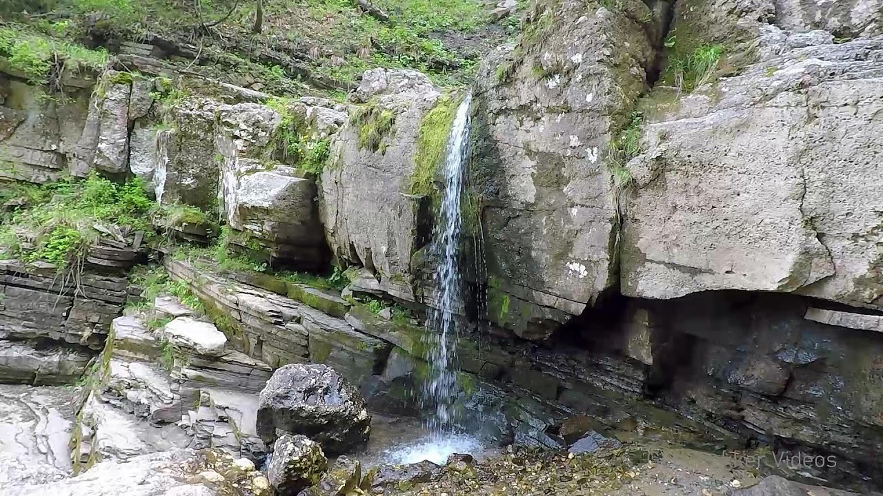
Urlatoarea waterfall - Bucegi Mountains (8 photos) 5.9 km away. Urlatoarea waterfall (Cascada Urlatoarea) - Bucegi Mountains.

Valley of mountain pines - Bucegi (12 photos) 8.1 km away. Valley of mountain pines (Valea Jepilor) - Bucegi Mountains.

Costila Peak, Caraiman Mountain - Bucegi (18 photos) 8.5 km away. Costila Peak, Caraiman Mountain - Bucegi Mountains.


Cave of Ialomita river - Bucegi Mountains (17 photos) 10.1 km away. Cave of Ialomita river (Pestera Ialomitei) - Bucegi Mountains.

Ladies Valley - Bucegi Mountains (12 photos) 10.4 km away. Ladies Valley (Valea Doamnele) - Bucegi Mountains.

Valley of the Slim Figures - Bucegi Mountains (5 photos) 10.6 km away. Valley of the Slim Figures (Valea Sugarilor) - Bucegi Mountains.

The source region of the Jalomita River - Bucegi Mountains (14 photos) 12.6 km away. The source region of the Jalomita River (Obarsia Ialomitei) - Bucegi Mountains.

Turkish Mosque Rock - Bucegi Mountains (6 photos) 12.7 km away. Turkish Mosque Rock (Mecetul Turcesc) - Bucegi Mountains.

Omu Peak, chamois - Bucegi Mountains (18 photos) 13 km away. Omu Peak (Varful Omu), chamois - Bucegi Mountains.

Great Bucsoi Mountain, Omu Peak - Bucegi (24 photos) 13.7 km away. Great Bucsoi Mountain (Bucsoiul Mare), Omu Peak (Varful Omu) - Bucegi Mountains.

Ciubotea-Scara - Bucegi Mountains (24 photos) 14.3 km away. Ciubotea clearing - Scara peak - Omu peak - Gaura sheepfold.

Piatra Mare peak and surroundings (24 photos) 24 km away. Piatra Mare hut - Piatra Mare peak - Stone Mushrooms - Stone Barn.

Seven Ladder Waterfall - Piatra Mare Mountains (12 photos) 25.4 km away. The Seven Ladders are located in the middle-western part of the Piatra Mare Mountains, at an average altitude of 980 m, not far away from Valea Timisului (Dambu Morii), on the Seven Ladders River, the left-side affluent of Sipoaia creek. These are the greatest and the most spectacular gorges of the whole Piatra Mare Mountains.

Zarnesti precipice - Piatra Craiului Mountains (16 photos) 28.9 km away. Zarnesti precipice (Prapastiile Zarnestilor) - Piatra Craiului Mountains (King Rock).

Zarnesti Gorge - Piatra Craiului Mountains (6 photos) 28.9 km away. Zarnesti Gorge (Prapastiile Zarnestilor) - Piatra Craiului Mountains.


Little King Rock - Piatra Craiului Mountains (14 photos) 31.6 km away. Little King Rock (Piatra Mica) - Piatra Craiului Mountains (King Rock).

The Cats Gorge - Curmatura Cabin (20 photos) 32.1 km away. The Cat's Gorge - Valley of the Gorge Stream - Curmatura Cabin - Rift Saddle.
[ Top ↑ ]
Videos of nearby places
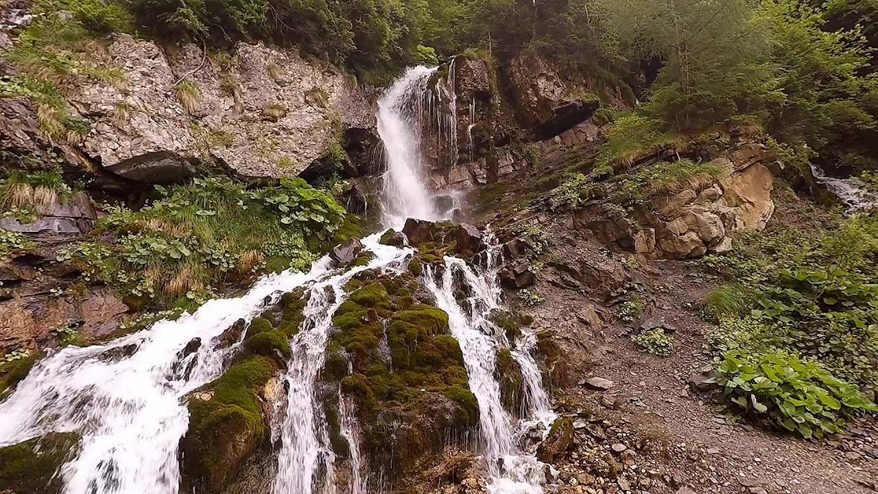
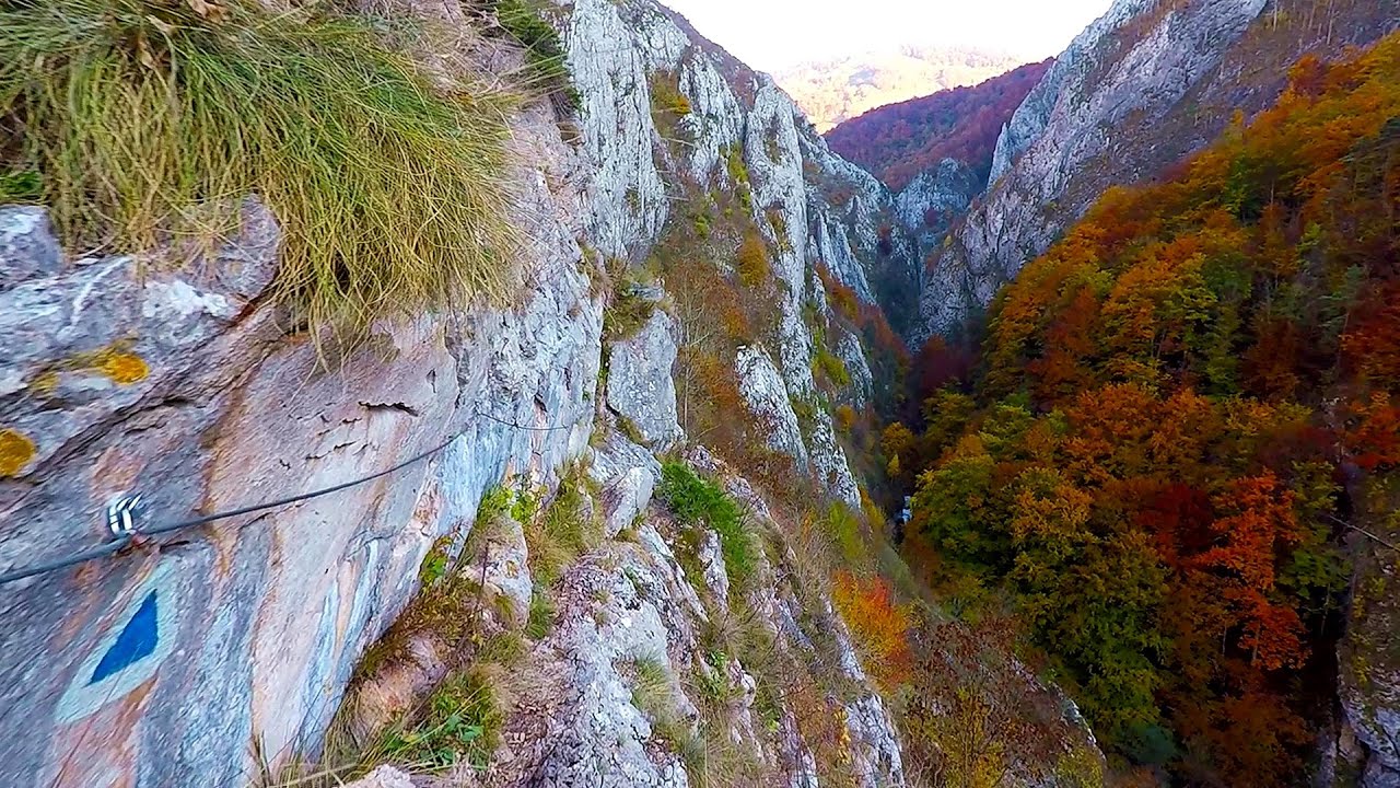
Downstream of the Izvorul Dorului creek - Vanturis waterfalls 4.6 km away. Downstream of the Izvorul Dorului (Source of longing) creek - Vanturis waterfalls, Bucegi Mountains.
Upstream of the Izvorul Dorului creek - Vanturis waterfalls 5.5 km away. Upstream of the Izvorul Dorului (Source of longing) creek - Vanturis waterfalls, Bucegi Mountains.
Foamy valley waterfall - Bucegi Mountains 7.3 km away. Access to the Foamy valley waterfall (Cascada Valea Spumoasa) is made from the town of Busteni. The starting point is the lower station of the cable car that ascends to the Babele cabin.

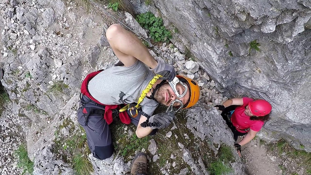
Big Via ferrata Rasnoavei Gorge 22.1 km away. The most dangerous Eastern European iron path, and also one of the most beautiful via ferrata routes in Romania, is in the Rasnoavei Gorges, Postavaru Mountains.The route is 450 m long, with a level difference of 220 m.

Small Via ferrata - Rasnoavei Gorge 22.1 km away. In the past few days, it has snowed, so I climbed the two climbing routes in the Rasnoavei Gorge under winter conditions. While the lower part of the challenging Big via ferrata was dry, the upper section had patches of snow and icicles.
Other places
Tesárska Gorge Tesárska gorge (Tesárska roklina) - Hontianske Tesáre.

Womens Spiral via ferrata, climbing fun Baia de Fier 141.5 km away. The Women's Spiral (Spirala Muierilor) via ferrata is set up on the rock that conceals the Women's Cave (Pestera Muierii). It is one of the seven routes near Baia de Fier as of now (2018).
Goats Ledge iron path Ramet Gorge 193.2 km away. Via ferrata Goats Ledge (Brana Caprei) iron path - Ramet Gorge, Trascau Mountains.
Silberkar Gorge Ramsau am Dachstein One of the most beautiful hiking spots in the area of Ramsau am Dachstein, is the Silberkarklamm (Silberkar Gorge). It is possible to drive to the entrance of the gorge, there is parking available on the side of the road, and you have to pay an entrance fee.

Hias via ferrata Silberkarklamm, Ramsau am Dachstein The Hias via ferrata in the Silberkar Gorge (Silberkarklamm) is the first of the three via ferrata routes, and perhaps the easiest to complete. Two cable bridges and a few trickier sections make it interesting, but it is truly impressive due to the view of the narrow gorge.

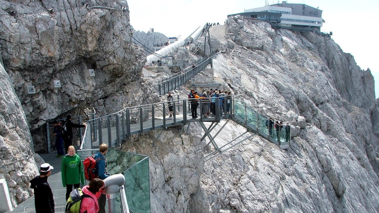
Sky Walk, Suspension Bridge, Stairway to Nothingness Styria, Dachstein The Dachstein cable car (Gletscherbahn Panorama Gondel, Panorama Cable Car) took me up to a height of 2700 meters, to the highest mountain in Styria (Steiermark), the Dachstein. Next to the upper station of the cable car there are several tourist attractions.
[ Top ↑ ]
Copyright © 2003-2026 Trekkingklub and friends. Reproduction of any text, picture or video from this website, either in printed or electronic form, is prohibited without prior written permission. Website made with love  in Miercurea Ciuc.