Tourist attractions near Horezu (Horezu, Valcea county, Romania)
Photos of nearby places

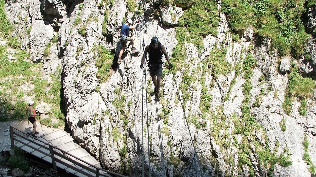
Ledge path of the chamois - Cheii Gorge (40 photos) 17.2 km away. Ledge path of the chamois (Brana Caprelor) - Cheii Gorge (Cheile Cheii).

Womens Cave - Parang Mountains (11 photos) 19.7 km away. The Cave of Women (Pestera Muierii, Pestera Muierilor) is located at the southern foot of the Parang Mountains, in the area of Baia de Fier in Gorj County. There are several climbing routes established on the rocks above the cave and on the other side of the road.

Doabra Snail Shells - Brezoi (12 photos) 30.2 km away. Doabra Valley - Calinesti-Brezoi forest - Lotru Valley, Cozia National Park

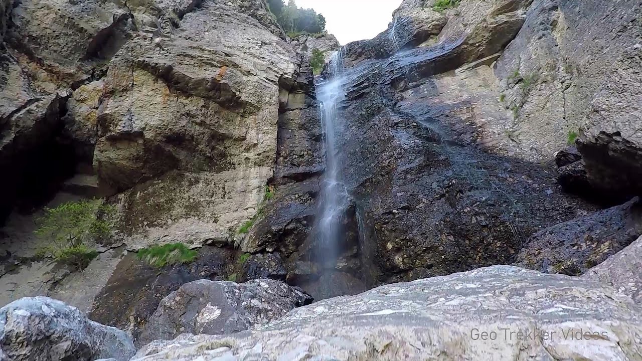
Circular hiking tour in Cozia Mountain (48 photos) 33.1 km away. Arutela - Turnu monastery - Rosiei Rocks - Turneanu ridge - Cozia peak - Stone portal - Stanisoara monastery - Gardului waterfall.

Parangul Mare peak (16 photos) 41.8 km away. Chamois saddle (Saua Caprelor), Carja mountain shelter (Refugiul Carja) - Carja peak (Varful Carja) - Stoienita peak (Varful Stoienita) - Gemanarea - Parangul Mare peak.

Boli Cave - Banita (20 photos) 63.1 km away. The main cave passage is approximately 460 m long, with an entrance portal that is 10 m high and 20 m wide at its base. In the 1960s, bridges were built over the underground stream flowing through the cave.

Banita Gorge - Banita (16 photos) 63.4 km away. The approximately 250 m long gorge, similar to the Corcoaia Gorge, is truly spectacular. According to assumptions, it was formed by the collapse of a cave passage ceiling, and then the erosion formed spectacular karst formations in the limestone.

Natural bridge next to the Banita Stone Quarry (12 photos) 66.4 km away. Although the Banita Stone Bridge is not far from the road that passes through the village, it is located beyond the railway line, so its approach is a bit cumbersome. We can go around the railway line on Carierei Street, and then we have to walk a few meters from the stone quarry.

Chamois saddle - Fagaras Mountains (12 photos) 70.7 km away. Chamois saddle (Saua Caprei) - Fagaras Mountains.


Stanciu rock porch - Piatra Craiului Mountains (18 photos) 102 km away. Stancius rock porch (Ceardacul Stanciului) - Piatra Craiului Mountains (King Rock).

Cave of Stanciu - Piatra Craiului Mountains (10 photos) 102 km away. Cave of Stanciu (Pestera Stanciului) - Piatra Craiului Mountains (King Rock).

The shoulder of Piatra Craiului Mountains (36 photos) 102.8 km away. The shoulder of Piatra Craiului Mountains (King Rock's Shoulder).

Southern ridge - Piatra Craiului Mountains (42 photos) 102.8 km away. Southern ridge - Piatra Craiului Mountains (King Rock).

Deubels path - Piatra Craiului Mountains (36 photos) 103.4 km away. Plaiul Foii - Deubel cavities (La Zaplaz) - Grind saddle. Deubel's path - Piatra Craiului Mountains (King Rock).

Middle Belt Trail - Piatra Craiului Mountains (114 photos) 105 km away. Ravine valley of Calinet (Padina lui Calinet) - Thermopylae - Anghelide's canyon, Piatra Craiului Mountains (King Rock).

Border Ravine Valley, Northern ridge (53 photos) 105.9 km away. Border Ravine Valley (Padina Hotarului), Northern ridge - Piatra Craiului Mountains (King Rock).

Northern ridge - Piatra Craiului (11 photos) 105.9 km away. Northern ridge - Piatra Craiului Mountains (King Rock).

The Cats Gorge - Curmatura Cabin (20 photos) 108.2 km away. The Cat's Gorge - Valley of the Gorge Stream - Curmatura Cabin - Rift Saddle.

Tower of King Rock - Piatra Craiului Mountains (15 photos) 108.3 km away. Border Ravine Valley (Padina Hotarului), Turm des Königstein (Turnul Pietrei Craiului).

Zarnesti precipice - Piatra Craiului Mountains (16 photos) 108.3 km away. Zarnesti precipice (Prapastiile Zarnestilor) - Piatra Craiului Mountains (King Rock).

Zarnesti Gorge - Piatra Craiului Mountains (6 photos) 108.3 km away. Zarnesti Gorge (Prapastiile Zarnestilor) - Piatra Craiului Mountains.
[ Top ↑ ]
Videos of nearby places
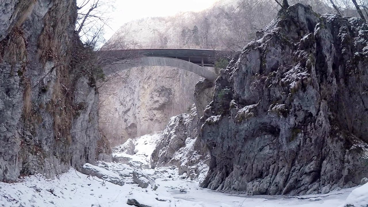
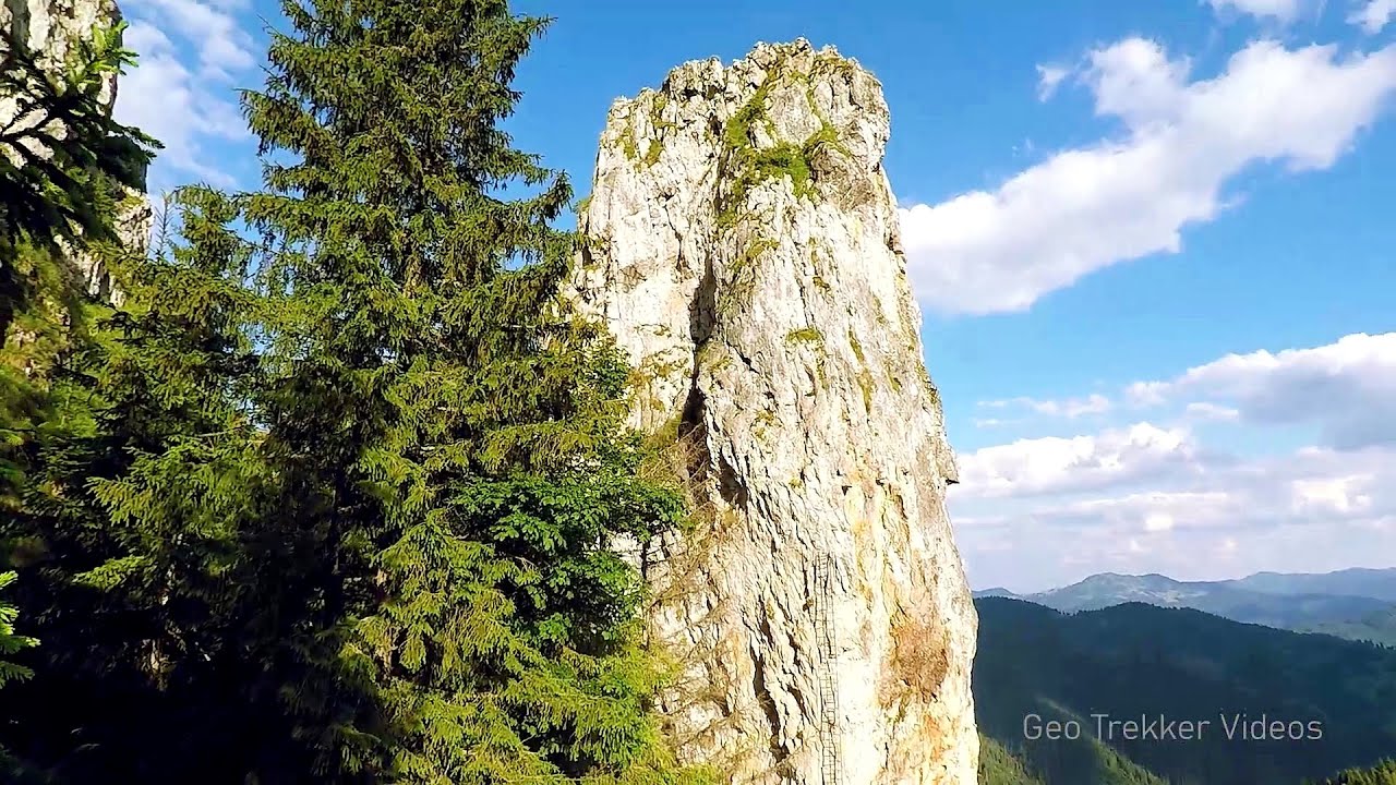
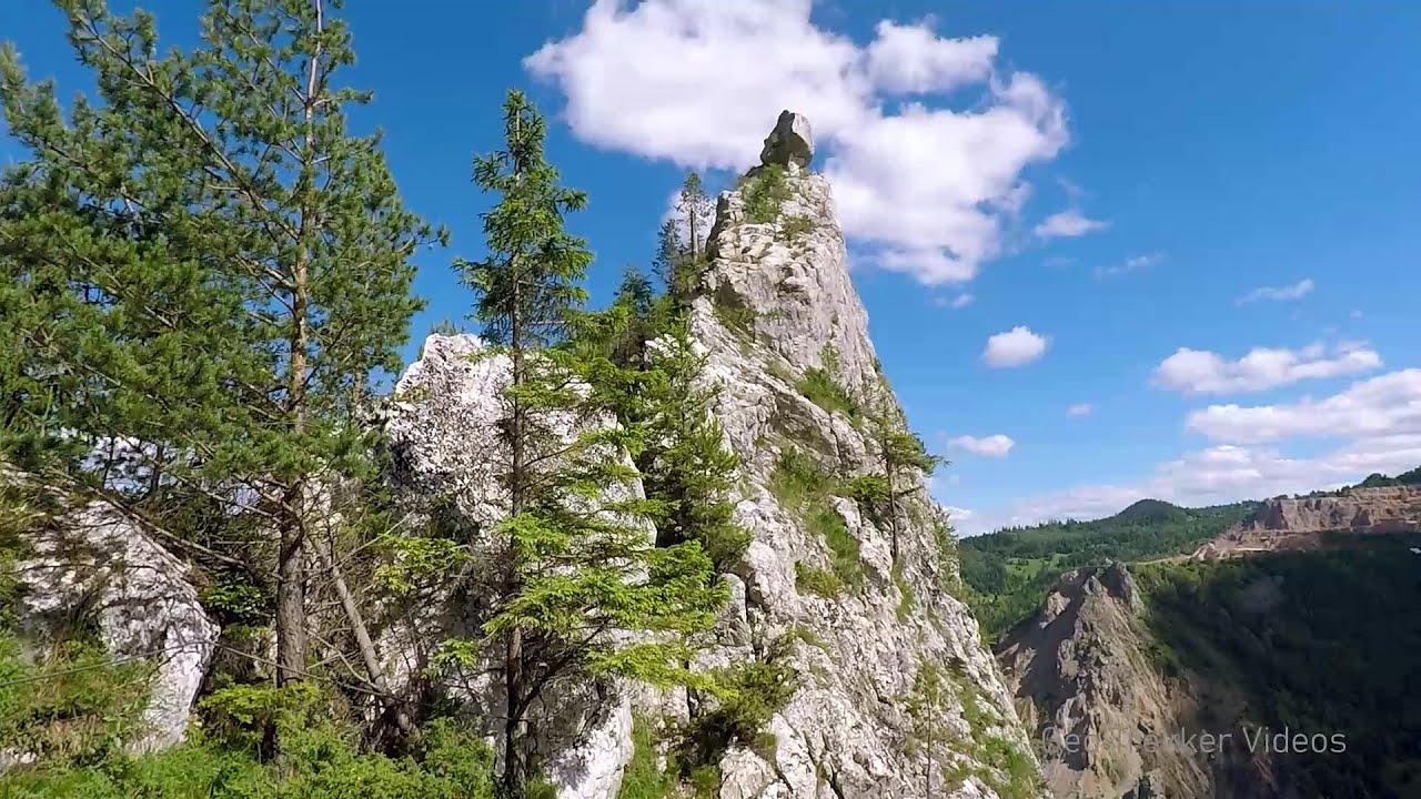
The Gorge of the Creek of the Gorge - Buila-Vanturarita National Park 16.9 km away. The Gorges of the Creek of the Gorge (Cheii Gorge, Cheile Cheii) is located in the Buila-Vanturarita National Park within the Capatana Mountains. It is one of the most beautiful and picturesque gorges in Romania.
Oltet Gorge - Capatana Mountains 18.3 km away. Oltet Gorge (Cheile Oltetului) - Capatana Mountains. That day, we had planned to ski at the Ranca resort, situated alongside the Transalpina high altitude mountain road in the Parang Mountains.
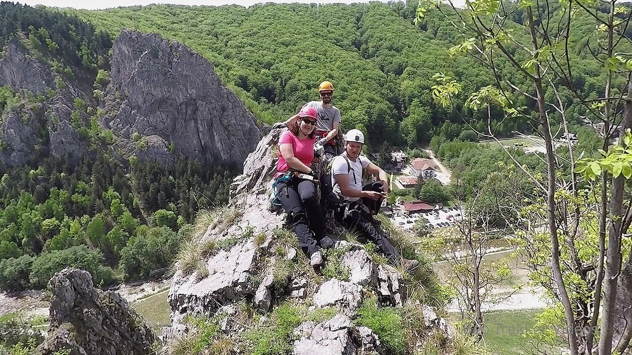
Via Ferrata Pink Panther - Baia de Fier 19.4 km away. In the area of Baia de Fier in Gorj County, several via ferrata routes have been set up on the rock above the Women's Cave (Muierii Cave) and on the other side of the road. At that time (2018), there were a total of seven.
Other places
Falco Tinnunculus via ferrata, the ascent Falcons Rock, Corbu 246.4 km away. Falco Tinnunculus (Common kestrel) via ferrata (E), the ascent - Falcon's Rock, Corbu. Over Corbu village in Harghita County, on the rocks of Falcon's Rock (Piatra Soimilor), which belong to the Bistrita Mountains, five via ferrata routes have been established.
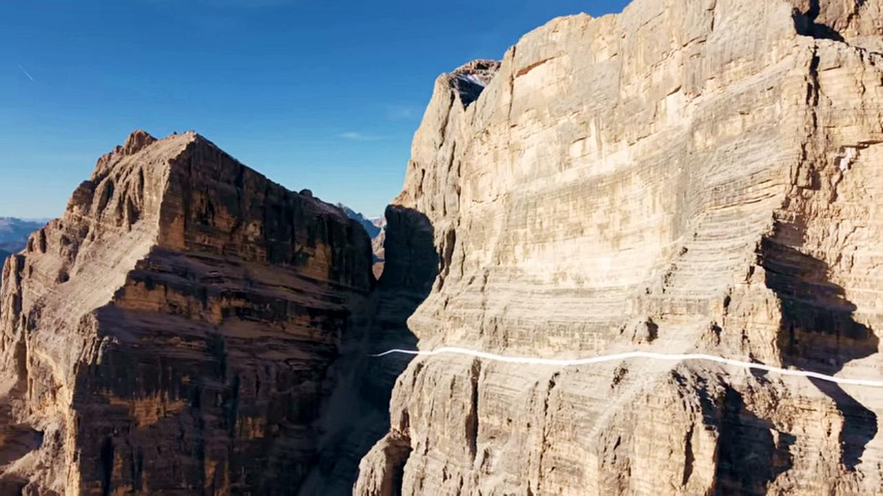
The Crack Grohmanns Ledge Monte Pelmo Monte Pelmo is nicknamed God's Armchair because its shape resembles a huge armchair. Between Monte Pelmo and Monte Pelmetto is The Crack (La Fessura).
Balázs Hill Lookout Western Mecsek 467.7 km away. The Balázs hill lookout, located at an altitude of 320 meters, offers a beautiful view of Lake Pécs and the wooded mountain ranges of Western Mecsek. The original lookout, built in 1975, was destroyed by fire, and it was rebuilt in 2001 using a metal structure, which was renovated in 2014.

Big Via ferrata Rasnoavei Gorge 127 km away. The most dangerous Eastern European iron path, and also one of the most beautiful via ferrata routes in Romania, is in the Rasnoavei Gorges, Postavaru Mountains.The route is 450 m long, with a level difference of 220 m.
Sugau Rock lookout point and iron path 235.5 km away. Sugau Rock lookout point and iron path (B/C). Sugau Gorges - Munticelu Nature Reserve, Hasmas Mountains.

Buzludzha monument Kazanluk 290.4 km away. Buzludzha is a historically significant mountain located in the Central Balkan Mountains of Bulgaria. At its summit, at an altitude of 1432 meters above sea level, there is an abandoned monument.
Rosina via ferrata Silberkar Gorge, Ramsau am Dachstein The Rosina via ferrata is the most difficult via ferrata in the Silberkar Gorge (Silberkarklamm), has a D difficulty rating, and it is a vertical masterpiece. After a short suspension bridge above the stream, it leads up the rock wall next to the gorge waterfall, all the way vertically.
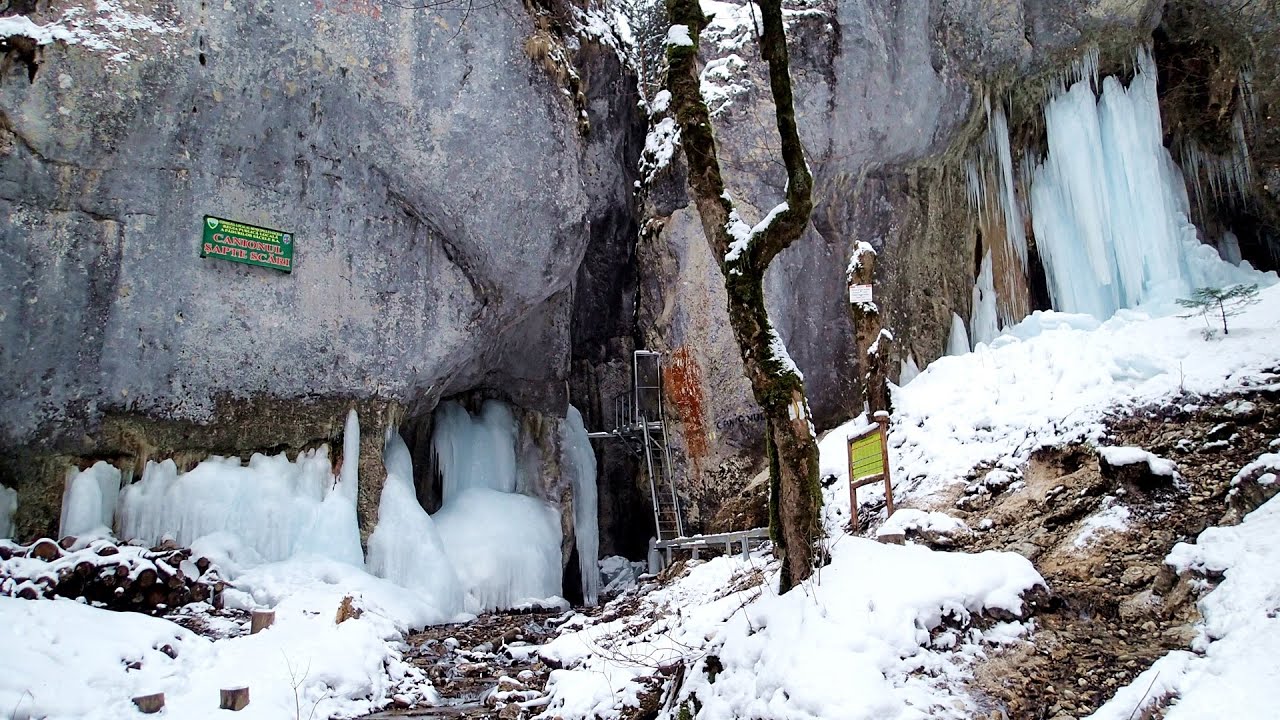
Seven Ladder Canyon in Winter Piatra Mare Mountain 137 km away. Seven Ladder Canyon and Waterfall in Winter - Piatra Mare Mountain
Upstream of the Izvorul Dorului creek Vanturis waterfalls 118.2 km away. Upstream of the Izvorul Dorului (Source of longing) creek - Vanturis waterfalls, Bucegi Mountains.
[ Top ↑ ]
Copyright © 2003-2026 Trekkingklub and friends. Reproduction of any text, picture or video from this website, either in printed or electronic form, is prohibited without prior written permission. Website made with love  in Miercurea Ciuc.